BCH Africa Border Crossings in Togo

Togo

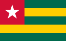
Togo flag

Togo's border crossings are an essential part of regional road travel, serving local communities alongside international traffic. Most routes are practical and easy to navigate, although commercial activity and busy travel periods can occasionally slow the pace.

5

Border Crossings

Listed in BCH

3

Capital

Lomé

Time Zone

UTC

Togo

Understanding Togo

Togo’s narrow shape stretches from the Gulf of Guinea to the Sahel, influencing its border crossings with Ghana, Benin, and Burkina Faso. Southern crossings are busy and urbanized, particularly along coastal routes, while northern posts are quieter and set in savanna terrain. Seasonal rains can impact travel in central and southern regions, especially on secondary roads.

Border Map

Quick Information

Capital Lomé
Official Language French
Currency West African CFA Franc (XOF)
Calling Code +228

Quick Information

Capital Lomé
Official Language French
Currency West African CFA Franc (XOF)
Time zone UTC
Calling code +228

Travel Tip

Togo is long and narrow, allowing travelers to experience coastal plains, forested hills, and northern savannah without covering huge distances. The CFA franc is the local currency, and cash is the easiest way to pay in markets and smaller communities.

Border Crossings in Togo

Browse border crossings connecting Togo with its neighbouring countries.

5 crossings

Border crossings will load when this tab is opened.

Crossing Tip

Togo is long and narrow, allowing travelers to experience coastal plains, forested hills, and northern savannah without covering huge distances. The CFA franc is the local currency, and cash is the easiest way to pay in markets and smaller communities.