Monthly Update (September 2026):
Ursprung Pass & Germany remains a small Alpine crossing where road conditions matter more than border queues. Germany's temporary controls on the Austrian border continue through September 15, meaning a document check is possible even on this minor route. There is no significant September closure or new restriction reported, so travelers should mainly check mountain-road conditions before setting out.
About this crossing
Location and Connections
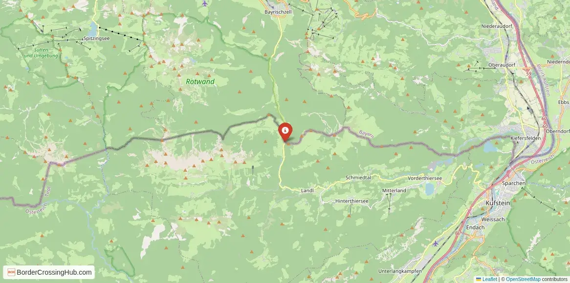
You approach this pass from Bayrischzell in Bavaria, Germany, along the St 2075 (Bundesstraße 307 in parts), which ascends through the Ursprung Valley before crossing at 836 meters into Austria. The road continues south toward Thiersee and eventually joins the B171 near Kufstein in the Inn Valley. Bayrischzell lies about 11 kilometers north of the summit, roughly 15 to 20 minutes drive on the twisting ascent. On the Austrian side, Thiersee sits a short distance beyond, with Kufstein around 20 to 30 minutes further. Cars, motorcycles, and local buses use it; heavy trucks avoid the narrow, steep sections. Cyclists tackle it as a challenging climb, while hikers follow nearby trails. The route provides an alternative to busier passes like Kufstein-Kiefersfelden or Inntal Autobahn, appealing to those exploring the Mangfall Mountains or heading from the Schliersee area toward Tyrol.
Alternative Names
It appears as Ursprung Pass, Ursprungpass, or Ursprungpaß. The crossing is sometimes called Bayrischzell-Thiersee Grenzübergang or the Ursprungtal pass.
Nearby Border Crossings


Historical Background
The pass developed in the 19th century as a local connection between Bavarian alpine valleys and the Austrian Inn region, amid older trade paths used for salt, timber, and livestock. The border here reflects 19th-century Bavarian-Austrian agreements that stabilized the line after earlier disputes. Customs posts operated until Schengen in the late 1990s eased formalities. The road gained popularity among motorists and motorcyclists in the 20th century for its curves and views, while remaining a secondary route without major infrastructure changes. Nearby mining and farming heritage influenced the surrounding communities, though the pass itself stayed a low-key divide.
Geopolitical Context
Schengen since the late 1990s normally eliminates routine passport and customs checks for EU citizens and visa-exempt travelers. Germany and Austria maintain no temporary controls on this Bavaria-Tyrol border segment as of February 10, 2026 (unlike controls on Germany's eastern borders or Austria's eastern neighbors extended through mid-2026 for migration and security). Random spot checks by police remain possible but occur infrequently at this low-traffic pass. The border follows the summit ridge, marked simply without permanent booths or barriers.
Practical Crossing Procedures
You drive straight over the summit road with a border sign or marker. No booths or systematic queues exist under normal Schengen conditions. If a random check happens, police may ask for ID and brief travel details. EU citizens present passport or national ID. Non-EU nationals carry valid passports, visas/residence permits if required, and supporting documents like accommodation proof. Vehicles need insurance; no Austrian vignette applies to this non-motorway route. Pedestrians and cyclists cross easily, though the road favors vehicles.
Typical Wait Times
You cross in seconds with no interruption. Random checks might add 5 to 15 minutes at most. Traffic stays light, even in summer tourist periods or weekends, so backups rarely form.
Operating Hours
The road operates 24 hours daily, year-round. Schengen removed fixed schedules. Winter snow can slow the steep ascent temporarily, but plowing keeps it open.
Transportation Options and Road Conditions
Drive your car or motorcycle for the best experience; local buses serve Bayrischzell and Thiersee but less frequently cross the pass. The St 2075/B307 provides narrow, well-paved asphalt with tight curves, steep gradients (up to 10-12% in places), and elevation changes. Views include forested valleys, meadows, and distant peaks. Watch for oncoming traffic, cyclists, or fallen branches on rural sections.
Scams & Warnings
Scams remain rare at this minor pass. No common touts or fake services reported. Roadside stops or small shops near Bayrischzell occasionally have higher prices, but issues stay minimal. The road has sharp bends and drops; drive cautiously in wet, foggy, or icy conditions. The area feels peaceful and low-risk for prepared travelers.
Nearby Attractions
Bayrischzell offers village charm, hiking trails, and access to the Mangfall Mountains. Thiersee provides a scenic lake with summer boating and winter cross-country skiing. Kufstein farther south features its historic fortress and Inn River views. The Ursprung Valley trail network includes paths to nearby summits like the Wendelstein or Rotwand. The route suits those combining Bavarian alpine villages with Tyrolean lakes and mountains.
Seasonal Variations and Weather Impacts
Winter snow December to March requires winter tires; roads ice on shaded curves. Summer brings clear skies and more motorcycles/hikers. Autumn foliage colors the forests with lighter traffic. Rain or fog reduces visibility, but closures stay uncommon.
Travel Tips and Preparation
Carry passport or ID for possible spot checks. Refuel in Bayrischzell or Thiersee. Offline maps help in hilly areas. Pack layers for elevation shifts. Check weather and road apps before departure. Drive defensively on curves.
Cultural and Economic Significance
The crossing supports regional tourism linking Bavarian Prealps with Tyrolean Inn Valley, drawing day-trippers and motorcyclists. Shared alpine heritage in hiking, skiing, and village life sustains local economies through cross-border visits.
Before You Cross
Confirm road conditions and weather from official sources near your travel time. With prep for mountain driving and rare checks, you tackle this scenic pass and continue through alpine valleys on both sides. Safe travels.
View all border crossings between Austria and GermanyPractical information
Fuel
Austria: 2 km - Bavaria: 2 km
Currency
EUR only; ATMs in Bayrischzell/Thiersee
Safety information
Narrow road; snow/ice in season
Connectivity
Wi-Fi points; 4G
Have you crossed here?
Help other travelers by sharing your experience, wait times, and any updates.