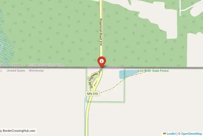
Approximate Border Location
Border Countries
- 🇺🇸United States
- 🇨🇦Canada
Border Cities
- 🇺🇸Roseau
- 🇨🇦South Junction
Wait Times
15-45 min for pedestrians/vehicles
Just crossed? Tap to report:
Operating Hours
Open 8:00 AM – 6:00 PM
Crossing Types
Pedestrians, vehicles
Border Type
Land crossing via road
Peak Times
Mornings (7-10 AM), weekends
Daily Crossings
~1000 travelers/vehicles
Currency Exchange
Limited near Roseau (USD, CAD)
Safety Information
Generally safe, rural area
Languages Spoken
English
Accessibility Features
Ramps
About Roseau & South Junction
Monthly Update (March 2026):
In recent weeks of 03/2026, the Roseau & South Junction Border Crossing has stayed calm and predictable. Passenger vehicles usually pass without much delay, though trucks occasionally pause longer at customs. Early morning crossings are typically the smoothest. Winter weather in the region can slow travel on both sides.
No Cell Service at the Border? No Problem.
Don’t get caught scrambling for paperwork when you lose signal. Download the complete North America Transit Guide directly to your device and access every critical detail, fast-track strategy, and border rule – 100% offline.
A Crossing in the North Woods
The border crossing connecting the area near Roseau, Minnesota, with South Junction, Manitoba, is a journey into the vast, forested wilderness of the North American borderlands. This is not a major trade corridor; it is a secondary checkpoint on a two-lane road that runs through a landscape of dense forests, wetlands, and small farming communities. To cross here is to experience the US-Canada border at its most tranquil and natural. It is a passage that serves the needs of the local communities and the tourists who come to explore the remote and beautiful Lake of the Woods region. It is a crossing defined by the quiet rhythm of the North Woods.
Operational Details
This checkpoint connects Roseau County, Minnesota, with the Municipality of Piney in Manitoba. It is a smaller Port of Entry with limited operating hours, from 8:00 AM to 8:00 PM daily (as adjusted effective January 2025). It is essential to verify the current schedule before planning your trip, as arriving after hours will mean a long detour to one of the 24/7 crossings. The crossing is intended for passenger cars and local commercial traffic, particularly from the timber and agricultural industries. The facilities are small and functional, and the traffic is generally light, making for a quick and personal crossing experience with no significant wait times reported.
A History of a Peaceful Frontier
The history of this region is the history of the settlement of the North Woods. For centuries, this was the land of the First Nations. In the 19th century, the “49th parallel” was established as the border. The area was settled by European immigrants, who developed the logging and farming industries. The border has been overwhelmingly peaceful, and this crossing is a powerful symbol of that long-standing friendship and the shared natural heritage of the region. It is a place where the economy and the way of life are deeply connected to the forest that spans the international line.
Border Crossing Procedure
The border crossing procedure is a professional and efficient process. You will approach a single, primary inspection booth for the country you are entering. You will need a valid passport or other approved travel document (such as a NEXUS card or an Enhanced Driver’s License). The border officer will ask you a series of questions about your citizenship, your destination, the purpose of your trip, and what goods you are bringing with you. Be prepared to declare all items. The process is generally straightforward and courteous. Given the low volume of traffic, the experience is often much more relaxed than at the major highway crossings.
The Surrounding Region: United States Side
On the US side, the crossing is near the city of Roseau, which is known as the home of Polaris Industries, a major manufacturer of snowmobiles and all-terrain vehicles. The city is a gateway to the vast Beltrami Island State Forest and the Red Lake Wildlife Management Area, a huge expanse of wilderness that is popular for hunting, fishing, and wildlife viewing. The region is also a gateway to the unique “Northwest Angle,” the northernmost point of the contiguous United States, which can only be reached by land by driving through Canada.
The Surrounding Region: Canada Side
On the Canadian side, the crossing is in the rural municipality of Piney. The nearby village of South Junction is a small, quiet community. The area is part of the vast boreal forest that stretches across Canada. It is a paradise for outdoor enthusiasts, with numerous lakes and forests offering opportunities for fishing, hunting, and camping. The Sandilands Provincial Forest is nearby. The road from the border leads towards the city of Steinbach, a major center of the Mennonite community in Manitoba, and the provincial capital, Winnipeg.
Practical Travel Information
Practical planning for this route is straightforward. The most important factor is the limited operating hours. The roads are two-lane highways and are well-maintained, but can be subject to closure during winter blizzards. The official currencies are the US Dollar (USD) in the United States and the Canadian Dollar (CAD) in Canada. Services are limited in the immediate border area, so it is best to plan for fuel and other needs in the larger towns. Be aware of the customs limits for goods, particularly firewood, as there are restrictions to prevent the spread of invasive species. Recent 2025–2026 reports note no major delays or safety issues beyond typical seasonal weather.
Final Considerations
The Roseau–South Junction border crossing is a journey through the heart of the North Woods. It is a quiet, peaceful checkpoint that is a vital link for the local communities and for those seeking recreation in the vast wilderness. It is a passage through a landscape of immense natural beauty. For the traveler, it offers a straightforward and relaxed experience, a testament to the peaceful and cooperative relationship that defines the world’s longest undefended border. It is a crossing that is as quiet and unassuming as the great forest that surrounds it.
No reviews yet.