Approximate Border Location
Border Countries
- 🇺🇸United States
- 🇨🇦Canada
Border Cities
- 🇺🇸Porthill, Idaho
- 🇨🇦Rykerts, British Columbia
Wait Times
15-30 min for pedestrians/vehicles
Just crossed? Tap to report:
Operating Hours
Open 8:00 AM – 6:00 PM
Crossing Types
Pedestrians, vehicles
Border Type
Land crossing via road
Peak Times
Mornings (7-10 AM)
Daily Crossings
~800 travelers/vehicles
Currency Exchange
Limited near Porthill (USD, CAD)
Safety Information
Remote, beware wildlife
Languages Spoken
English
Accessibility Features
Ramps
About Porthill, Idaho & Rykerts, British Columbia
Monthly Update (March 2026):
As of 03/2026, the Porthill, Idaho & Rykerts, British Columbia Border Crossing remains quiet and steady. Traffic is mostly local and clears quickly when it arrives. Inspections can slow the line briefly if a few vehicles reach the booth at once. Weather in the nearby valleys sometimes affects driving conditions.
No Cell Service at the Border? No Problem.
Don’t get caught scrambling for paperwork when you lose signal. Download the complete North America Transit Guide directly to your device and access every critical detail, fast-track strategy, and border rule – 100% offline.
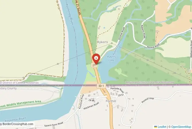
A Scenic Gateway to the Kootenays
The Porthill-Rykerts border crossing connects Porthill, Idaho, with Rykerts, British Columbia, via Idaho State Highway 1 and British Columbia Highway 21. This quiet, picturesque route links Bonners Ferry to Creston, offering a gateway to the Kootenay region’s stunning lakes, rugged mountains, and quaint towns. Its rural charm comes with a catch. Limited services mean you’ll need to plan ahead. Check official sources like U.S. Customs and Border Protection (CBP) or Canada Border Services Agency (CBSA) for updates before you go. This crossing’s rich history and natural beauty make it a hidden gem for travelers seeking a peaceful journey.
Historical Background
Born in the late 19th century, the crossing took root during the Kootenay Valley’s mining and logging surge. Porthill, named after founder Charles Plummer Hill, blossomed as a trade hub by the 1890s, bustling with miners hauling silver-lead ore across the border. On the Canadian side, Rykerts, once called Bedlington, served lumber camps feeding timber to growing settlements. By 1929, nearly 10,000 vehicles crossed yearly, a figure that spiked with 1930s highway upgrades. The crossing has its share of wild tales, like a 1999 fugitive chase ending in gunfire and a dramatic arrest. Now, it’s a quieter spot, perfect for those dodging the busier Eastport-Kingsgate route.
Crossing Details and Wait Times
Heading to Canada? You’ll stop at Porthill’s CBP office for an exit stamp, then hit Rykerts’ Canadian immigration. A passport’s a must, and you might need a $7 CAD eTA (apply online). Going to the U.S.? You’ll get a Canadian exit stamp and meet U.S. entry rules. Usually just a passport. Porthill operates 7:00 AM to 7:00 PM year-round, while Rykerts extends to 8:00 AM to midnight seasonally, so time your return to avoid a detour to 24/7 Eastport-Kingsgate. Waits are short, typically under 15 minutes with no delay reported recently, though summer weekends (July-August) can stretch slightly during local events. The CBSA’s CanBorder app or CBP site gives real-time wait updates.
Watch Out for Scams
Scammers sometimes target travelers near Creston, offering “visa help” for $10-$50 or running fake “customs offices” that overcharge for forms. Stick to CBSA/CBP channels and get your eTA online. Currency exchange traps near Creston push lousy rates. Carry USD/CAD cash or hit ATMs in Bonners Ferry instead. Summer crowds bring pickpockets, so keep your stuff secure. If someone sketchy offers “help,” just say no and head to the official counters.
Getting There
From Spokane, it’s a 2-hour drive to Porthill via U.S. Highway 95 and Idaho State Highway 1, winding through forested hills. No buses or trains hit the border, so you’ll need a car. Rent one if you don’t own one. From Creston, Highway 21 gets you to Cranbrook in 1.5 hours, passing vineyards and orchards. Gas, food, and lodging are 5-10 minutes away in Bonners Ferry or Creston. Skip “free” shuttles that lead to scam-prone spots and lock in taxi fares upfront. Cyclists, beware: it’s hilly with narrow shoulders.
Roads and Views
Highway 1 and Highway 21 are paved but tight, with deer and bears popping out, especially at dawn or dusk. Summer (June-September) is smooth sailing; winter (December-March) brings snow. Pack chains or snow tires. The Kootenai River and Selkirk Mountains steal the show, with summer highs around 29°C and winter lows dipping to -10°C. Dress for dusty summer roads or sudden winter snow. Fall (September-October) paints the route with golden aspens. A total stunner.
What to See Nearby
Creston’s winery tours and the Creston Valley Wildlife Management Area (10 minutes north) are great for nature buffs and birdwatchers. South of the border, Kootenai National Wildlife Refuge (15 minutes from Porthill) offers hiking and more birds. Grab huckleberry pie or Nanaimo bars at Creston’s True North Café. Nelson, 45 minutes north, has a cool arts scene, historic downtown, and a free Kootenay Lake ferry. Check its schedule first.
Cultural and Economic Impact
This crossing mixes Idaho’s rugged vibe with BC’s outdoor spirit. Creston’s Blossom Festival brings folks from both sides together, swapping tales over crafts and music. It fuels tourism. Think lake trips and trail hikes. And small-scale trade like fruit and crafts. Less hectic than Eastport-Kingsgate, it’s a passenger favorite, knitting a tight border community. Economically, it props up Creston’s cherry orchards and Bonners Ferry’s timber scene.
Travel Tips
Check hours (7:00 AM to 7:00 PM U.S., extended Canada) and bring cash. ATMs are rare. An eTA speeds things up. Winter drivers need snow tires; check Idaho’s 511 or BC’s (800) 550-4997 for road updates. Use CBP/CBSA sites for rules and lock up valuables in this remote spot. Pack snacks and water. Services are sparse between towns. Got pets? Bring their rabies certificates.
Bonus Tips
Cell service fades fast. Download maps ahead. Summer dust and winter ice call for cautious driving, especially on curves. Locals are friendly but few, so be self-reliant. Hit True North Café in Creston for sandwiches or Under the Sun in Bonners Ferry for brews and tunes. This crossing’s chill vibe and epic scenery make it a Kootenay must-do.
No reviews yet.