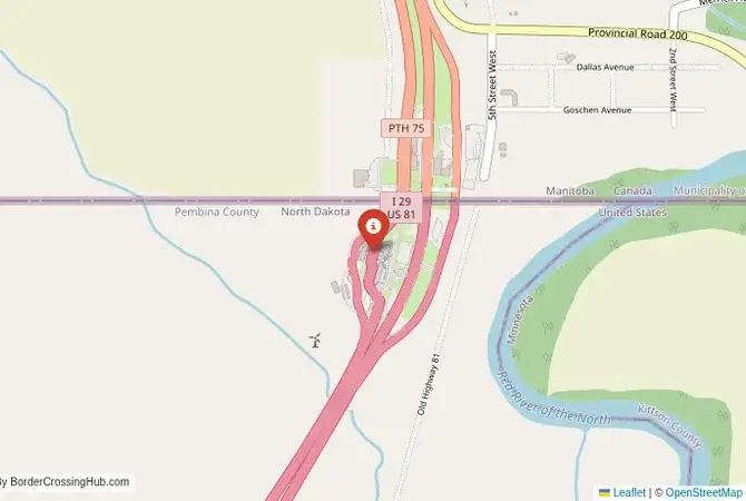
Approximate Border Location
Border Countries
- 🇺🇸United States
- 🇨🇦Canada
Border Cities
- 🇨🇦Emerson, Manitoba
- 🇺🇸Pembina, North Dakota
Wait Times
15-60 min for pedestrians/vehicles
Operating Hours
Open 24 hours
Crossing Types
Pedestrians, vehicles, commercial
Border Type
Land crossing via road
Peak Times
Mornings (7-10 AM), weekends
Daily Crossings
~3000 travelers/vehicles
Currency Exchange
Available near Pembina (USD, CAD)
Safety Information
Generally safe, busy traffic
Languages Spoken
English
Accessibility Features
Ramps, elevators
About Emerson, Manitoba & Pembina, North Dakota
A Crossing in the Heart of the Continent**
The border crossing connecting Pembina, North Dakota, with Emerson, Manitoba, is one of the most important and busiest checkpoints in the heart of North America. This is not just a border; it is a major international trade corridor, the point where US Interstate 29 meets Manitoba Highway 75. To cross here is to travel through the vast, flat landscape of the Red River Valley, the heart of the North American prairies. It is a journey through the breadbasket of the continent, a passage defined by the immense scale of the landscape, the constant flow of commercial trucks, and the professional, efficient nature of one of the world’s longest and most peaceful frontiers.
Operational Details
This checkpoint connects the United States and Canada in the central part of the continent. It is a massive, 24/7 facility, open to all passenger cars, buses, and commercial freight. The crossing is one of the busiest on the entire US-Canada border in terms of truck traffic, as it is a key part of the “Mid-Continent Trade Corridor” that links Mexico, the US, and Canada. The facilities on both sides are large and modern, designed to process a high volume of traffic. While it can be busy, the multi-lane design and efficient processing systems generally keep wait times manageable for passenger vehicles, with current average waits of 0 minutes for passenger vehicles (as of January 2026).
Before Crossing
Crossing borders gets messy sometimes, think political flare-ups or gates shutting fast. Good travel insurance is a must for handling doctor visits, trip disruptions, or security scares. Don’t get caught unprepared. To find a policy that’s got your back, check out reliable plans today for peace of mind.
A History of a Peaceful Frontier
The history of this region is the history of the settlement of the prairies. For centuries, this was the land of the First Nations and the great bison herds. In the 19th century, the “49th parallel” was established as the border between the United States and British North America (later Canada). The towns of Pembina and Emerson grew up as customs posts and railway hubs on this new frontier. Pembina is the oldest European settlement in North Dakota, originally a fur trading post. The relationship between the two countries has been overwhelmingly peaceful, and this crossing is a powerful symbol of that long-standing friendship and economic partnership.
Border Crossing Procedure
The border crossing procedure is a highly professional and efficient process. You will approach a single, primary inspection booth for the country you are entering. You will need a valid passport or other approved travel document (such as a NEXUS card or an Enhanced Driver’s License). The border officer will ask you a series of questions about your citizenship, your destination, the purpose of your trip, and what goods you are bringing with you. Be prepared to declare all items. You may be directed to a secondary inspection area for a more thorough check of your vehicle or luggage. The process is generally straightforward and courteous, but it is important to be honest and direct in your answers. NEXUS lanes are available for expedited processing.
The Surrounding Region: United States Side
On the US side, the crossing is in the small town of Pembina. The region is part of the vast Red River Valley, an incredibly flat and fertile agricultural area known for its production of wheat, soybeans, and sugar beets. The nearby Pembina Gorge State Recreation Area offers a surprising and beautiful contrast to the flat plains, with a deep, forested river valley that is popular for hiking and kayaking. The city of Grand Forks, with its university and air force base, is about an hour’s drive to the south.
The Surrounding Region: Canada Side
On the Canadian side, the crossing is in the town of Emerson. The region is the southern part of the province of Manitoba. The road from the border, Highway 75, is the main route to the provincial capital, Winnipeg, which is about an hour’s drive away. Winnipeg is a major cultural and economic hub, known for its historic Exchange District, the Canadian Museum for Human Rights, and its vibrant arts scene. The region is the heart of the Canadian prairies, a land of vast farms and wide-open skies.
Practical Travel Information
Practical planning for this route is straightforward. The highway is a modern, multi-lane road. The official currencies are the US Dollar (USD) in the United States and the Canadian Dollar (CAD) in Canada. Be aware of the customs limits for goods, particularly alcohol and tobacco. NEXUS card holders can use a dedicated express lane, which can significantly reduce wait times. The weather in this region can be extreme, with very cold winters and the potential for blizzards, and hot summers with the risk of tornadoes. Recent traveler reports from 2025–2026 note occasional reduced traffic due to economic factors, but no major closures or restrictions.
Final Considerations
The Pembina–Emerson border crossing is a journey through the heart of the North American continent. It is a busy, efficient checkpoint that is a vital artery for the integrated economies of the United States and Canada. It is a passage through a landscape of immense scale and agricultural productivity. For the traveler, it is a straightforward and professional experience, a testament to the peaceful and cooperative relationship that defines the world’s longest undefended border. It is a crossing that is as vast and open as the prairie sky above it.
No reviews yet.