Monthly Update (September 2026):
Paso de Jama & San Pedro de Atacama remains a key high-altitude route between northern Argentina and Chile. September is still a good period for crossing before the wetter summer season arrives, but the route's elevation means weather and road conditions can change quickly. Travelers should check the latest status before leaving San Pedro de Atacama or Jujuy.
Driving there, or sending a driver? Send them this guide.
For reports and websites
Cite this page
Border Crossing Hub (2026). Paso de Jama & San Pedro de Atacama Border Crossing. Updated September 2026. https://bordercrossinghub.com/paso-de-jama-san-pedro-de-atacama-border-crossing/<a href="https://bordercrossinghub.com/paso-de-jama-san-pedro-de-atacama-border-crossing/">Paso de Jama & San Pedro de Atacama Border Crossing (Border Crossing Hub)</a>Put this crossing's card on your website
Free. It updates on its own when our information changes.
<iframe data-bch-card src="https://bordercrossinghub.com/paso-de-jama-san-pedro-de-atacama-border-crossing/?bch_view=card" width="100%" height="980" scrolling="no" style="border:0;max-width:480px;display:block" loading="lazy" title="Paso de Jama & San Pedro de Atacama border crossing information"></iframe>
<p style="font-size:12px;margin:4px 0 0">Crossing information: <a href="https://bordercrossinghub.com/paso-de-jama-san-pedro-de-atacama-border-crossing/">Border Crossing Hub</a></p>
<script src="https://bordercrossinghub.com/?bch_embed_js=1" async></script>Paste it where you want the card. The last line (a script) only adjusts the height and can be left out.
About this crossing
Operational Details
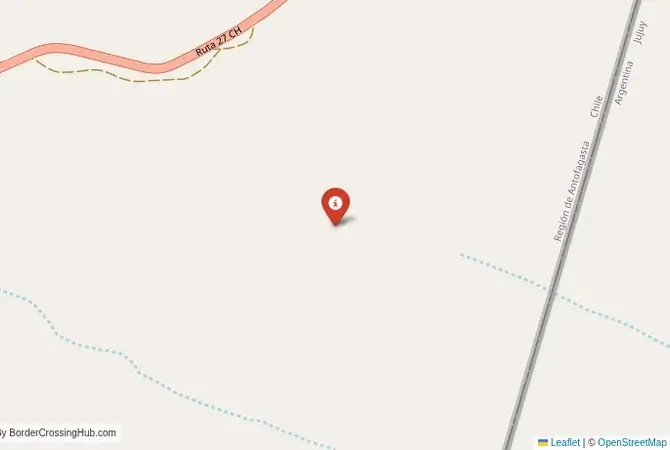
This checkpoint connects the Jujuy Province of Argentina with the Antofagasta Region of Chile. It is a major international crossing, open 24/7 under normal conditions, but subject to temporary closures in winter (June-August) due to heavy snow, high winds, or weather (e.g., occasional short closures reported). The crossing is an integrated checkpoint, with both Argentine and Chilean officials housed in a single, large, modern facility on the Chilean side. This streamlines the process, as travelers only have to stop once to complete all formalities for both countries. The pass is the most important commercial link between northern Argentina and the Pacific ports of northern Chile.
A History of a New Corridor
The history of this crossing is a modern one. For centuries, this high-altitude desert was considered an impassable barrier. The paving of the road and the opening of the Paso de Jama in the 1990s was a major strategic project, part of the "Bi-Oceanic Corridor" initiative to link the Atlantic and Pacific coasts. It has transformed the economy of the region, allowing for the efficient transport of goods from Argentina's agricultural heartland to the markets of Asia via Chilean ports. It has also opened up one of the most spectacular and previously inaccessible regions of the Andes to tourism.
Nearby Border Crossings


Border Crossing Procedure
The border crossing procedure is a well-organized, integrated process. At the single checkpoint facility, you will proceed through a series of windows for both Argentine and Chilean immigration and customs. You will need a valid passport. Many nationalities can enter both countries visa-free for short stays, but it is essential to check the specific requirements for your nationality in advance. Vehicle registration and international insurance are also necessary. A key part of the process is the strict agricultural inspection by Chilean authorities (SAG), who prohibit the entry of most fresh fruits, vegetables, and animal products to protect Chile's unique agricultural environment; declare all such items (fines high for non-declaration). A yellow fever vaccination certificate is required for entry into Chile from risk areas.
The Surrounding Region: Argentina Side
On the Argentine side, the crossing is the culmination of a spectacular journey through the Puna de Atacama. The route from the city of Jujuy climbs steeply into the high Andes, passing through the colorful Quebrada de Humahuaca (a UNESCO World Heritage site), the vast Salinas Grandes salt flats, and a landscape of vicuñas, llamas, and flamingos. The nearby town of Susques is one of the highest in Argentina and serves as a final stop before the pass. The entire region is a paradise for photographers and adventurous travelers.
The Surrounding Region: Chile Side
On the Chilean side, the road descends dramatically from the high plateau towards the Atacama Desert, the driest desert in the world. The main destination is the oasis town of San Pedro de Atacama, a major hub for tourism. From San Pedro, visitors can explore the otherworldly landscapes of the Valley of the Moon, the El Tatio geysers, the high-altitude Miscanti and Miñiques lagoons, and some of the best stargazing in the world. The crossing is also a gateway to the major mining centers and port cities of northern Chile, such as Antofagasta and Iquique.
Practical Travel Information
Practical planning is absolutely essential for this route. The high altitude can cause altitude sickness (soroche). It is crucial to acclimatize properly and to drink plenty of water. The distances are vast, and services are non-existent on the high plateau. You must have a full tank of fuel and carry extra food, water, and warm clothing, as temperatures can drop dramatically. The official currencies are the Argentine Peso (ARS) in Argentina and the Chilean Peso (CLP) in Chile. Ensure your vehicle is in excellent condition. Check the road status before you travel, especially in winter.
Final Considerations
The Paso de Jama border crossing is a journey of a lifetime. It is a modern, efficient checkpoint in the middle of a wild and spectacular landscape. It is a route that requires careful preparation but rewards the traveler with some of the most stunning and surreal scenery on the planet. It is a passage that connects the colorful mountains of northern Argentina with the stark beauty of the Atacama Desert, a journey through the roof of the Andes that is as unforgettable as it is breathtaking.
View all border crossings between Argentina and ChileHeading to Paso de Jama & San Pedro de Atacama? Take this with you.
One page with the hours, waits, emergency numbers and coordinates. Works without signal.
Practical information
Fuel
Argentina: <1 km - Chile: 160 km
Currency
ARS/CLP nearby
Safety information
Altitude; sudden weather
Connectivity
Limited 3G
Have you crossed here?
Help other travelers by sharing your experience, wait times, and any updates.