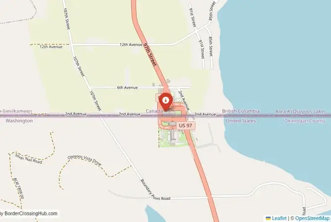
Approximate Border Location
Border Countries
- 🇺🇸United States
- 🇨🇦Canada
Border Cities
- 🇺🇸Oroville, Washington
- 🇨🇦Osoyoos, British Columbia
Wait Times
15-45 min for pedestrians/vehicles
Just crossed? Tap to report:
Operating Hours
Open 8:00 AM – 8:00 PM
Crossing Types
Pedestrians, vehicles
Border Type
Land crossing via road
Peak Times
Mornings (7-10 AM), weekends
Daily Crossings
~2000 travelers/vehicles
Currency Exchange
Available near Oroville (USD, CAD)
Safety Information
Generally safe, rural area
Languages Spoken
English
Accessibility Features
Ramps, elevators
About Oroville, Washington & Osoyoos, British Columbia
Monthly Update (February 2026):
In February 2026, the Oroville, Washington & Osoyoos, British Columbia Border Crossing runs mostly steady with occasional slow patches. Northbound traffic tends to build later in the day, especially heading into weekends. Snow, icy roads, and holiday travel still shape how smoothly things move at any given moment.
General Overview
Warning: The Oroville, WA – Osoyoos, BC border crossing, also known as Osoyoos Border or Oroville Station, is busy with occasional scams; stay cautious, use official services, and verify with government sources. Located in Washington’s Okanogan County, the Oroville, WA – Osoyoos, BC border connects to British Columbia’s Okanagan Valley via Highway 97. This vibrant 24/7 crossing, a hub for tourists and wine enthusiasts, links Washington’s apple orchards with Canada’s desert wine country, offering scenic views of Lake Osoyoos and rolling vineyards.
Historical and Geopolitical Context
Formalized in the 1920s to serve farmers and traders, this crossing grew with Highway 97’s 1960s expansion, boosting trade in fruit, wine, and tourism services. It handles CA$500 million in annual commerce, reflecting the region’s agricultural prominence. The Syilx (Okanagan) people’s heritage, celebrated in local festivals, adds cultural richness with cross-border ties. In 2026, customs operations remain routine with no significant delays reported; its popularity with wine tourists increases summer traffic, so check news for disruptions, such as inspections or festival-related congestion, to plan your trip effectively.
Crossing Procedures and Wait Times
Open 24/7, the border sees moderate traffic, with waits typically under 15 minutes and no delay reported recently (check CBSA or CBP for real-time). U.S. immigration in Oroville, at 3325 Highway 97, processes exit stamps; Canadian immigration in Osoyoos, at 202 97th Street, handles entry. Most nationalities receive a 90-day visa-free stamp for Canada; U.S. entry requires a passport or NEXUS card. Carry your passport, vehicle registration, and proof of insurance. NEXUS lanes operate limited hours (check current via CBP/CBSA); English is widely spoken. Wait times are posted on U.S. Customs’ website or via 509-476-2955; Canadian updates are at 1-800-461-9999. Declare agricultural goods to avoid fines, as both sides enforce strict rules.
Scam Awareness
Scams include money changers in Osoyoos offering poor exchange rates; use ATMs or banks like BMO on Main Street. Taxi drivers may inflate fares (~$20-25 USD); negotiate upfront. Unofficial “border helpers” offering paperwork assistance are unnecessary. Avoid them, as the process is efficient. Duty-free shops, like Osoyoos Duty Free (8:00 AM to 8:00 PM), are legitimate but compare prices to avoid overpaying. In recent years, reports noted fake winery tour guides targeting visitors. Book through Destination Osoyoos to avoid scams. Local vendors may sell “tax-free” wine or fruit; verify legitimacy with established businesses.
Transportation Options
Buses from Oroville to Osoyoos (10 minutes, $5 USD) are limited via Okanogan County Transit; taxis ($20 USD) or private cars are faster via Highway 97’s four-lane stretch. From Osoyoos, BC Transit buses to Kelowna (1 hour, ~CAD 25) are frequent, connecting to Vancouver. In Oroville, buses to Spokane (3 hours, ~$40 USD) are available via Northwest Trailways. Roads are paved, winding through Lake Osoyoos and vineyards. Pedestrians can cross, but towns are 2-3 km apart, making vehicles preferable. Winter ice requires caution; check Washington’s 511 or BC’s 511 for updates. The route’s desert vistas and orchards add a vibrant charm.
Nearby Attractions and Tips
Osoyoos’ Nk’Mip Desert Cultural Centre showcases Syilx history with exhibits and guided tours, while Oroville’s Lake Osoyoos State Park offers boating and fishing. Book activities through official operators. The Okanagan Wine Trail, 10 km north, features wineries like Burrowing Owl and Moon Curser; reserve tastings early. Spotted Lake, 8 km west, is a sacred Syilx site with unique mineral patterns. Carry USD or CAD, as ATMs are unreliable in smaller shops. Stay in Osoyoos for resorts like Watermark Beach or campgrounds like Desert Lake RV Park. A Canadian SIM card ensures connectivity, as U.S. signals weaken north. Try local diners for poutine, fruit pies, or Syilx-inspired dishes. Summer wine festivals, like Osoyoos’ Pig Out, draw crowds with tastings and live music.
Seasonal and Weather Considerations
Summer (June-August) brings hot, dry weather (25-35°C) and heavy tourism from wine enthusiasts, with waits minimal on weekends. Winter (December-March) delivers snow (-5 to 5°C) and icy roads, requiring winter tires; check 511 services for conditions. Spring and fall are quieter but rainy, with occasional dust storms. Peak holidays, like Canada Day or U.S. Independence Day, increase traffic, so cross early. Osoyoos’ wine and harvest festivals add vibrancy, making summer and fall lively but busy.
Planning Your Crossing
Bring a valid passport or NEXUS card, vehicle documents, and cash for small transactions. Declare agricultural goods, use official transport, and check wait times online or by phone. Avoid unofficial vendors to steer clear of scams. This crossing connects Washington’s lush orchards with BC’s desert wine country, offering a vibrant blend of agriculture, culture, and natural beauty for travelers seeking a scenic escape.
No reviews yet.