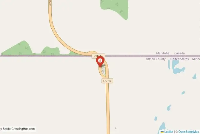
Approximate Border Location
Border Countries
- 🇺🇸United States
- 🇨🇦Canada
Border Cities
- 🇺🇸Lancaster, Minessota
- 🇨🇦Tolstoi, Manitoba
Wait Times
15-30 min for pedestrians/vehicles
Just crossed? Tap to report:
Operating Hours
Open 9:00 AM – 5:00 PM
Crossing Types
Pedestrians, vehicles
Border Type
Land crossing via road
Peak Times
Mornings (8-11 AM)
Daily Crossings
~500 travelers/vehicles
Currency Exchange
Limited near Lancaster (USD, CAD)
Safety Information
Remote, beware weather
Languages Spoken
English
Accessibility Features
Ramps
About Lancaster, Minessota & Tolstoi, Manitoba
Monthly Update (March 2026):
As of 03/2026, the Lancaster, Minnesota & Tolstoi, Manitoba Border Crossing remains quiet most of the time. Local traffic passes steadily, and long lines are rare. Inspections can still take a few extra minutes when several vehicles arrive together. Snowy conditions in late winter sometimes slow the approach roads.
No Cell Service at the Border? No Problem.
Don’t get caught scrambling for paperwork when you lose signal. Download the complete North America Transit Guide directly to your device and access every critical detail, fast-track strategy, and border rule – 100% offline.
A Quiet Crossing on the Prairie
The border crossing connecting the area near Lancaster, Minnesota, with Tolstoi, Manitoba, is a journey into the quiet, agricultural heartland of the North American prairies. This is not a major trade corridor or a bustling tourist route; it is a small, local checkpoint on a two-lane road that runs through a vast, flat landscape of endless fields. To cross here is to experience the US-Canada border at its most tranquil and unassuming. It is a passage that serves the needs of the local farming communities, a place defined by the immense sky, the rich soil of the Red River Valley, and the peaceful, cooperative relationship between two friendly nations.
Operational Details
This checkpoint connects Kittson County, Minnesota, with the Municipality of Emerson-Franklin in Manitoba. It is a smaller Port of Entry with limited operating hours, from 8:00 AM to 6:00 PM daily (as permanently maintained effective January 2025). It is essential to verify the current schedule before planning your trip, as arriving after hours will mean a long detour to the 24/7 crossing at Pembina-Emerson. The crossing is intended for passenger cars and local commercial traffic. The facilities are small and functional, and the traffic is generally very light, making for a quick and personal crossing experience with no significant wait times reported.
A History of a Peaceful Frontier
The history of this region is the history of the settlement of the prairies. For centuries, this was the land of the First Nations and the great bison herds. In the 19th century, the “49th parallel” was established as the border between the United States and British North America (later Canada). The area was settled by European immigrants, particularly from Scandinavia, Germany, and Ukraine, who turned the vast grasslands into one of the most productive agricultural regions in the world. The border has been overwhelmingly peaceful, and this crossing is a powerful symbol of that long-standing friendship and the shared agricultural heritage of the region.
Border Crossing Procedure
The border crossing procedure is a professional and efficient process. You will approach a single, primary inspection booth for the country you are entering. You will need a valid passport or other approved travel document (such as a NEXUS card or an Enhanced Driver’s License). The border officer will ask you a series of questions about your citizenship, your destination, the purpose of your trip, and what goods you are bringing with you. Be prepared to declare all items. The process is generally straightforward and courteous. Given the low volume of traffic, the experience is often much more relaxed than at the major highway crossings.
The Surrounding Region: United States Side
On the US side, the crossing is in the far northwestern corner of Minnesota. The nearby town of Lancaster is a small, agricultural community. The entire region is part of the vast Red River Valley, an incredibly flat and fertile agricultural area known for its production of wheat, soybeans, and sugar beets. The area is a paradise for birdwatchers, with numerous wildlife refuges that are home to a vast array of migratory birds. The Lake Bronson State Park is also nearby, offering recreational opportunities.
The Surrounding Region: Canada Side
On the Canadian side, the crossing is in the rural municipality of Emerson-Franklin. The nearby village of Tolstoi is one of the oldest Ukrainian settlements in Western Canada, and the region has a strong Ukrainian cultural heritage, with beautiful Orthodox churches dotting the landscape. The area is part of the “Manitoba Tall Grass Prairie Preserve,” a protected area that preserves one of the last large remnants of this unique and endangered ecosystem. The road from the border leads north towards the provincial capital, Winnipeg.
Practical Travel Information
Practical planning for this route is straightforward. The most important factor is the limited operating hours. The roads are two-lane highways and are well-maintained, but can be subject to closure during winter blizzards. The official currencies are the US Dollar (USD) in the United States and the Canadian Dollar (CAD) in Canada. Services are limited in the immediate border area, so it is best to plan for fuel and other needs in the larger towns. Be aware of the customs limits for goods, particularly agricultural products. Recent 2025–2026 reports indicate light traffic and no major restrictions or safety concerns beyond standard seasonal weather.
Final Considerations
The Lancaster–Tolstoi border crossing is a journey through the heart of the North American continent. It is a quiet, peaceful checkpoint that is a vital link for the local farming communities. It is a passage through a landscape of immense scale and agricultural productivity. For the traveler, it offers a straightforward and relaxed experience, a testament to the peaceful and cooperative relationship that defines the world’s longest undefended border. It is a crossing that is as vast and open as the prairie sky above it, a perfect example of a friendly, small-town frontier.
No reviews yet.