Monthly Update (October 2026):
Kharlachi & Paktia remains a smaller Afghanistan–Pakistan crossing compared with Torkham and Chaman, serving the southeastern Afghan–Pakistan frontier. Its remote location and the security situation in the surrounding Paktia region remain more important to travelers than ordinary passenger queues. No significant October development has established it as a dependable alternative to the major crossings, so travelers should confirm current authorization and operating status before using the route.
About this crossing
Operational Details
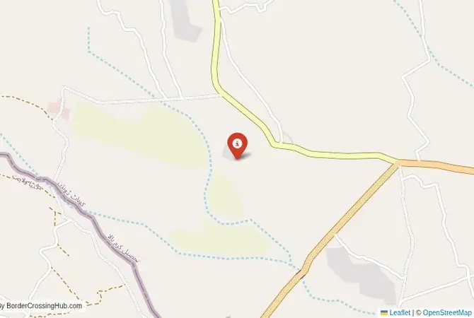
This checkpoint connects Pakistan's Kurram District in the Khyber Pakhtunkhwa province with Afghanistan's Paktia Province. It is one of the officially recognized crossings between the two nations. The crossing has been modernized in recent years to improve the processing of trade, as it is an important route for the export of Afghan fruit and other agricultural products. Despite the modern facilities, the crossing is frequently closed due to security incidents, military operations, or political disputes. Its operation is always subject to the prevailing security situation.
A History of the Durand Line
The history of this crossing is the history of the Durand Line, the border established in 1893 between British India and Afghanistan. This line was drawn through the heart of the Pashtun tribal lands, dividing the Pashtun people between two states. Afghanistan has never officially recognized the Durand Line as a permanent international border. The Kurram valley has been a particularly sensitive and strategic area, a "parrot's beak" of Pakistani territory that juts into Afghanistan. During the Soviet-Afghan War, it was a major base for the Mujahideen. In recent decades, it has been a frontline in the war against the Taliban and other militant groups.
Nearby Border Crossings

The Border Crossing Procedure
The border crossing procedure is an extremely rigorous and meticulous process, reflecting the extreme security situation. You will need a valid passport and valid visas for both countries, which must be obtained well in advance. The checks by both Afghan and Pakistani authorities are intense. The area is a major transit point for militants, smugglers, and refugees, and the security forces on both sides are on high alert. For foreigners, crossing here would be an exceptional event, requiring high-level official permission and a major security detail. It is not a standard procedure.
The Surrounding Region: Pakistan Side
On the Pakistani side, the crossing is in the Kurram District, part of the former Federally Administered Tribal Areas (FATA). The main town is Parachinar. The region is a landscape of rugged mountains and fertile valleys. It has a significant Shia Muslim population, which has often been the target of sectarian violence by Sunni extremist groups. The area is still subject to military control, and access is heavily restricted. The journey from the main city of Peshawar to the border is a journey through numerous military checkpoints.
The Surrounding Region: Afghanistan Side
On the Afghan side, the crossing is in the Paktia Province. The nearby city of Gardez is the main provincial capital. The province has been a major stronghold for the Haqqani network, one of the most powerful and violent factions of the Taliban. The security situation is extremely volatile. The road from the border leads towards the city of Kabul.
Practical Travel Information
Travel on this route is not possible for independent tourists. The entire region is a high-risk security zone. The official currencies are the Pakistani Rupee (PKR) in Pakistan and the Afghan Afghani (AFN) in Afghanistan. Any travel would have to be part of an official, heavily guarded convoy. The risks of kidnapping, IEDs, and terrorist attacks are extremely high.
Final Considerations
The Kharlachi border crossing is a journey into the heart of one of the world's most famous and dangerous conflict zones. It is a place where modern geopolitics, tribal traditions, and religious extremism have converged to create a landscape of perpetual conflict. It is a vital economic artery that operates under the constant shadow of war. It is a border that is not for the traveler, but for the soldier, the spy, the trader, and the people who call this beautiful but unforgiving land their home. It is a true frontier, a line that is written in blood.
View all border crossings between Pakistan and AfghanistanPractical information
Fuel
Afghanistan: 2 km - Pakistan: 2 km
Currency
Local exchange; AFN, PKR
Safety information
Remote; elevated security risk
Connectivity
Basic mobile 3G
Have you crossed here?
Help other travelers by sharing your experience, wait times, and any updates.