Monthly Update (September 2026):
Kawarpuchiah & Kawrpuichhuah remains a remote local crossing between Bangladesh and Mizoram rather than a normal international gateway for foreign tourists. There is no significant September change to report, and its limited local role continues to distinguish it from the larger India-Bangladesh checkpoints. The mountainous terrain and monsoon conditions around southern Mizoram can make the approach more challenging than the border procedure itself, so this remains a route best suited to permitted local movements.
About this crossing
The Kawarpuchiah Crossing: A Frontier in the Mizo Hills
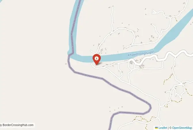
This border crossing is located deep within the Lushai Hills (also known as the Mizo Hills), a formidable mountain range that forms the border between Bangladesh and India in this region. This is a land of steep, jungle-clad hills, deep river gorges, and remote tribal villages. The border here is not a simple line on a plain but a rugged, mountainous frontier. The crossing connects the Rangamati Hill District of Bangladesh with the Lunglei district of Mizoram. The people on both sides of the border share close ethnic and cultural ties; they are part of the broader Zo people, which includes the Mizos of India and the Chin of Myanmar. The crossing is a simple, functional post, a testament to the need for local connections in a region where geography makes travel extremely difficult. The atmosphere is one of profound remoteness, a place far from the centers of power, where life is dictated by the rhythms of the hills.
A History of a Shared Tribal Homeland
The history of this border is the history of the Zo peoples. For centuries, they lived in these hills under their own chiefs and systems of governance. The modern international border is a legacy of British colonialism, which drew lines through the middle of this tribal homeland, dividing communities between British India and the Chittagong Hill Tracts. After the 1947 Partition, this became the border between India and East Pakistan (now Bangladesh). The border has been a source of tension and conflict. The Chittagong Hill Tracts in Bangladesh have experienced a long-running insurgency, and the region has been heavily militarized. Similarly, Mizoram in India had its own period of insurgency before a successful peace accord was signed. The Kawarpuchiah crossing, therefore, is situated in a region with a complex history of conflict and security challenges. Its operation is tightly controlled by the security forces of both nations, the Border Guard Bangladesh (BGB) and the Indian Border Security Force (BSF).
Nearby Border Crossings



Border Procedures: Not Applicable for Tourists
As this is not an international crossing for foreigners, there are no procedures for tourists. The crossing is designated as a Land Customs Station, meaning its primary official purpose is to regulate and tax a limited amount of local, cross-border trade in items like ginger, turmeric, and bamboo. It also serves as a point for local residents to cross under specific agreements, often for market days or family occasions, with special permits. For a foreign traveler, there is no way to get a legal entry or exit stamp at this location. The facilities are not equipped to handle international passports or visas. Any foreigner attempting to use this crossing would be in violation of the immigration laws of both countries and would be immediately detained by the BSF or BGB for questioning. This is a high-security area, and unauthorized movement is treated as a serious security matter.
The Regional Context: The Chittagong Hill Tracts and Mizoram
This is one of the most remote and inaccessible regions on the subcontinent. On the Bangladeshi side, the Chittagong Hill Tracts are a special administrative zone. Travel for foreigners within the CHT remains highly restricted and requires special permits from the authorities in Dhaka, which are difficult to obtain, with ongoing advisories against travel due to risks of politically motivated violence, kidnappings, and ethnic clashes as of 2026. The region is beautiful but remains a sensitive area due to its history of conflict. On the Indian side, the state of Mizoram requires special permits (Protected Area Permit - PAP) for travel for many foreigners, with rules reimposed in recent years due to security concerns. The infrastructure in the entire region is very basic. The roads are narrow, winding mountain tracks that are often impassable during the monsoon season due to landslides. Travel is slow, difficult, and requires a 4x4 vehicle and extensive local knowledge. This is a region for serious, dedicated exploration, not casual travel.
Final Contextual Note: A Border for Locals Only
The Kawarpuchiah-Kawrpuichhuah crossing is a vital local link in a remote and rugged part of the world. It serves the needs of the communities who have lived in these hills for generations. However, for the international traveler, it is firmly off-limits. It is not a hidden gateway or an adventurous shortcut. It is a restricted border in a sensitive region. Any overland travel between Bangladesh and Northeast India must be done through the official, designated international crossings, such as the one at Agartala-Akhaura in Tripura or Tamabil-Dawki in Meghalaya. These crossings have the legal authority and the necessary infrastructure to process foreign nationals. The crossing in the Mizo Hills remains a testament to the resilience of local life on a challenging and beautiful frontier.
View all border crossings between Bangladesh and IndiaPractical information
Currency
Limited exchange (BDT, INR)
Safety information
Safe, river nearby
Connectivity
Limited Wi-Fi, 3G
Have you crossed here?
Help other travelers by sharing your experience, wait times, and any updates.