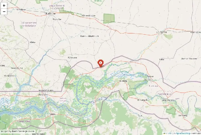
Approximate Border Location
Wait Times
15–45 min
Just crossed? Tap to report:
Operating Hours
7:00 AM–6:00 PM
Crossing Types
Pedestrian, cars
Border Type
Land
Peak Times
Market days
Daily Crossings
200–700
Safety Information
Quiet rural area
Languages Spoken
English,Wolof
Accessibility Features
Minimal
About Kaur & Wassu (Janneh Kunda area)
Monthly Update (May 2026):
As of May 2026, the Kaur & Wassu (Janneh Kunda area) Border Crossing is staying quiet and mostly stable. It’s a low-key spot where the Senegalese side can be a bit slower with vehicle paperwork, though pedestrians rarely have to wait long. Everything ticks along fine unless a local market day brings an unexpected burst of travelers that bogs down the process.
Introduction to the crossing
You reach a quieter, lesser-known land border in the Central River Region where roads connect central Gambia with southern Senegal. This post near Kaur on the Gambian side and the Wassu/Janneh Kunda area on the Senegalese side serves mainly local traders, farmers, and residents moving between the two countries. It offers an off-the-beaten-path option for foreign travelers who want to avoid the main northern or southern crossings while exploring inland routes.
Position and connections
Kaur sits along the north bank of the Gambia River in Gambia’s Central River Division. The Senegalese side near Wassu or Janneh Kunda lies just across in the Kolda or Sedhiou region. The border here cuts through savanna, rice fields, and wooded areas close to the river. From the Gambian side you link toward Janjanbureh or further west to Banjul. On the Senegalese side roads head toward inland towns and eventually Ziguinchor or other southern points. Trade focuses on local goods like rice, groundnuts, and fish, with many daily movements by foot or small vehicles.
Background details
The area reflects the deep historical and ethnic ties across this long, winding border. Communities share family links and have crossed for generations despite the official line. Kaur and nearby Wassu are known for their proximity to cultural sites, including ancient stone circles that draw occasional visitors. The post functions as a secondary point with limited infrastructure compared to bigger crossings, supporting everyday local traffic rather than heavy international flows.
Signal can be a coin toss at borders, and the last thing you want is to be stuck at the gate hunting for info. We’ve pulled all our research for this region into one simple eBook that works 100% offline. It keeps everything you need in one spot so you can stay focused on the trip. Grab the guide here.
Operating hours
This smaller post usually operates during daylight hours, roughly from 8 AM to 5 or 6 PM. Both sides use the same time zone. Arrive early to finish processing before closing, as staffing can be limited and hours sometimes adjust without much notice. Confirm locally if possible, since secondary posts like this adapt to daily conditions.
Crossing from Gambia into Senegal
At Kaur you handle Gambian exit formalities first. Officials check your passport and stamp you out. Then you proceed the short distance across to the Senegalese side near Wassu or Janneh Kunda for entry. Senegal grants visa-free access for up to 90 days to many nationalities. Present your yellow fever certificate and answer basic questions about your plans. The process stays low-key but can involve manual paperwork at multiple small counters.
Entering Gambia from Senegal
Begin with exit stamps on the Senegalese side. Cross and complete entry at the Kaur post. The Gambia offers visa on arrival or visa-free options for many visitors, often with a fee around USD 20-100 depending on nationality. Have cash ready (dalasi preferred) and show proof of onward travel or funds. Yellow fever vaccination is mandatory and checked.
Wait times and daily flow
With light traffic, full crossings often wrap up in 30 to 90 minutes. Market days or group movements add some delays. The relaxed pace means fewer crowds than at major posts, though occasional extra questions or checks can stretch things. Rainy season from June to October brings mud and slower approach roads, while dry months feel more straightforward.
Transport options
Shared taxis, minibuses, or motorbikes handle most movement here. From the Gambian side you find rides toward Janjanbureh or other river towns. On the Senegalese side options connect to nearby villages and larger hubs. No big bus station exists at the post, so arrange onward transport nearby after immigration. Travelers often piece together short segments with local drivers.
Roads and scenery
Approach tracks mix laterite surfaces with some paved sections that degrade quickly in rain. You pass rice paddies, small villages, baobab trees, and open savanna typical of the river valley. Traffic includes taxis, loaded bikes, pedestrians, and occasional trucks. Wet season turns paths slippery with puddles and potholes. The short border stretch stays easy to walk.
Security situation and caution
This inland area generally sees calm daily activity for those using official posts during daylight. Still, check current official travel advisories before crossing, as broader regional issues can occasionally affect border zones. Stick to main roads, travel before dark, and avoid unofficial paths. Most visitors report routine experiences when prepared.
Scams and traveler experiences
Smaller crossings sometimes attract unofficial helpers offering unnecessary services or extra fees. Reports mention minor confusion at counters or requests for small payments. Carry exact change in dalasi and CFA francs, stay at official buildings, and politely decline unrequested assistance. Keep documents organized and stay patient during checks.
Nearby spots
Kaur offers a typical riverside town feel with local markets. The Wassu area on both sides gives access to the famous Wassu Stone Circles, a UNESCO site with ancient megalithic rings. Janneh Kunda and surroundings provide glimpses into rural village life, rice farming, and birdwatching opportunities along the Gambia River. Further out you reach Janjanbureh for more cultural exploration.
Preparation steps
Confirm visa and yellow fever rules ahead. Bring passport copies, sufficient local currency for fees and small expenses, and proof of onward plans. Download offline maps as mobile signal can fade near the border. If driving, prepare vehicle temporary import papers. Dress modestly, travel in daylight, and review any recent border updates.
Economic and cultural role
The post supports local trade, family visits, and agricultural exchange across the boundary. Markets stay active with everyday goods, while communities maintain strong cross-border ties. It plays a modest but meaningful part in daily life along this stretch of the Gambia River valley.
Seasonal and practical factors
Dry season from November to May brings easier road conditions and fewer weather issues. Rainy months increase mud, flooding risks, and potential delays. Holidays or peak farming periods raise local traffic. Always build extra time into your itinerary.
Crossing advice
Research the latest conditions shortly before travel, allow buffer for processing, and stay flexible. With solid preparation you manage this quiet Kaur and Wassu (Janneh Kunda area) crossing and continue your journey through central Gambia and southern Senegal. (Word count: 1039)
No reviews yet.