Approximate Border Location
Border Countries
- 🇺🇸United States
- 🇨🇦Canada
Border Cities
- 🇺🇸Highgate Springs, Vermont
- 🇨🇦St. Armand/Philipsburg, Quebec
Wait Times
15-60 min for pedestrians/vehicles
Just crossed? Tap to report:
Operating Hours
Open 24 hours
Crossing Types
Pedestrians, vehicles, commercial
Border Type
Land crossing via road
Peak Times
Mornings (7-10 AM), weekends
Daily Crossings
~5000 travelers/vehicles
Currency Exchange
Available near Highgate Springs (USD, CAD)
Safety Information
Generally safe, busy traffic
Languages Spoken
English
Accessibility Features
Ramps, elevators
About Highgate Springs, Vermont & St. Armand/Philipsburg, Quebec
Monthly Update (March 2026):
In 03/2026, the Highgate Springs, Vermont & St. Armand/Philipsburg, Quebec Border Crossing stays fairly busy but predictable. It’s a main route between Montreal and the northeastern U.S., so vehicle lines often build during afternoon travel. Passenger cars usually clear faster than trucks. Holiday weekends and ski-season traffic can stretch waits.
No Cell Service at the Border? No Problem.
Don’t get caught scrambling for paperwork when you lose signal. Download the complete North America Transit Guide directly to your device and access every critical detail, fast-track strategy, and border rule – 100% offline.
The Lake Champlain Corridor
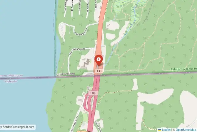
The border crossing connecting Highgate Springs, Vermont, with St. Armand/Philipsburg, Quebec, is the second major gateway between the Northeastern United States and the province of Quebec. This is the main highway, where US Interstate 89 meets Quebec Route 133, the primary route that runs along the eastern shore of the magnificent Lake Champlain. It is a busy, 24/7 international facility, a critical artery for trade and tourism. To cross here is to travel a route of great scenic beauty and historical importance, a passage through a landscape of wide-open water, fertile farmland, and a rich, multicultural heritage. It is a crossing that serves as the main gateway to the beautiful Eastern Townships of Quebec.
Operational Details
This checkpoint connects Franklin County, Vermont, with the Brome-Missisquoi Regional County Municipality of Quebec. It is a full-service international crossing, open to all passenger cars, buses, and commercial freight. The facility is large and modern, designed to handle a significant volume of traffic. It is the busiest crossing in Vermont. While it is a major corridor, the traffic is generally less overwhelming than at the main New York-Montreal crossing at Champlain, which can sometimes make it a faster alternative for travelers from New England heading to Montreal. Current wait times show no delays for passenger vehicles (as of January 2026).
A History of a Strategic Waterway
The history of this route is the history of the Lake Champlain and Richelieu River valley, which has been a major military and trade corridor for centuries. This was a key battleground during the French and Indian Wars, the American Revolution, and the War of 1812. The modern border was established in the 18th and 19th centuries. During the era of Prohibition in the United States, this border was a major route for smuggling alcohol from Canada. The construction of the interstate highway system in the 20th century solidified this route as a primary link between New England and Quebec.
Border Crossing Procedure
The border crossing procedure is a highly professional and efficient process. You will approach a single, primary inspection booth for the country you are entering. You will need a valid passport or other approved travel document (such as a NEXUS card or an Enhanced Driver’s License). The border officer will ask you a series of questions about your citizenship, your destination, the purpose of your trip, and what goods you are bringing with you. Be prepared to declare all items. You may be directed to a secondary inspection area for a more thorough check. NEXUS card holders can use a dedicated express lane, which can significantly reduce wait times.
The Surrounding Region: United States Side
On the US side, the crossing is in the beautiful Lake Champlain valley of Vermont. The nearby city of St. Albans has a beautiful historic downtown and is known for its annual Maple Festival. The region is a gateway to the magnificent Green Mountains, a paradise for hiking, skiing, and enjoying the famous fall foliage. The city of Burlington, Vermont’s largest city, is a vibrant, progressive hub on the shores of Lake Champlain, with a beautiful waterfront and a lively cultural scene.
The Surrounding Region: Canada Side
On the Canadian side, the crossing is the gateway to the Eastern Townships (Cantons-de-l’Est) of Quebec, a beautiful region of rolling hills, picturesque villages, and vineyards. The region was originally settled by Loyalists fleeing the American Revolution and has a unique blend of New England and French-Canadian charm. The “Route des Vins” (wine route) is a major tourist attraction. The nearby town of Bedford is a charming local center. The road from the border provides a direct connection to the city of Montreal, which is about an hour’s drive away.
Practical Travel Information
Practical planning for this route is straightforward. The highway is a modern, multi-lane road. The official currencies are the US Dollar (USD) in the United States and the Canadian Dollar (CAD) in Canada. Be aware of the customs limits for goods, particularly alcohol and tobacco. The crossing is busy, so it is always wise to check live border wait times online before you travel, especially on Friday and Sunday afternoons. The weather in this region can be extreme, with very cold winters and the potential for major snowstorms. Recent 2025–2026 reports confirm no delays and smooth operations, with ongoing modernization at the port providing improved flow.
Final Considerations
The Highgate Springs–St. Armand border crossing is a major artery connecting New England with Quebec. It is a busy, efficient checkpoint that is a vital link for the deeply integrated economies of the two regions. It is a passage through a landscape of great natural beauty and deep historical significance. For the traveler, it is a straightforward and professional experience, a testament to the peaceful and cooperative relationship that defines the world’s longest undefended border. It is a crossing that is the starting point for countless adventures in the mountains, lakes, and charming towns that lie on either side.
No reviews yet.