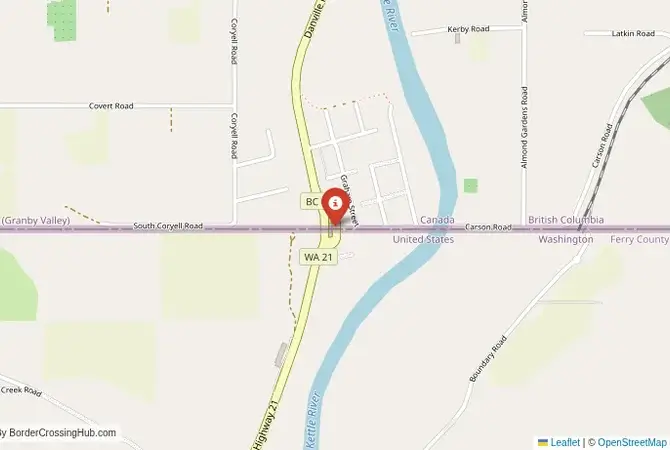
Approximate Border Location
Border Countries
- 🇺🇸United States
- 🇨🇦Canada
Border Cities
- 🇺🇸Danville, Washington
- 🇨🇦Grand Forks, British Columbia
Wait Times
15-30 min for pedestrians/vehicles
Just crossed? Tap to report:
Operating Hours
Open 8:00 AM – 6:00 PM
Crossing Types
Pedestrians, vehicles
Border Type
Land crossing via road
Peak Times
Mornings (7-10 AM)
Daily Crossings
~700 travelers/vehicles
Currency Exchange
Limited near Danville (USD, CAD)
Safety Information
Remote, beware weather
Languages Spoken
English
Accessibility Features
Ramps
About Danville, Washington & Grand Forks, British Columbia
Monthly Update (March 2026):
In 03/2026, the Danville, Washington & Grand Forks, British Columbia Border Crossing runs smoothly and stays fairly predictable. Vehicles usually clear quickly, though routine checks entering Canada can slow things slightly. Late afternoon sometimes brings a small rush of local traffic. Regional events and weekend travel can shift the pace.
No Cell Service at the Border? No Problem.
Don’t get caught scrambling for paperwork when you lose signal. Download the complete North America Transit Guide directly to your device and access every critical detail, fast-track strategy, and border rule – 100% offline.
A Quiet Passage in the Pacific Northwest
Tucked amidst the rolling hills of northeastern Washington, the Danville-Grand Forks border crossing, also known as Danville Border or Grand Forks Port, connects Danville, Washington, to Grand Forks, British Columbia. This lesser-known route ties U.S. Highway 395 and Washington State Route 41 to British Columbia Highway 41, offering a path to Spokane or Kelowna. Its remote vibe means services are sparse, so foreign visitors should check updates from U.S. Customs and Border Protection (CBP) or Canada Border Services Agency (CBSA) before heading out.
Historical Significance
This crossing popped up in the late 19th century amid a mining and logging boom. Grand Forks, named for the confluence of the Kettle and Granby rivers, turned into a copper mining hotspot by the 1890s. The border became a lifeline for trading ore and timber, knitting together American and Canadian settlers in a shared economy. Smuggling squabbles, think alcohol or untaxed goods, spiced things up in the early 20th century. One standout moment was the 1908 railway expansion, which supercharged cross-border trade and left a gritty industrial mark. In 1921, a tense standoff over timber tariffs shut the border for a few days, a reminder of its economic clout even then.
Crossing Procedures and Wait Times
Going north, you’ll flash your passport at Danville’s CBP office for an exit stamp. After a short hop, Canadian immigration in Grand Forks wants a valid passport and, for some, an Electronic Travel Authorization (eTA). It’s $7 CAD and online. Southbound, you’ll snag a Canadian exit stamp before hitting U.S. entry rules, usually just a passport for visa-exempt folks. It’s open 8 AM–8 PM daily, but hours may trim during holidays. Waits typically under 15 minutes with no delay reported recently, though summer weekends (July-August) might push slightly longer. The CBSA’s CanBorder app or CBP site gives real-time wait info. Handy for planning.
Scam Awareness
Scams aren’t common here thanks to light traffic, but in Grand Forks, unofficial “guides” might pitch document help for cash. Skip them and use CBSA or CBP resources. On the U.S. side, vehicle compliance matters; a busted taillight or expired tags could mean a fine. Bring USD or CAD cash. Roadside currency swaps often sting with bad rates. Foreign travelers, check visa needs online to dodge overpriced “assistance” from sketchy border touts.
Transportation and Access
From Spokane, it’s a 2-hour drive to Danville via U.S. Highway 395. No buses or trains hit this spot, so a car’s your best bet. Rentals are fine if you don’t own one. On the Canadian side, Grand Forks connects to Kelowna (2 hours) via Highway 3. Taxis and rideshares are tough to snag, so driving’s the play. Gas stations and basic services are in Grand Forks or Kettle Falls, Washington, about 20 minutes out. If you’re using private transport, settle fares upfront to avoid surprises.
Road Conditions and Scenery
U.S. Highway 395 and BC Highway 41 are paved but narrow, with deer or elk popping up unexpectedly. Keep your eyes peeled. June to September is smooth driving; December to March brings snow and ice, so pack chains or snow tires. Pine forests hug the route, with the Kettle River Valley and Selkirk Mountains painting a stunning backdrop. Summer temps climb to 30°C, while winter can drop to -10°C. Layers are your friend.
Nearby Attractions
Grand Forks has the Boundary Museum, a deep dive into mining history, and the Kettle River for kayaking or a lazy float. South of the border, Colville National Forest (30 minutes) tempts with trails and camping. For bigger adventures, Kelowna’s wineries (2 hours north) or Spokane’s Riverfront Park (2 hours south) call out. Local eateries sling poutine or juicy burgers, a nod to the area’s rustic roots.
Cultural and Economic Role
This crossing mixes American and Canadian rural life. Logging traditions, outdoor obsessions, and all. Grand Forks’ farmers’ markets and Danville’s small-town festivals, like the annual Harvest Days with its pie contests and live music, weave the communities tight. Economically, it props up agriculture and tourism. Canadian fruit exports and U.S. visitors keep cash flowing. Its understated charm is its staying power.
Travel Tips
Confirm the 8 AM–8 PM hours. Gates lock outside that window. Carry USD and CAD for small buys; ATMs are rare. An eTA’s a smart move for visa-exempt travelers to avoid hiccups. Winter travelers, check snow forecasts. Storms can snarl roads fast. Use CBP or CBSA sites for entry rules, and keep valuables secure in this sleepy nook.
Extra Nuggets for Visitors
Cell service can get patchy, so download maps ahead. Summer dust kicks up on side roads; winter winds bite hard. Pack a scarf. Locals are warm but thin on the ground, so self-reliance rules. For eats, try The Wooden Spoon in Grand Forks for comfort food or Kettle Falls’ Hudson’s Hamburgers for a quick, tasty stop. It’s a chill spot. Embrace the pace.
No reviews yet.