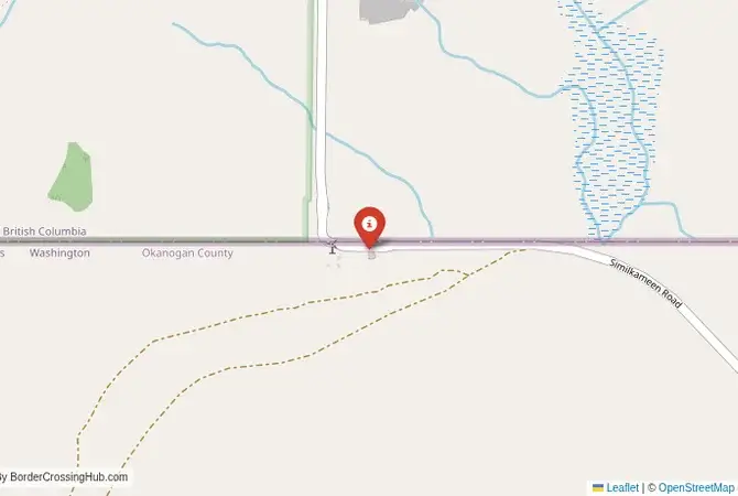
Approximate Border Location
Border Countries
- 🇺🇸United States
- 🇨🇦Canada
Border Cities
- 🇺🇸Chopaka, Washington
- 🇨🇦Nighthawk, British Columbia
Wait Times
15-30 min for pedestrians/vehicles
Just crossed? Tap to report:
Operating Hours
Open 8:00 AM – 5:00 PM
Crossing Types
Pedestrians, vehicles
Border Type
Land crossing via road
Peak Times
Mornings (7-10 AM)
Daily Crossings
~300 travelers/vehicles
Currency Exchange
Limited near Chopaka (USD, CAD)
Safety Information
Remote, beware weather
Languages Spoken
English
Accessibility Features
Ramps
About Chopaka, Washington & Nighthawk, British Columbia
Monthly Update (March 2026):
As of 03/2026, the Chopaka, Washington & Nighthawk, British Columbia Border Crossing feels quiet and steady. Traffic is light, mostly local travelers and occasional tourists. The pace can slow briefly when several cars arrive together at the small checkpoint. Winter weather in the surrounding hills sometimes affects the drive to the border.
No Cell Service at the Border? No Problem.
Don’t get caught scrambling for paperwork when you lose signal. Download the complete North America Transit Guide directly to your device and access every critical detail, fast-track strategy, and border rule – 100% offline.
General Overview
The Chopaka, WA – Nighthawk, BC border crossing, also known as Nighthawk Border or Chopaka Station, is remote with rare scams; stay cautious, use official services, and verify with government sources. Tucked in Washington’s Okanogan County, the Chopaka, WA – Nighthawk, BC border connects to British Columbia’s Similkameen Valley via Similkameen Road. This serene crossing, nestled among desert hills, sagebrush, and burgeoning vineyards, offers a peaceful route for travelers exploring Washington’s wine country or BC’s orchard-laden landscapes, far from urban bustle.
Historical and Geopolitical Context
Opened in the early 20th century to serve miners and farmers, this crossing was formalized in the 1920s with small customs posts. It supports CA$100 million in annual trade, primarily apples, cherries, and wine grapes, reflecting the region’s agricultural roots. The Syilx (Okanagan) people’s heritage adds cultural depth, with cross-border ties evident in local festivals. In 2026, border operations remain stable with no major disruptions reported; Canadian customs continue routine checks, with minimal delays for local trucks. Its low traffic preserves a tranquil, rural charm, but checking news for disruptions, such as inspections or seasonal closures, is wise to avoid unexpected issues.
Crossing Procedures and Wait Times
Open daily from 9:00 AM to 5:00 PM, the border sees minimal traffic, with waits typically under 15 minutes and no delay reported recently (call for updates). U.S. immigration in Chopaka, at 2600 Similkameen Road, processes exit stamps; Canadian immigration in Nighthawk, a short drive north, handles entry. Most nationalities receive a 90-day visa-free stamp for Canada; U.S. entry requires a passport or NEXUS card. Carry your passport, vehicle registration, and proof of insurance. NEXUS lanes are unavailable due to the crossing’s small scale. English is widely spoken, though basic French may help in BC. Wait times are rarely posted online; call U.S. Customs (509-476-2955) or Canada Border Services (1-800-461-9999) for updates.
Scam Awareness
Scams are rare due to the crossing’s low volume, but vigilance is key. Money changers in Nighthawk may offer poor exchange rates; stick to ATMs or banks in Osoyoos, 20 km north. Taxi drivers may inflate fares (~$20-25 USD) for short trips; always negotiate upfront. Unofficial “border helpers” offering paperwork assistance are unnecessary. Avoid them, as the process is simple. Duty-free shops are absent, but local vendors may sell “tax-free” wine or crafts; verify legitimacy with established businesses like Osoyoos’ wineries. In recent years, local forums reported fake vineyard tour guides targeting visitors. Book through reputable operators like Destination Osoyoos to avoid overpriced or fraudulent tours.
Transportation Options
No public buses serve this border directly; taxis (~$25 USD) or private cars take 5-10 minutes between Chopaka and Nighthawk via Similkameen Road’s narrow, paved stretch. From Nighthawk, BC Transit buses to Kelowna (2 hours, ~CAD 30) are infrequent. Check schedules at Osoyoos’ visitor center. In Chopaka, buses to Oroville (20 minutes, ~$10 USD) are limited; confirm with Okanogan County Transit. Roads wind through desert hills and the Similkameen River valley, offering scenic vineyard views. Pedestrians can cross, but towns are 5-10 km apart, making vehicles preferable. Winter ice and occasional rockslides require caution; check Washington’s 511 or BC’s 511 for road updates. The route’s arid beauty and occasional deer sightings add a unique charm.
Nearby Attractions and Tips
Nighthawk’s Similkameen River is ideal for fishing or kayaking, while Osoyoos, 20 km north, boasts Canada’s only desert at the Nk’Mip Desert Cultural Centre, showcasing Syilx history through exhibits and guided tours. Book via official operators. In Chopaka, the Okanogan National Forest, 30 km south, offers hiking trails and wildlife viewing. The Okanagan Wine Trail, 10 km north, features award-winning wineries like Burrowing Owl; reserve tastings early. Carry USD or CAD, as ATMs are scarce in Nighthawk, and small shops prefer cash. Stay in Osoyoos for resorts like Watermark Beach or campgrounds like Nk’Mip RV Park. A Canadian SIM card ensures connectivity, as U.S. signals fade north. Try Osoyoos’ diners for poutine or local fruit pies, and visit summer farmers’ markets for fresh cherries and crafts.
Seasonal and Weather Considerations
Summer (June-August) brings hot, dry weather (25-35°C) and slight tourism from wine enthusiasts, with waits minimal. Winter (December-March) delivers snow (-5 to 5°C) and icy roads, requiring winter tires; check 511 services for conditions. Spring and fall are quiet but rainy, with occasional mudslides. Peak holidays, like Canada Day or U.S. Labor Day, see minor traffic increases, so cross early to avoid delays. Osoyoos’ wine festivals in summer and fall add vibrancy, drawing regional visitors.
Planning Your Crossing
Bring a valid passport or NEXUS card, vehicle documents, and cash for small transactions. Use official transport, check wait times by phone, and avoid unofficial vendors to steer clear of scams. This crossing connects Washington’s rugged wine country with BC’s lush orchards, offering a serene blend of agriculture, culture, and natural beauty for travelers seeking a quiet escape.
No reviews yet.