Approximate Border Location
Border Countries
- 🇺🇸United States
- 🇨🇦Canada
Border Cities
- 🇺🇸Champlain, New York
- 🇨🇦Saint‑Bernard‑de‑Lacolle, Quebec
Wait Times
15-60 min for pedestrians/vehicles
Just crossed? Tap to report:
Operating Hours
Open 24 hours
Crossing Types
Pedestrians, vehicles, commercial
Border Type
Land crossing via road
Peak Times
Mornings (7-10 AM), weekends
Daily Crossings
~10000 travelers/vehicles
Safety Information
Generally safe, busy traffic
Languages Spoken
English
Accessibility Features
Ramps, elevators
About Champlain, New York & Saint‑Bernard‑de‑Lacolle, Quebec
Monthly Update (May 2026):
Moving through May 2026, the Champlain, New York & Saint‑官bernard‑de‑Lacolle, Quebec Border Crossing is mostly stable but remains one of the busier hubs. Commercial trucks often stack up in their own lanes, while passenger cars usually tick along nicely unless it’s a weekend afternoon. It stays predictable for the most part, but a festival in Montreal can quickly stretch waits at the booths.
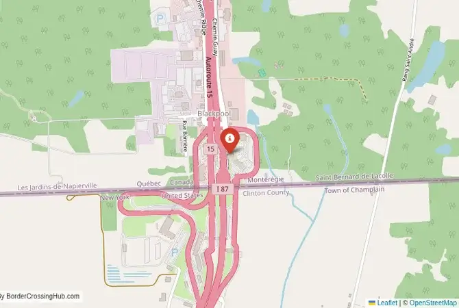
The Main New York-Montreal Corridor
The border crossing connecting Champlain, New York, with Saint-Bernard-de-Lacolle, Quebec, is one of the busiest and most important checkpoints on the entire US-Canada border. This is the main highway, where US Interstate 87 becomes Quebec Autoroute 15, the primary route that links New York City with Montreal. It is a massive, 24/7 international facility, a critical artery for trade, tourism, and the deep cultural and economic ties between the Northeastern United States and Quebec. To cross here is to travel on a major North American corridor, a passage through a landscape of fertile river valleys and rolling hills, a journey defined by its immense strategic importance and the constant, overwhelming flow of traffic.
Operational Details
This checkpoint connects Clinton County, New York, with the Montérégie region of Quebec. It is a full-service international crossing, open to all passenger cars, buses, and commercial freight. The facility is vast on both sides, with numerous lanes, large, modern administrative buildings, and extensive infrastructure for customs and border control. It is the busiest crossing in New York State and one of the top five busiest on the entire border. Despite its size and modern design, the sheer volume of traffic means that queues, especially on weekends and holidays, can be very long. Current wait times show no delays for passenger vehicles (as of January 2026), though redevelopment work at related nearby facilities may cause occasional variations until Winter 2027.
A History of a Strategic Valley
The history of this route is the history of the Richelieu River and Lake Champlain valley, which has been a major military and trade corridor for centuries. This was a key battleground during the French and Indian Wars, the American Revolution, and the War of 1812. The forts at Crown Point and Ticonderoga, further south in New York, are a testament to the region’s strategic importance. The modern border was established in the 18th and 19th centuries. The construction of the interstate highway system in the 20th century solidified this route as the primary link between the two major metropolitan areas of New York and Montreal.
Signal can be a coin toss at borders, and the last thing you want is to be stuck at the gate hunting for info. We’ve pulled all our research for this region into one simple eBook that works 100% offline. It keeps everything you need in one spot so you can stay focused on the trip. Grab the guide here.
Border Crossing Procedure
The border crossing procedure is a highly professional and efficient process, but one that is designed to handle a huge volume of traffic. You will approach a single, primary inspection booth for the country you are entering. You will need a valid passport or other approved travel document (such as a NEXUS card or an Enhanced Driver’s License). The border officer will ask you a series of questions about your citizenship, your destination, the purpose of your trip, and what goods you are bringing with you. Be prepared to declare all items. You may be directed to a secondary inspection area for a more thorough check. NEXUS card holders can use a dedicated express lane, which can significantly reduce wait times (NEXUS lanes open daily with limited hours, typically 6 AM to midnight for Canada entry and 6 AM to 8 PM for US entry).
The Surrounding Region: United States Side
On the US side, the crossing is in the small town of Champlain. The area is part of the beautiful Lake Champlain valley. The city of Plattsburgh, on the shores of the lake, is a major regional center with a rich history from the War of 1812. The region is a gateway to the magnificent Adirondack Mountains, the largest protected area in the contiguous United States, a paradise for hiking, canoeing, and winter sports. The Lake Placid Olympic sites are also in this region.
The Surrounding Region: Canada Side
On the Canadian side, the crossing is the gateway to the Montérégie region of Quebec, known for its apple orchards and cideries. The road from the border is a modern autoroute that leads directly to the city of Montreal, which is less than an hour’s drive away. Montreal is the second-largest French-speaking city in the world, a vibrant, multicultural metropolis famous for its historic old town (Vieux-Montréal), its world-class festivals, its unique culinary scene, and its European charm. The Eastern Townships, a beautiful region of rolling hills, picturesque villages, and vineyards, are also easily accessible from this crossing.
Practical Travel Information
Practical planning for this route is straightforward. The highway is a modern, multi-lane road. The official currencies are the US Dollar (USD) in the United States and the Canadian Dollar (CAD) in Canada. Be aware of the customs limits for goods, particularly alcohol and tobacco. The crossing is very busy, so it is always wise to check live border wait times online before you travel, especially on Friday and Sunday afternoons. The weather in this region can be extreme, with very cold winters and the potential for major snowstorms. Recent 2025–2026 reports note occasional peak delays in summer/holidays but generally smooth processing outside rush periods.
Final Considerations
The Champlain–Saint-Bernard-de-Lacolle border crossing is the main artery connecting two of North America’s greatest cities. It is a busy, efficient checkpoint that is a vital link for the deeply integrated economies of New York and Quebec. It is a passage through a landscape of great natural beauty and deep historical significance. For the traveler, it is a straightforward and professional experience, a testament to the peaceful and cooperative relationship that defines the world’s longest undefended border. It is a crossing that is the starting point for countless adventures in the mountains, lakes, and vibrant cities that lie on either side.
No reviews yet.