Monthly Update (September 2026):
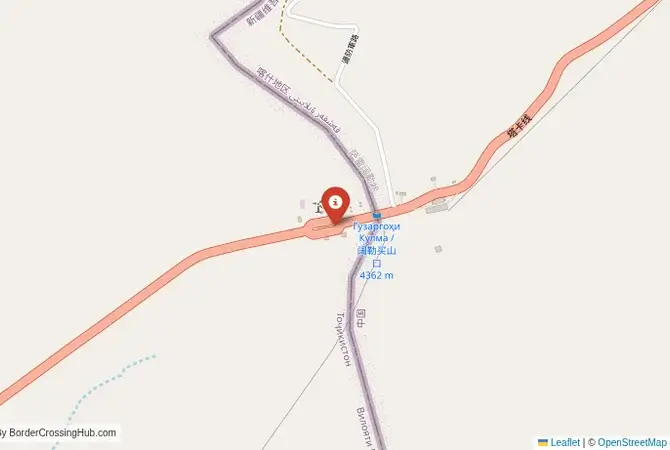
Kulma & Pamirs remains Tajikistan's only modern international land crossing with China. Tajikistan's Foreign Ministry identifies Kulma as the country's sole China border-crossing point and classifies it as international. Current border information lists Kulma-Karasu as a daylight highway crossing, making the timing of arrival particularly important on the high Pamir route. Travelers should also allow extra time for the remote mountain approach, where weather and road conditions can matter more than the border queue.
About this crossing
A History of a New Silk Road Artery
Unlike the ancient Silk Road routes over other passes, the Kulma Pass was not a major historical thoroughfare. The route was too high and difficult. Its modern history begins in the early 2000s when, as part of a new era of cooperation, Tajikistan and China agreed to build a road and open a formal border crossing to boost trade. The "Sino-Tajik Friendship Road" was a major engineering project, creating a link between the Pamir Highway (M41) in Tajikistan and the Karakoram Highway (KKH) in China. This new artery was intended to provide Tajikistan with a direct route to a seaport via China and Pakistan, and to give China a new strategic foothold in Central Asia. The crossing opened in 2004 and has since become a vital, if challenging, route for Chinese trucks bringing consumer goods into Tajikistan and for Tajik trucks transporting minerals and other raw materials back to China. It is a border born entirely of modern geopolitical and economic ambition.
The Border Crossing Procedure: A Restricted and Complex Expedition
Independent travel across the Kulma Pass is impossible. You must be part of a fully organized tour, with a licensed Tajik operator handing you over to a licensed Chinese operator at the border, or vice versa. The process is long, expensive, and subject to the border's limited operating hours (it is often closed on weekends and for a long lunch break).The Tajik Side: The journey begins from Murghab, the main town in the eastern Pamirs. It is a drive of a few hours on a rough road to the Tajik border post. You will need your passport, your Tajik visa, and your GBAO permit. The Tajik officials will check your documents and provide an exit stamp. The process on this side is relatively straightforward. The No-Man's-Land: After the Tajik post, you will be driven for 14 kilometers through a high-altitude, desolate no-man's-land to the Chinese facility at the top of the pass. The Chinese Side (Karasu Port): The Chinese port of entry at Karasu is a massive, modern, high-security facility that feels completely out of place in the remote landscape. The procedures here are extremely strict and time-consuming. The entire process on the Chinese side can take many hours. Only after every check is complete can you begin the long drive down from the pass towards Tashkurgan and the Karakoram Highway.
Nearby Border Crossings




Logistics, Permits, and Seasonal Constraints
The Kulma Pass is a logistical puzzle. You must arrange the entire crossing months in advance with tour agencies that specialize in this route. They will handle the necessary permits and coordinate the handover at the border. The cost is significant. The pass is generally open from May 1st to November 30th each year, but these dates can change based on weather conditions. It is typically closed on weekends and all Chinese and Tajik national holidays. You must plan your itinerary with extreme precision to align with the border's operating schedule. The altitude is a major factor; you must be well-acclimatized before attempting the crossing to avoid serious illness. The journey requires complete self-sufficiency in terms of food and water. This is one of the most demanding border crossings in the world for an overland traveler.
Final Contextual Note: A High-Altitude Hurdle
The Kulma Pass is a magnificent journey through the heart of the Pamirs, connecting two of the world's great mountain highways. However, it is not a simple border crossing. It is a tightly controlled strategic gateway where security and political considerations are paramount. The bureaucracy, cost, and logistical complexity make it an option for only the most determined and well-funded of overland travelers. It is a place that demands respect for its formidable geography and its equally formidable political reality. For most, it remains a legendary line on the map, a symbol of the immense challenges and rewards of travel at the intersection of great empires and great mountain ranges.
View all border crossings between Tajikistan and ChinaPractical information
Currency
Exchange near Kulma (TJS, CNY)
Safety information
Restricted access, altitude risks
Connectivity
Limited Wi-Fi, 3G
Have you crossed here?
Help other travelers by sharing your experience, wait times, and any updates.