Monthly Update (September 2026):
Sost Tashkurgan Border Crossing remains a highly unusual high-altitude international crossing on the Khunjerab Pass. The route is currently being used by organized travelers, with a September 18 Sost-to-Tashkurgan itinerary published for this month, confirming that the crossing is operating during the September travel season. Recent 2026 traveler reports also indicate that the crossing can involve special transport and additional permit checks on the Chinese side, even when travelers hold the necessary Pakistani visa. The 4,693-metre altitude and the long Karakoram approach remain much bigger practical concerns than queues.
About this crossing
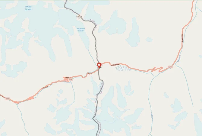
This crossing follows the Karakoram Highway, a road often described as one of the highest paved international highways anywhere. If you are traveling overland between these two countries, this is the primary and only official route available.
A Remote Crossing With Strict Controls
Unlike many borders, this one operates under tight regulations. You cannot simply show up and cross independently without preparation. Both Pakistan and China enforce controlled access, and foreign travelers usually need to be part of an organized tour or have special permits.
Nearby Border Crossings





China, in particular, restricts movement in the Xinjiang region. You may be required to travel with a guide once you enter Chinese territory. Independent travel beyond Tashkurgan is often limited for foreign visitors.
You should verify all requirements well in advance, as rules can change without much notice.
Historical Context of the Karakoram Route
The route between Sost and Tashkurgan follows ancient trade paths that were once part of the Silk Road network. For centuries, traders moved goods like silk, spices, and precious stones through these mountains, despite the harsh terrain.
The modern Karakoram Highway, completed in the late 20th century, transformed this historic route into a paved road connecting Pakistan and China. It stands as a major engineering achievement, built through landslide-prone valleys and extreme altitudes.
Even today, the crossing reflects both its historical roots and its modern geopolitical importance, particularly in trade and regional cooperation.
Operating Season and Hours
This border crossing is not open year-round. Due to heavy snowfall and dangerous conditions in winter, it typically operates from around April or May until late autumn, often closing in November.
Daily operating hours are usually limited to daytime, often between 9:00 AM and 5:00 PM, though this can vary depending on weather and administrative decisions.
If you are planning a trip, you must confirm the opening schedule before departure, especially during shoulder seasons when conditions can change quickly.
Immigration Process and Checkpoints
On the Pakistani side, immigration takes place in Sost. The town has a dry port where customs and immigration procedures are handled.
After exiting Pakistan, you will travel toward the Khunjerab Pass, which sits at over 4,600 meters above sea level. This is the actual border line between the two countries.
On the Chinese side, immigration is completed in Tashkurgan, not directly at the pass. You will continue driving for several hours after crossing the border before reaching the main checkpoint.
This setup means the process can take an entire day, even without major delays.
The Journey Between Sost and Tashkurgan
The distance between Sost and Tashkurgan is roughly 270 kilometers, but travel time is extended due to terrain and checkpoints.
You will pass through the Khunjerab Pass, one of the highest border crossings in the world. The scenery includes snow-covered peaks, wide valleys, and stretches of open plateau. Wildlife such as yaks and ibex are sometimes visible along the route.
Road conditions on the Karakoram Highway are generally good, but landslides and weather disruptions can occur, particularly after heavy rain or snow.
Altitude and Health Considerations
This crossing reaches extreme elevations, and altitude sickness is a real concern. The Khunjerab Pass sits above 4,600 meters, where oxygen levels are significantly lower than at sea level.
You may experience headaches, dizziness, or shortness of breath if you are not acclimatized. It is advisable to spend time at higher elevations in northern Pakistan before attempting the crossing.
Carrying basic medication and staying hydrated can help reduce symptoms, but you should take altitude risks seriously.
Transport Options and Logistics
From Pakistan, you can reach Sost via the Karakoram Highway from cities like Gilgit or Hunza. Public transport exists, but many travelers prefer private vehicles or organized tours due to the complexity of the crossing.
Cross-border buses have operated in the past between Pakistan and China, but schedules are irregular and subject to suspension. Most travelers rely on arranged transport that handles both sides of the journey.
Once in Tashkurgan, you can continue onward to Kashgar, a major city in Xinjiang, which is about 300 kilometers away.
Weather and Seasonal Challenges
Weather is one of the biggest factors affecting this crossing. Even during the open season, sudden snowfalls or strong winds can disrupt travel.
Temperatures at the Khunjerab Pass can drop below freezing, even in summer. You should carry warm clothing regardless of the season.
Landslides are another concern along the Karakoram Highway, especially after heavy rainfall. Delays of several hours or even days are possible in extreme cases.
Cultural and Regional Significance
This crossing links two culturally distinct regions. On the Pakistani side, you are in Gilgit-Baltistan, known for its mountain communities and diverse languages. On the Chinese side, Tashkurgan is home to Tajik ethnic groups, with a culture influenced by Central Asia.
The border also plays a role in trade between Pakistan and China, particularly under initiatives aimed at improving regional connectivity.
Despite its remote location, it remains an important link for both economic and strategic reasons.
Common Challenges Travelers Face
Travelers often encounter a few recurring issues here. These include:
- Sudden border closures due to weather or political reasons
- Permit complications or changing entry requirements
- Long processing times at checkpoints
- Limited accommodation options in Sost and Tashkurgan
Planning ahead and allowing extra time in your itinerary can help you manage these challenges more effectively.
Nearby Attractions Along the Route
The journey itself is a major attraction. On the Pakistani side, the Hunza Valley offers dramatic mountain scenery and historic forts.
Near the border, Khunjerab National Park provides a chance to see high-altitude wildlife and expansive landscapes.
On the Chinese side, Tashkurgan features views of the Pamir Mountains and access to remote valleys that are rarely visited by international travelers.
Final Notes
The Sost–Tashkurgan crossing is one of the most unique overland routes between South Asia and East Asia, shaped by altitude, terrain, and strict regulations.
You should approach it with careful planning, proper permits, and flexibility in your schedule. While the journey demands effort, it offers access to landscapes and cultural regions that are difficult to experience elsewhere.
View all border crossings between Pakistan and ChinaPractical information
Fuel
Pakistan: <1 km - China: <1 km
Currency
PKR/CNY
Safety information
Altitude risk
Connectivity
Limited
Have you crossed here?
Help other travelers by sharing your experience, wait times, and any updates.