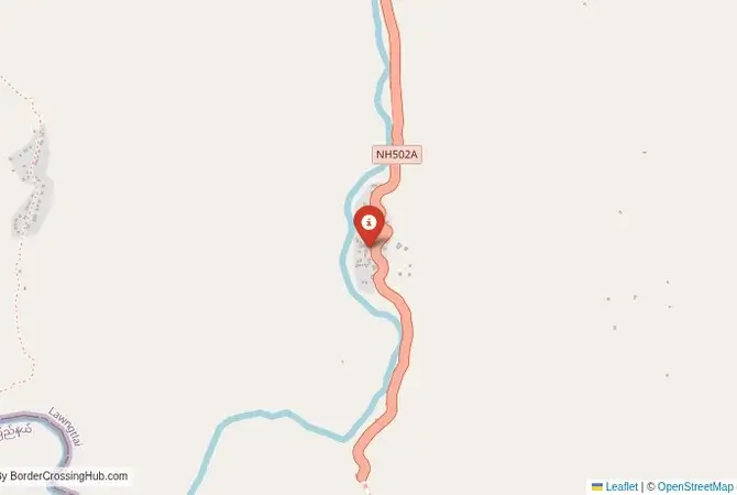
Approximate Border Location
Wait Times
30–90 min variable
Just crossed? Tap to report:
Operating Hours
Open 8:00 AM–6:00 PM
Crossing Types
Pedestrians, vehicles
Border Type
Land crossing via road
Peak Times
7:00–10:00 AM, weekends
Daily Crossings
1,500–3,000 crossings
Currency Exchange
Exchange near Zochawchhuah (INR, MMK)
Safety Information
Restricted zone controls
Languages Spoken
Hindi, Burmese, English
Accessibility Features
Ramps, assistance
About Zochawchhuah & Zorinpui
Monthly Update (March 2026):
In recent weeks of 03/2026, the Zochawchhuah & Zorinpui Border Crossing stays fairly quiet with light cargo movement and limited passenger travel between India and Myanmar. Trucks pause for customs checks before heading into Mizoram. Most hours feel calm. Local trade shipments shape the pace.
No Cell Service at the Border? No Problem.
Don’t get caught scrambling for paperwork when you lose signal. Download the complete Asia Transit Guide directly to your device and access every critical detail, fast-track strategy, and border rule – 100% offline.
Security Note: A Remote and Inaccessible Conflict Zone
The India-Myanmar border in Mizoram and Chin State is an active conflict zone. The region is the site of intense fighting between the Myanmar military and a coalition of ethnic and pro-democracy forces. The border is closed to all foreign travelers. This guide is for informational and geopolitical context about a border crossing that is part of a major infrastructure project but is currently completely inaccessible due to war. Travel to this region is extremely dangerous and impossible for foreigners. You must follow your government’s advisories, which warn against all travel to the area.
The Zochawchhuah Crossing: A Bridge of Strategic Ambition
The border crossing at Zochawchhuah in Mizoram, India, which is intended to connect to Zorinpui in Myanmar’s Chin State, represents a major strategic and developmental project rather than a currently functioning border for people. It is the designated land crossing for the ambitious Kaladan Multi-Modal Transit Transport Project, a joint initiative by India and Myanmar designed to connect the Indian port of Kolkata to the landlocked northeastern states of India via Myanmar. The centerpiece of the crossing is a large, modern bridge over the Kaladan River. However, the project has been plagued by delays, and the ongoing, fierce civil war in Myanmar’s Chin State has rendered the entire corridor non-operational and extremely dangerous. It is a border of the future, a piece of grand strategy that has been completely stalled by the harsh realities of a brutal conflict.
A History of the Kaladan Project and Regional Conflict
The history of this crossing is the history of the Kaladan project itself. The project was conceived as a way for India to bypass the “Chicken’s Neck,” the narrow and vulnerable strip of land that connects the main part of India to its eight northeastern states. The plan involves shipping goods from Kolkata to the Sittwe port in Myanmar, then up the Kaladan River by barge to Paletwa, and then by road from Paletwa to the border at Zorinpui/Zochawchhuah and into Mizoram. This would create a new, strategic transport artery. India has invested heavily in building the port, dredging the river, and constructing the roads. However, the project has faced immense challenges. The Chin State and the neighboring Rakhine State in Myanmar are home to long-running ethnic insurgencies, which have now merged with the broader civil war against the military junta. The project’s infrastructure has been repeatedly attacked, and the area is a major battlefield. The road on the Myanmar side from Paletwa to the border remains incomplete and is in a high-intensity conflict zone.
Border Procedures: Theoretical and Non-Operational
There are no established border crossing procedures for international travelers at Zochawchhuah because the border is not open for this purpose. The infrastructure, including a large Integrated Check Post (ICP) on the Indian side, has been built, but it is not operational for civilian traffic. The intended function is for commercial freight as part of the Kaladan project. Any current use of the crossing is limited to local residents (under a Free Movement Regime, which is often suspended) and security forces. For a foreign traveler, there is no legal or practical way to cross here. There are no immigration or customs services available for processing tourists. Any attempt to approach the border would be stopped by the Indian military or paramilitary forces who heavily patrol this sensitive area.
The Regional Context: A War in the Chin Hills
The crossing connects the Lawngtlai district of Mizoram in India with the Chin State in Myanmar. The Chin Hills are a rugged, remote, and undeveloped region. Since the 2021 military coup in Myanmar, the Chin State has become one of the strongest centers of armed resistance against the junta. The Chin National Army and various local defense forces control large swathes of the state, and the fighting with the Myanmar military is intense and ongoing. The area has seen heavy airstrikes, artillery shelling, and the displacement of tens of thousands of people, many of whom have fled across the border into Mizoram for safety. The Indian state of Mizoram shares a close ethnic and cultural bond with the Chin people of Myanmar, and the conflict has created a major humanitarian situation on the Indian side of the border. The entire region is a de facto war zone and is completely off-limits for any form of travel.
Final Contextual Note: A Project on Hold
The Zochawchhuah-Zorinpui border crossing is a fascinating case study in how geopolitics and infrastructure development can be completely derailed by conflict. It is a modern gateway with a new bridge and check-post, built for a future of trade and connectivity, that leads directly into a battlefield. It represents a significant strategic investment by India that is currently unusable due to the war in the very region it was meant to develop. For the traveler, it is a place that exists on planning maps but not in reality. It serves as a stark and powerful reminder that a border is more than just a line or a bridge; its function is entirely dependent on the peace and stability of the lands it is meant to connect. Until there is a lasting resolution to the conflict in Myanmar, this gateway will remain closed.
No reviews yet.