Approximate Border Location
Wait Times
15–60 min typical
Just crossed? Tap to report:
Operating Hours
Open 24 hours
Crossing Types
People, cars, freight
Border Type
Land crossing via road
Peak Times
7–10 AM, weekends
Daily Crossings
6,000–9,000 daily
Currency Exchange
Nearby exchange EUR, PLN
Safety Information
Busy but orderly
Languages Spoken
Slovak/Polish
Accessibility Features
Ramps, elevators
About Barwinek & Vyšný Komárnik
Monthly Update (February 2026):
Long stretches of open road lead into the Barwinek & Vyšný Komárnik Border Crossing, with cars slowing as they crest the pass. In February 2026 it’s felt mostly stable. Passenger vehicles move through steadily, though the Polish side can stack up after snow. Winter weather and holiday travel shape the flow.
A Crossing Through a Battlefield
The border crossing connecting Vyšný Komárnik in Slovakia with Barwinek in Poland is a journey through one of the most historically charged landscapes in all of Europe. This is the Dukla Pass, a strategic route through the Carpathian Mountains that has been a corridor for armies for centuries. Its name is forever associated with the brutal Battle of the Dukla Pass in 1944, one of the largest and bloodiest mountain battles of World War II. Since both Slovakia and Poland are members of the European Union and the Schengen Area, there are no permanent border controls. To cross here is to travel through a landscape of profound military history, a seamless passage through a valley of memorials, cemeteries, and silent, forested hills that bear the scars of a terrible conflict.
Operational Details
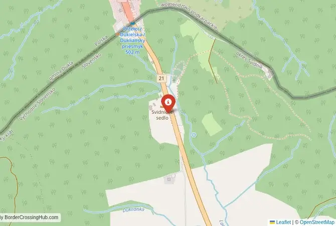
This checkpoint connects Slovakia’s Prešov Region with Poland’s Podkarpackie Voivodeship. It is the main international crossing in the eastern part of the border, a major 24/7 route for both passenger cars and heavy freight. The road (E371) is a key north-south artery, linking eastern Slovakia with southeastern Poland. The former border posts are now abandoned, and traffic flows freely. The crossing is a place of constant commercial movement, but it is impossible to drive through without being aware of the immense history of the location.
A History of the Dukla Pass
The history of this crossing is dominated by the events of autumn 1944. The Battle of the Dukla Pass was a massive offensive launched by the Soviet Red Army, with the inclusion of the 1st Czechoslovak Army Corps, to break through the German lines in the Carpathians and support the Slovak National Uprising. The battle turned into a brutal, two-month-long meat grinder, with horrific casualties on both sides. The fighting devastated the surrounding villages and forests. Today, the entire region is an open-air museum. An observation tower stands near the former border, and the road is lined with monuments, memorials, and military cemeteries dedicated to the Soviet and Czechoslovak soldiers who died here. The area near Svidník on the Slovak side is known as the “Valley of Death,” where a major tank battle took place.
The Seamless Border Procedure
Today, there is no border procedure for travelers. You simply drive through the pass. There are no passport checks and no customs inspections. This is the reality of the Schengen Area. However, it is important to remember that both Polish and Slovak police and customs authorities can and do perform random checks on vehicles anywhere in their territory, including near the former border. You are still required to carry a valid passport or national ID card with you at all times.
The Surrounding Region: Slovakia Side
On the Slovak side, the crossing is the gateway to the Prešov region, an area with a strong Rusyn (Ruthenian) cultural heritage. The town of Svidník has a major military history museum dedicated to the battle and an open-air museum of Ukrainian and Rusyn folk architecture. The nearby town of Bardejov is a UNESCO World Heritage site, with a perfectly preserved medieval town square. The region is also famous for its beautiful wooden churches, many of which are also on the UNESCO list.
The Surrounding Region: Poland Side
On the Polish side, the crossing is in the heart of the Beskid Niski, the lowest and wildest part of the Polish Carpathian mountains. The area is known for its beautiful, sparsely populated landscapes and its Lemko (Rusyn) heritage. The spa town of Iwonicz-Zdrój is nearby. The road leads towards the city of Rzeszów, the capital of the Podkarpackie Voivodeship. The entire region is dotted with World War I and World War II cemeteries, a testament to its history as a major European battlefield.
Practical Travel Information
Practical planning for this route is very simple. The most important thing is to have the required motorway vignettes if your journey involves motorways in either country. Both Slovakia and Poland use an electronic vignette system, which must be purchased online in advance. The official currencies are the Euro (EUR) in Slovakia and the Polish Złoty (PLN) in Poland. Services are available in the towns on both sides of the border. The mountain roads are well-maintained but can be challenging in winter, so it is important to have appropriate tires and to check the weather conditions.
Final Considerations
The Vyšný Komárnik–Barwinek border crossing is a journey through a landscape of immense historical weight. The seamless Schengen passage stands in stark contrast to the brutal battles that were fought here to cross this same line. It is a beautiful and scenic drive, but one that should be undertaken with a sense of reverence for the past. It is a border that you cross freely today because of the immense sacrifices that were made here, a powerful and moving testament to the difference between a continent at war and a continent at peace.
No reviews yet.