

Monthly Update (August 2026):
In August 2026, the Tummo border crossing between Libya and Niger remains unpredictable, with operations affected by heightened security concerns and recent armed activity around the crossing. Movement is possible but may involve additional security checks and delays, particularly for vehicles, while conditions can change quickly because of the remote location and ongoing security situation in southern Libya.
About this crossing
Scams & Warnings
You should exercise extreme caution if you are considering travel toward Tummo. This is not a conventional tourist border crossing, and the surrounding region has serious security risks involving armed groups, smuggling networks, migration routes and competing authorities. In January 2026, an armed group temporarily seized the Al-Toum crossing before forces affiliated with eastern Libya's military command said they had retaken it. Reports stated that personnel were killed, wounded or captured during the attack.
Further clashes were reported near the Libyan-Nigerien frontier in February 2026, demonstrating that the security situation remains unstable. Before considering this route, you should consult current official travel advisories and authorities in both countries. You should not assume that a border post shown on an older map is currently accessible or operating for foreign travelers.
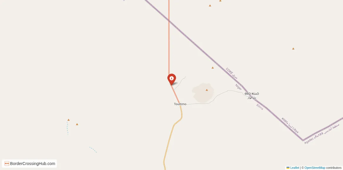
Where Tummo Is Located
The Libyan side of the crossing is approximately 310 kilometers south of Qatrun, one of the nearest established settlements on the Libyan side. The area around the crossing contains little permanent infrastructure. Historical descriptions characterize Tumu as consisting of little more than government buildings and a checkpoint, while the wider approach is dominated by open desert.
On the Nigerien side, the crossing forms part of the remote route running north from Agadez through Dirkou and Madama toward Libya. This route has long been used by commercial traffic, local communities, migrants and people involved in cross-border trade. The road environment becomes increasingly isolated as you travel north from the populated parts of Niger.
The Main Libya-Niger Crossing
Tummo is generally identified as the main formal border crossing between Libya and Niger. A recent regional transport study describes the Tummo post as the border crossing between the two countries, but also notes that its infrastructure is extremely basic and lacks specialized services intended to support trade.
Research by Chatham House likewise identifies the Toummo crossing as a formal border crossing and found significant development of infrastructure and fortifications around the post between 2011 and 2022. The same research identifies the Salvador Pass as an important route feeding movement toward the Tummo area.
A Border With Limited Infrastructure
You should not expect the facilities found at major international land crossings. Tummo is a remote checkpoint rather than a large commercial border complex. Basic border-control infrastructure exists, but services for travelers are extremely limited. Fuel, food, accommodation, medical assistance and reliable communications should not be assumed to be available at the crossing.
This lack of infrastructure is one reason preparation matters so much. If you are traveling through the Sahara, a minor delay can become a serious problem because the distances between settlements are substantial. You should have enough fuel, water, food, navigation equipment and emergency supplies for the entire desert section of your journey.
Crossing Procedures
Under normal circumstances, international travelers would need to complete the relevant departure and entry procedures with the authorities on each side. Your passport and immigration documents would be checked, and you would need to satisfy the entry requirements of the country you are entering.
The exact procedure at Tummo can be difficult to predict because the border has experienced periods of closure and changing security control. Historical sources also describe the checkpoint as frequently closed, with travelers sometimes required to report to authorities in Qatrun rather than simply proceeding directly to the border.
Wait Times and Opening Hours
Reliable current opening hours and standard tourist wait times are not available for Tummo. You should not use normal border-crossing assumptions when planning this route. The checkpoint has historically been subject to closures, and recent armed incidents make its operating status particularly difficult to predict.
The crossing's remote location also means that even when immigration personnel are present, delays can be caused by security checks, vehicle inspections, changes in local control or restrictions on movement. You should obtain confirmation from relevant authorities before starting the journey rather than relying on information from another traveler.
The Desert Route From Niger
From Niger, the route toward Tummo forms part of a long northbound desert corridor. Travel research describes the route running from Agadez through Séguédine and Madama before reaching the Tummo border post and continuing toward southern Libya. Historically, this journey has involved 4x4 vehicles, military surveillance posts and, in some cases, organized escorts.
Road conditions vary considerably. Much of the route is desert track rather than conventional paved highway, and sand, rough surfaces and lack of services can make progress unpredictable. You should not treat the journey as an ordinary road trip.
The Libyan Approach
On the Libyan side, the road leads north toward Qatrun and eventually the wider Fezzan region. Qatrun is approximately 310 kilometers from the Tummo checkpoint and sits on the main road connecting southern Libya with the country's routes toward Chad and Niger.
Once away from the checkpoint, settlements remain widely separated. A vehicle breakdown can therefore become a major emergency rather than a routine inconvenience. If you are traveling independently, you should have a reliable vehicle and a realistic contingency plan before entering this section of the Sahara.
Migration and Smuggling Routes
Tummo has also become significant because of migration across the central Sahara. Studies have documented movement from Niger toward Libya through the Tummo area, including both formal crossings and routes that bypass the official post. The southern Libyan border is particularly porous, and traffickers have historically used desert routes to avoid formal controls.
This activity has contributed to the area's security problems. You should be particularly cautious about accepting transportation from strangers, entering unofficial desert routes or becoming involved with anyone offering to bypass immigration controls. A route that appears to save time can expose you to considerably greater risks.
Weather and Seasonal Conditions
Sahara conditions can be severe throughout the year. Summer temperatures can become dangerously high, while winter nights may be surprisingly cold. Sandstorms can reduce visibility and make desert travel difficult, and heavy rain elsewhere in the region can occasionally affect tracks and drainage areas.
Seasonal conditions also affect mobility. You should plan around daylight, carry considerably more water than you expect to need and avoid depending on a precise arrival time. At a remote crossing such as Tummo, weather-related delays can have consequences well beyond simply arriving late.
Why Tummo Matters
Despite its minimal facilities, Tummo has considerable geopolitical importance. It is the principal formal crossing along the Libya-Niger border and sits on a route connecting the Fezzan region with northern Niger and the wider Sahel. Movement through the area has implications for trade, migration, border security and relations between communities on both sides.
The crossing has also become part of broader plans to improve transport connections between Libya and Niger. In 2023, the two countries discussed a proposed Misrata-Tamanhint-Agadez road project, although reliable information about the project's implementation remains limited.
Plan Around Conditions
Tummo is a border crossing where current conditions matter far more than a standard timetable. If you are planning an international journey through this part of the Sahara, verify the crossing's status immediately before departure, check official security advice and confirm that your nationality and travel documents are accepted.
You should also prepare for the possibility that the crossing will be closed or that movement will be restricted after you have already reached the region. Given the recent armed incidents and the area's limited infrastructure, turning back or changing your route can be considerably more complicated than at a conventional international checkpoint.
Final Considerations
Tummo provides the principal formal connection between Libya and Niger, but its importance comes with serious practical and security challenges. The checkpoint is remote, infrastructure is limited, operating conditions can change, and armed incidents have occurred nearby in 2026. If you are considering this route, treat official confirmation of the crossing's status as essential rather than optional, and plan for the possibility of significant delays or closure before entering the Sahara.
View all border crossings between Libya and NigerPractical information
Fuel
Libya: >100 km - Niger: >100 km
Currency
No known exchange post; carry LYD and XOF
Safety information
High security risk; armed attack reported in 2026
Connectivity
Limited mobile service; satellite phone advised
Have you crossed here?
Help other travelers by sharing your experience, wait times, and any updates.