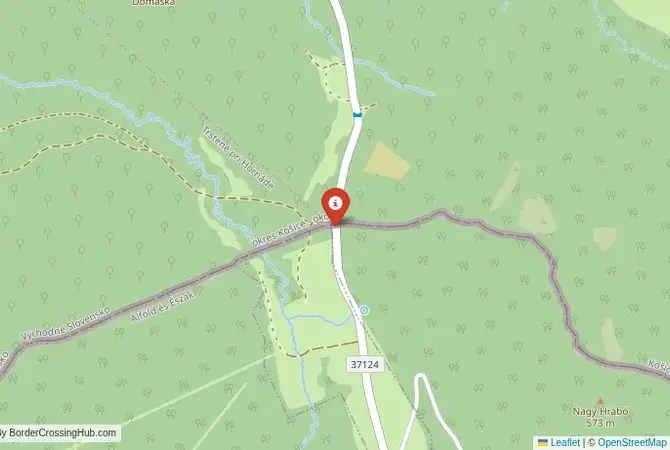
Approximate Border Location
Wait Times
15–50 min typical
Just crossed? Tap to report:
Operating Hours
06:00 AM–10:00 PM
Crossing Types
Pedestrians, private vehicles
Border Type
Land crossing via road
Peak Times
07–10 AM mornings
Daily Crossings
1,200–1,800 crossings
Currency Exchange
Limited locally (EUR, HUF)
Safety Information
Quiet crossing area
Languages Spoken
Slovak/Hungarian
Accessibility Features
Ramps, assistance offered
About Hollóháza & Skároš
Monthly Update (February 2026):
Cars approach the Hollóháza & Skároš Border Crossing one or two at a time, with long quiet gaps in between. Over recent weeks in February 2026 it’s felt stable, with passenger vehicles clearing quickly in both directions. There’s rarely a difference between sides. Weather and local weekend movement are about the only things that nudge the pace.
A Crossing in the Zemplén Mountains
The border crossing connecting the Slovak village of Skároš with Hollóháza in Hungary is a journey into the heart of the Zemplén Mountains (Slanské Vrchy in Slovak). This is a secondary road crossing, a more local and less-traveled alternative to the main highway at Milhosť-Tornyosnémeti. Since both Slovakia and Hungary are members of the European Union and the Schengen Area, there are no permanent border controls. To cross here is to take a peaceful, scenic route through a landscape of dense forests, rolling hills, and traditional villages, a seamless passage between the Košice region of Slovakia and the historic Zemplén region of Hungary.
Operational Details
This checkpoint connects Slovakia’s Košice Region with Hungary’s Borsod-Abaúj-Zemplén County. It is a regional road, open 24/7, and used by local traffic and tourists seeking a more tranquil journey away from the main highways. The former border posts are now abandoned or repurposed. Traffic flows freely, and the only signs of the border are the standard blue EU signs. The road winds through a beautiful, forested mountain landscape, making it a pleasant drive for those who are not in a hurry and wish to savor the scenery. It is not suitable for heavy freight traffic.
A History of a Divided Land
The history of this region is the history of the historic Zemplén County of the Kingdom of Hungary. It has always been a region of beautiful nature, small villages, and a number of noble estates. The border, established after World War I, divided the region, leaving a smaller part in Czechoslovakia (now Slovakia) and the larger part in Hungary. This division separated villages from their traditional market towns and agricultural lands, forcing residents to make long detours to the few official crossing points. The open Schengen border has allowed for the reunification of this historic landscape, promoting cross-border tourism and cooperation.
The Seamless Border Procedure
Today, there is no border procedure for travelers. You simply drive through the wooded hills. There are no passport checks and no customs inspections. This is the reality of the Schengen Area. However, it is important to remember that both Hungarian and Slovak police and customs authorities can and do perform random checks on vehicles anywhere in their territory. You are still required to carry a valid passport or national ID card with you at all times. The open border has allowed for the development of cross-border hiking and cycling trails that follow the mountain ridges.
The Surrounding Region: Slovakia Side
On the Slovak side, the crossing is a gateway to the eastern part of the Košice region. The village of Skároš is a small, rural settlement. The road provides a good connection to the major city of Košice, the second-largest city in Slovakia and a European Capital of Culture in 2013. Košice has a magnificent Gothic cathedral (St. Elisabeth’s), a beautifully preserved historic main street, and a vibrant cultural scene. The Slanské Vrchy mountains offer excellent hiking opportunities, with trails leading to the ruins of Slanec Castle.
The Surrounding Region: Hungary Side
On the Hungarian side, the historic town of Hollóháza is famous for its porcelain manufactory, which has been producing high-quality porcelain since the 18th century. The factory has a museum and a factory shop. The crossing is a gateway to the Zemplén Mountains, a beautiful range of hills known for its castles, hiking trails, and narrow-gauge forest railways. The magnificent Füzér Castle, perched dramatically on a volcanic cone, is a short drive away. The crossing also provides access to the Hungarian part of the Tokaj wine region, a UNESCO World Heritage site.
Practical Travel Information
Practical planning for this route is very simple. The most important thing is to have the required motorway vignettes if your journey involves motorways in either country. Both Slovakia and Hungary use an electronic vignette system, which must be purchased online in advance. The official currencies are the Euro (EUR) in Slovakia and the Hungarian Forint (HUF) in Hungary. Services are available in the larger towns on both sides of the border. The mountain roads are well-maintained but can be challenging in winter, so it is important to have appropriate tires and to check the weather conditions.
Final Considerations
The Skároš–Hollóháza border crossing is a scenic and peaceful route through the heart of the Zemplén mountains. It offers a beautiful journey through a region rich in nature, history, and craftsmanship. It is a border that you might not even notice you have crossed, a testament to the success of the Schengen project in this stunning mountain landscape. For those looking to escape the main highways and enjoy a more relaxed drive through an authentic and culturally rich part of Central Europe, it is an excellent choice.
No reviews yet.