Approximate Border Location
Wait Times
Cars 0-10m; spot-check peaks 15-60m
Just crossed? Tap to report:
Operating Hours
Open 24 hrs (12:00 AM-11:59 PM)
Crossing Types
Ped,cars,bikes; rural road
Border Type
Land crossing via local road
Peak Times
10:00 AM-04:00 PM; weekends
Daily Crossings
300-1,600/day
Currency Exchange
EUR; DKK in Aabenraa/Flensburg; ATMs
Safety Information
Quiet area; limited services nearby
Languages Spoken
German/Danish
Accessibility Features
Uneven verges; minimal ramps
About Siltoft & Sluseby
The Siltoft-Sluseby border crossing marks the westernmost point where you can step from Denmark into Germany along their short land frontier.
Current Status and Safety Note
This remains a quiet, open internal Schengen border as of February 2026. Denmark continues temporary spot checks at various land crossings with Germany due to ongoing security concerns, including terrorism risks and organized crime. You might encounter random police stops for ID verification when entering Denmark, but full controls are rare here. The area itself carries low risk for ordinary travelers; no major incidents or scams stand out compared to busier spots. Still, carry your passport or national ID (from EEA countries) at all times, as Danish police can request it. Check your government’s travel site or Danish police updates before heading out, especially if tensions rise regionally.
Alternative Names
Locals and maps call it the Siltoft border crossing (Danish side, often Siltoftvej), Norddeich-Sieltoft or Sieltoft (German side, sometimes spelled with variations like Siltoft/Sluseby due to regional dialect or old references to nearby sluices). Some sources tie it to Sluseby or Slusevej nearby.
Location and Basic Connection
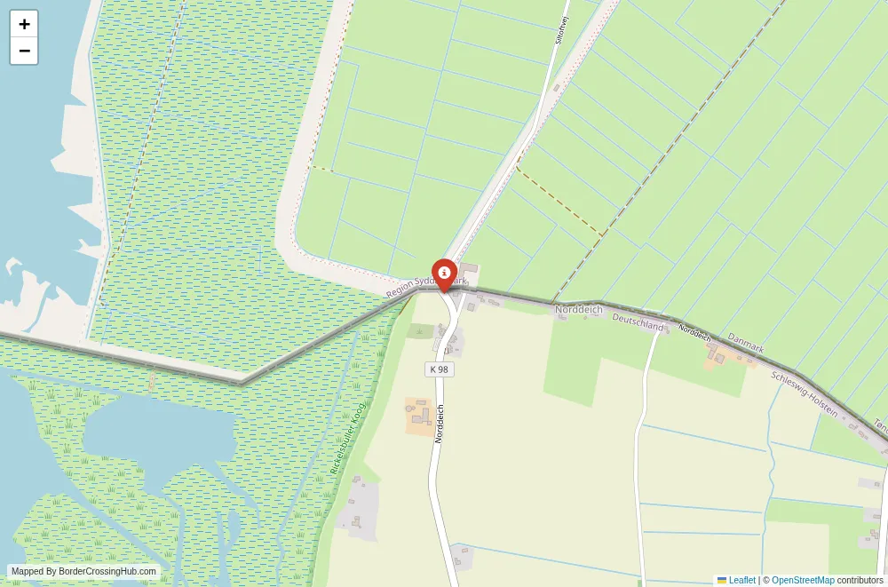
You find this point in the flat, marshy landscape of the Wadden Sea region. On the Danish side, it sits near Tønder Municipality in southern Jutland, close to the small settlement of Siltoft. The German counterpart lies in Nordfriesland, Schleswig-Holstein, near Norddeich. A minor road (Siltoftvej on the Danish end) crosses directly into Germany. This serves as one of the 13 approved vehicle crossings along the 68 km land border, though it sees far less traffic than major routes like Padborg or Kruså. The line ends not far west, where the border meets the North Sea coast at the final marker.
Historical Background
The current border took shape after the 1920 Schleswig plebiscites following World War I. Northern Schleswig voted to join Denmark, while southern parts stayed German, creating this 68 km line. Before that, the region shifted hands multiple times between Danish and German control, with roots in medieval duchies. The 1920 demarcation aimed for ethnic lines but left some odd pockets and adjustments. An old border checkpoint building still stands on the Danish side at Siltoftvej, a remnant from pre-Schengen days when customs and immigration operated here. The area saw refugee movements and military activity during earlier conflicts, but today it stands peaceful.
Geopolitical and Economic Role
As a Schengen internal border since 2001, formal checks vanished for years, though Denmark’s temporary controls (ongoing since 2016, extended repeatedly) mean occasional police presence. This western end handles minimal trade or commuter flow; most commerce uses bigger highways further east. The region relies on agriculture, tourism tied to the Wadden Sea (a UNESCO site), and local cross-border life. Residents sometimes cross for shopping or family, but volume stays tiny. The border fence for wild boars (built around 2020) runs nearby in parts, aimed at disease control rather than people.
Practical Crossing Procedures
No routine immigration or customs stops occur in either direction under normal Schengen rules. You drive or cycle across the road without barriers. If Danish police run spot checks (more common entering Denmark), expect them to wave most vehicles through but pull some aside for passport or ID inspection. Processing, when it happens, takes minutes. No visa-on-arrival applies; as EU/Schengen countries, entry relies on valid travel documents for non-EEA visitors. Cyclists and pedestrians use the same road. The crossing operates 24/7 with no official hours.
Transportation Options
Reach it by car from Tønder (Denmark) in about 15-20 minutes via local roads. From the German side, Husum or Niebüll offer access points. Public transport stays limited; no direct buses hit this exact spot. You might take a regional train to Tønder or nearby stations, then taxi or rent a bike. Walking or cycling works fine on the flat terrain. Avoid expecting taxis at the border itself; arrange in advance from towns.
Road Conditions and Scenery
The road stays narrow, paved, and quiet, winding through reclaimed marshland with dikes, canals, and open fields. Sheep graze on salt marshes, and birds fill the skies year-round. Westward views open to the Wadden Sea mudflats at low tide. In winter, wind cuts sharp; summer brings mild weather but mosquitoes near water. Fog rolls in occasionally, slowing visibility. No major hills or rough sections exist.
Scams and Warnings
This remote spot sees almost no reported scams. No touts, fake officials, or overpriced services appear here like at some busier crossings. The biggest annoyance might come from occasional police stops if you’re unlucky during checks, but they remain professional. Keep valuables out of sight in the car, as anywhere rural. Petty theft stays uncommon.
Nearby Attractions
Head east to Tønder for its historic town center, lace-making heritage, and museums. The Wadden Sea National Park surrounds you; try guided mudflat walks (tide-dependent) or birdwatching. An artificial shallow saltwater lake near Siltoft attracts waders and ducks. On the German side, explore Nordfriesland’s dike paths or Husum’s old port. The Gendarmstien trail (a long-distance path along the border) passes nearby for hiking.
Seasonal Variations and Weather
Winter brings cold winds, short days, and possible icy roads; crossings stay open but feel isolated. Spring and autumn offer good bird migration viewing with fewer people. Summer sees more visitors to the Wadden area, though this crossing remains uncrowded. Heavy rain floods low spots occasionally; check forecasts. High tourist seasons elsewhere (like Sylt) don’t affect here much.
Travel Tips and Preparation
Carry your passport or ID always; Danish spot checks can happen anytime. Bring cash for small local shops, as rural areas sometimes lack card options. Download offline maps since signal drops in marshes. Cross during daylight for better views and safety. If hiking nearby, wear waterproof boots and watch tides. Respect no-entry zones in protected wetlands.
Wrapping Up Your Plans
This quiet end-of-the-line crossing gives you a real sense of the Denmark-Germany frontier’s peaceful rural character. Verify any temporary control updates beforehand, pack essentials, and enjoy the marshes before or after your step across.
No reviews yet.