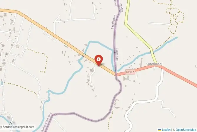
Approximate Border Location
Border Countries
- 🇧🇩Bangladesh
- 🇮🇳India
Border Cities
- 🇮🇳Sheola
- 🇧🇩Sutarkandi
Wait Times
30–60 min usual
Just crossed? Tap to report:
Operating Hours
Open 8:00 AM–6:00 PM
Crossing Types
Pedestrians, vehicles
Border Type
Land crossing via road
Peak Times
7:00–10:00 AM, weekends
Daily Crossings
2,500–3,500 crossings
Currency Exchange
Limited exchange (BDT, INR)
Safety Information
Safe, moderate traffic
Languages Spoken
Bengali, Hindi, English
Accessibility Features
Ramps, assistance
About Sheola & Sutarkandi
Monthly Update (March 2026):
In recent weeks of 03/2026, the Sheola & Sutarkandi Border Crossing handles a modest stream of trucks and local vehicles. Customs checks for cargo can slow things a bit. Most hours remain calm. Regional trade routes shape how busy it gets.
No Cell Service at the Border? No Problem.
Don’t get caught scrambling for paperwork when you lose signal. Download the complete Asia Transit Guide directly to your device and access every critical detail, fast-track strategy, and border rule – 100% offline.
The Sutarkandi-Sheola Crossing: A Sylhet-Assam Trade Route
The border crossing at Sutarkandi in the Karimganj district of Assam, India, which connects to the post of Sheola in the Sylhet division of Bangladesh, is a secondary but significant land gateway between the two nations. This is not a major tourist crossing like Tamabil-Dawki or Petrapole-Benapole. It is primarily a land port for commercial trade, a vital artery for the exchange of goods between the Barak Valley of Assam and the Sylhet region of Bangladesh. The landscape is one of lush, green plains and riverine networks, characteristic of this part of the subcontinent. For the traveler, this is an off-the-beaten-path route. The atmosphere is more functional and less chaotic than at the main borders, dominated by the slow movement of trucks laden with coal, limestone, and other commodities. It offers a glimpse into the everyday commercial life that underpins the relationship between these two closely connected regions, away from the main tourist flows.
A History of a Divided Valley
The history of this border is tied to the 1947 Partition of India. The Sylhet region, which had been a part of the British province of Assam, was subjected to a referendum to decide whether it would join India or Pakistan. The majority voted to join East Pakistan (now Bangladesh), but the Karimganj subdivision, where Sutarkandi is located, remained with India. This act of division cut through a single, integrated economic and cultural zone. The Sutarkandi-Sheola crossing became a necessary gateway to maintain the trade links that had existed for centuries. The Barak River and its tributaries have always been the defining geographical feature of the region, and the border was drawn across this riverine landscape. In recent years, both India and Bangladesh have worked to upgrade the infrastructure at this crossing, developing it into a more efficient land port to boost bilateral trade and ease the pressure on the other crossings in the region. It is a border that reflects the complex legacy of Partition and the modern imperative of economic cooperation.
The Border Crossing Procedure: A Functional and Quiet Process
This border is open during daylight hours and is not as accustomed to foreign tourists as the main crossings. The process is formal but generally quiet due to the low volume of passenger traffic. You must have a valid visa for the country you are entering, obtained in advance. Visas are not issued at the border.Exiting India (Sutarkandi): The Indian immigration and customs offices are located in a designated Integrated Check Post (ICP) at Sutarkandi. The facilities are functional. You will need to find the immigration office to present your passport and get your Indian exit stamp. The customs officials will be primarily focused on the commercial truck traffic but will process your luggage as well. The officials are professional, but you may need to be proactive in navigating the different offices within the ICP.The No-Man’s-Land: After clearing the Indian side, you will proceed a short distance through a no-man’s-land to the Bangladeshi post. You can walk or take a local rickshaw.Entering Bangladesh (Sheola): The Bangladeshi facility is known as the Sheola Land Port. You will enter the immigration building, present your passport and your Bangladeshi visa, and get your entry stamp. The customs check is usually straightforward for tourists. The entire complex is geared towards trade, so the passenger facilities are basic but adequate. Once you are cleared, you are officially in the Sylhet division of Bangladesh.
Route, Onward Travel, and Regional Context
On the Indian side, the nearest major town and transport hub is Karimganj, which has a railway station. The larger city of Silchar, with an airport, is a few hours’ drive away. The road connects Sutarkandi to the main road network of Assam and the rest of Northeast India. On the Bangladeshi side, after crossing at Sheola, you are in a rural area. The nearest major city is Sylhet, which is about a 1.5 to 2-hour drive away by bus or CNG (auto-rickshaw). Sylhet is a major city in Bangladesh, known for its tea gardens, Sufi shrines, and its large diaspora community in the United Kingdom. It is a good base for exploring the beautiful northeastern region of Bangladesh. This border crossing is a convenient entry point for travelers who have been exploring the Indian states of Assam or Tripura and wish to enter the eastern part of Bangladesh without a long detour. However, the transport connections are more localized, so you should be prepared for a more adventurous journey than on the main tourist routes.
Final Planning Advice for a Commercial Route
The Sutarkandi-Sheola crossing is an interesting option for the experienced traveler in the subcontinent who is looking to explore the less-traveled routes. It is a quieter and less chaotic alternative to the main Petrapole border. The key to using this crossing is to have your visas sorted in advance and to be prepared for a more basic level of infrastructure and less frequent long-distance transport. The reward is a journey through a fascinating and culturally rich region, a chance to see the deep commercial and social links that bind the Barak Valley of India and the Sylhet division of Bangladesh. It is a border that offers a more authentic glimpse into the daily life of this vibrant and complex frontier, away from the well-trodden tourist path.
No reviews yet.