Approximate Border Location
Wait Times
Cars 10-45m; peaks 60-150m freight
Just crossed? Tap to report:
Operating Hours
06:00 AM-06:00 PM
Crossing Types
Ped,cars,trucks; integrated controls
Border Type
Land crossing via road (local checkpoint)
Peak Times
07:00-09:00 AM; 03:00-06:00 PM
Daily Crossings
1,000-4,000/day
Currency Exchange
COP; USD in Lago Agrio/Pto Asís; some ATMs
Safety Information
Security checks; plan daylight crossing
Languages Spoken
Spanish
Accessibility Features
Ramps at buildings; lanes can be uneven
About San Miguel & San Miguel
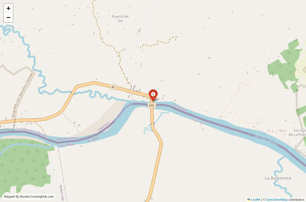
The San Miguel San Miguel border crossing stretches across the San Miguel River in the western Amazon lowlands, joining the Colombian municipality of San Miguel in Putumayo Department to the area near General Farfán and Lago Agrio in Ecuador’s Sucumbíos Province through a single international bridge.
Location and Basic Connections
You reach this point east of Lago Agrio (Nueva Loja) in Ecuador, about 20 minutes by road from the city center, and close to Valle del Guamuez or La Hormiga on the Colombian side. The bridge sits in a tropical frontier zone far from the main Rumichaca Ipiales corridor. Buses from Quito or Lago Agrio drop passengers at the Ecuadorian CEBAF San Miguel facility, followed by short taxis or colectivos to the bridge. On the Colombian side, transport from Puerto Asís or Mocoa connects to San Miguel town. The crossing sees mostly local residents, some freight trucks, and occasional overlanders exploring the Amazon regions rather than heavy tourist volumes.
Alternative Names
This bridge is known as Puente Internacional San Miguel, Paso San Miguel, CEBAF San Miguel, or the Lago Agrio San Miguel frontier point.
Historical Background
The San Miguel River has served as a natural divider in the Amazon basin for centuries. The modern bridge opened in September 2000 under a binational agreement between Presidents Pastrana of Colombia and Noboa of Ecuador, designed as a “Paso de Amistad” to improve connectivity in Putumayo and Sucumbíos. A joint attention center (CEBAF) began full operations in the following decade to centralize immigration and customs. The area experienced spillover from past armed conflict but transitioned toward peaceful integration focused on trade and local movement.
Geopolitical Significance
This Amazon passage provides a direct route for goods and people between eastern Colombia and northern Ecuador, shortening travel times compared to the northern Rumichaca option. It supports oil, agriculture, and consumer trade in the Sucumbíos Putumayo zone. Security measures tightened significantly in late 2025 when Ecuador closed several secondary crossings, including this bridge, as part of a nationwide effort against organized crime. Only Rumichaca stayed open for Colombia Ecuador land travel. The closure has caused substantial economic hardship in Putumayo, with reported losses exceeding 65 billion pesos in the first month alone from halted commerce and transport. As of February 2026 the bridge remains restricted or closed for general use; always confirm the latest status with Colombian DIAN, Ecuadorian migration authorities, or embassies before planning any trip.
Practical Crossing Procedures
When fully operational, you process at the Ecuadorian CEBAF San Miguel for exit or entry stamps, vehicle checks, and customs declarations, then cross the bridge to the Colombian side for similar formalities. Most nationalities receive visa free entry for tourism stays of 90 days in each country. Carry your passport valid for at least six months, proof of onward travel if requested, and vehicle documents including temporary import permits if driving. The bridge accommodates both pedestrians and vehicles. Ecuador requires an apostilled criminal record certificate for certain foreigners entering from Colombia. Under current restrictions no routine crossings occur, and any attempt would face denial or strict security screening.
Typical Wait Times and Operating Hours
When open, hours typically run from 0800 to 1800 daily with possible midday breaks. Waits average 30 to 90 minutes due to moderate volume and joint facilities. The ongoing closure eliminates standard processing times entirely.
Transportation Options
Buses from Lago Agrio or Quito reach the CEBAF area, with taxis covering the short final distance when active. On the Colombian side, colectivos or taxis connect to Puerto Asís or Mocoa. Private vehicles cross the bridge directly if permitted. Current restrictions force rerouting through Rumichaca for any Colombia Ecuador land travel.
Road Conditions and Scenery
Paved roads approach from Lago Agrio on the Ecuadorian side, transitioning to tropical lowlands with dense vegetation and oil infrastructure. The Colombian continuation stays mostly paved through Putumayo’s humid plains. The bridge offers views of the San Miguel River, surrounding jungle, and occasional river traffic. Rainy periods create puddles but rarely block the main access.
Scams and Warnings
This remote Amazon crossing has historically been described as calm and straightforward when open, with friendly officials. The security closure since late 2025 increases uncertainty, with potential for unofficial activity or frustration around the area. Avoid unofficial helpers near the bridge; use only CEBAF counters. Humidity, insects, and low altitude health concerns like dengue require basic precautions. The continued restriction makes planning unreliable; rely on official updates and consider Rumichaca as the safe alternative.
Nearby Attractions
San Miguel in Colombia provides quiet rural life and access to Putumayo’s Amazon trails or indigenous communities. Lago Agrio in Ecuador offers basic services and serves as a gateway to Cuyabeno Wildlife Reserve for wildlife viewing. The zone appeals to eco tourism or those interested in oil region dynamics rather than major landmarks.
Seasonal Variations and Delays
Heavy rains from December to April cause flooding risks and muddy secondary roads. Dry months from May to November provide more stable conditions. Security policies currently override seasonal factors.
Cultural and Economic Role
The bridge once sustained daily trade in produce, fuel, and goods, supporting border economies and indigenous groups in the region. Cultural blending occurs through shared Amazon traditions in food, music, and community life. The closure has disrupted these ties significantly.
Final Planning Notes
This crossing is currently restricted; route through Rumichaca for reliable travel between Colombia and Ecuador. If conditions change, carry passport copies, small cash in COP or USD, water, and insect repellent. Monitor official sources closely for any reopening. Prepare for Amazon humidity and potential delays from security measures.
Navigating This Amazon Frontier Bridge
San Miguel San Miguel stands as a modest river bridge link in the Putumayo Sucumbíos Amazon zone, built for integration but sidelined by recent security closures. Stay informed through official channels, prioritize alternatives like Rumichaca, and approach any future use with caution in this remote tropical setting.
No reviews yet.