Approximate Border Location
Wait Times
Cars 10-35m; peaks 60-120m
Just crossed? Tap to report:
Operating Hours
08:00 AM-06:00 PM
Crossing Types
Ped,cars; limited commercial traffic
Border Type
Land crossing via road (local route)
Peak Times
08:00-10:00 AM; 04:00-06:00 PM
Daily Crossings
300-1,200/day
Currency Exchange
USD; COP in San Lorenzo/Tumaco; cash common
Safety Information
Area can be sensitive; follow local advice
Languages Spoken
Spanish
Accessibility Features
Basic access; few marked bays
About San Lorenzo & San Lorenzo
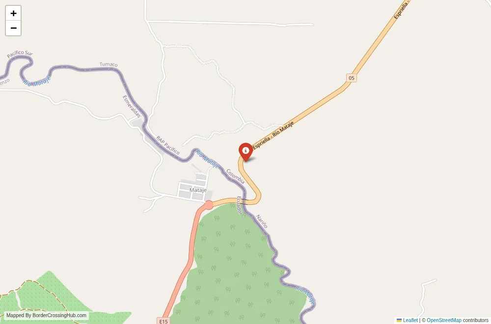
The San Lorenzo San Lorenzo border crossing operates along the Mataje River and Pacific coastal lowlands in the far northwest of Ecuador and southwest Colombia, connecting the Ecuadorian port city of San Lorenzo in Esmeraldas Province to the Colombian town of San Lorenzo in Nariño Department near Tumaco, primarily via the Mataje River bridge and fluvial routes.
Location and Basic Connections
You approach this coastal frontier in a mangrove and jungle dominated area near the Ancón de Sardinas bay on the Pacific. San Lorenzo (Ecuador) functions as the main hub with port facilities, reachable by road from Esmeraldas city (several hours) or by boat. The Colombian counterpart near Tumaco connects via local roads or river transport from Tumaco. The crossing uses the binational Mataje River bridge (under construction or recently advanced phases as of recent reports) and passenger boats or lanchas for people and light goods. It serves mostly local residents, fishermen, and limited commercial traffic rather than international tourists. Buses from Quito or Esmeraldas reach San Lorenzo Ecuador, then short taxis or boats lead to the frontier zone.
Alternative Names
This point goes by Paso San Lorenzo, San Lorenzo border (Ecuador Colombia), Puente Mataje crossing, or the Mataje River frontier at San Lorenzo.
Historical Background
The Mataje River has defined this coastal boundary since 19th century agreements post independence, amid Pacific access disputes. San Lorenzo Ecuador grew as a port town tied to fishing and trade, while the Colombian side developed around Tumaco’s influence. The zone saw violence from armed groups in the 2000s and 2010s, including bombings and displacement in 2018 near San Lorenzo police stations. A binational bridge project over the Mataje began in recent years (with significant investment reported) to formalize and boost connectivity, part of efforts to integrate Esmeraldas and Nariño economically despite ongoing security challenges.
Geopolitical Significance
This coastal passage ranks among the three main Colombia Ecuador land frontiers, alongside Rumichaca (main/safest) and San Miguel (Amazon). It supports local trade in fish, timber, and goods while linking to Pacific ports. High risks from drug trafficking and organized crime have prompted repeated restrictions. Ecuador militarized San Lorenzo in late 2025 amid clashes, and broader border closures (late 2025 onward) limited most crossings to Rumichaca only as anti crime measures. The Mataje bridge aims to enhance legal flow but remains affected by security policies. As of early 2026 the area stays high risk with limited or controlled access; official sources like Ecuadorian migration or Colombian authorities report ongoing militarization and prohibitions on non essential travel near the border.
Practical Crossing Procedures
When accessible, you process at Ecuadorian controls in San Lorenzo for exit stamps, then cross via bridge or boat to Colombian immigration near Tumaco for entry. Steps include passport verification, customs for goods, and possible vehicle or bag checks. Most nationalities get visa free entry for tourism (90 days each). Bring your passport valid six months and onward proof if asked. Boats handle pedestrians; the bridge (when fully operational) allows vehicles. Strict agricultural and security inspections apply due to the sensitive zone. Current restrictions often block routine crossings, forcing use of Rumichaca.
Typical Wait Times and Operating Hours
Hours when open align roughly with daylight (around 0800 to 1800), but security dictates variable and reduced shifts. Waits depend on controls; low volume keeps them short (under an hour) but militarization adds thorough checks. Closures and limited operations eliminate predictable times in 2026.
Transportation Options
Buses from Esmeraldas reach San Lorenzo Ecuador, then local taxis or lanchas to the frontier. On the Colombian side, boats or taxis connect to Tumaco for onward buses. Private vehicles use the Mataje bridge if permitted. The route suits locals or those with specific regional needs but current conditions push travelers to Rumichaca.
Road Conditions and Scenery
Roads to San Lorenzo Ecuador stay paved in parts but turn rough near the river with mangroves and jungle. The Mataje bridge offers views of wide river channels, dense forests, and coastal wetlands. Fluvial routes feature boat rides through mangroves and estuaries. Rain creates mud and flooding risks.
Scams and Warnings
This crossing carries severe safety warnings from multiple governments (including Australia, UK, and others) advising against non essential travel within 20 km of the Colombia Ecuador border except official Rumichaca. High kidnapping, violent crime, and drug related risks dominate due to organized groups. Militarization in San Lorenzo Ecuador (late 2025 onward) reflects clashes. Avoid unofficial boats or helpers; use only controlled points. The zone has a history of bombings and displacement. Current restrictions make it unreliable and dangerous; Rumichaca remains the recommended option.
Nearby Attractions
San Lorenzo Ecuador provides a frontier port feel with markets, fresh seafood, and mangrove tours. Tumaco Colombia offers beaches, Afro Colombian culture, and access to Pacific nature. The area suits those interested in coastal ecology but security limits exploration.
Seasonal Variations and Delays
Rainy season (December to May) brings heavy downpours, flooding mangroves, and road issues. Dry months offer better access but security overrides weather. Closures persist regardless.
Cultural and Economic Role
Local fishing and small trade sustain communities, blending Afro Ecuadorian and indigenous influences. The crossing once supported integration but faces disruption from crime and policies.
Final Planning Notes
This crossing is high risk and restricted in 2026; avoid unless essential and confirmed open via official channels. Use Rumichaca for safe travel. Carry passport, cash, and stay updated on alerts.
Crossing This Coastal Frontier
San Lorenzo San Lorenzo represents a challenging Pacific border in mangroves and jungle, historically tied to trade but dominated by security concerns in recent years. Prioritize official advice and alternatives like Rumichaca for any Colombia Ecuador movement in this volatile zone.
No reviews yet.