Approximate Border Location
Border Countries
Border Cities
- 🇹🇷Dilucu
- 🇦🇿Sədərək
Wait Times
15–60 min
Just crossed? Tap to report:
Operating Hours
Open 6:00 AM–10:00 PM
Crossing Types
Pedestrians, vehicles
Border Type
Land crossing via road
Peak Times
7:00–10:00 AM
Daily Crossings
1,000–2,000 daily
Currency Exchange
Limited exchange; AZN, TRY
Safety Information
Quiet route
Languages Spoken
Azerbaijani/Turkish
Accessibility Features
Ramps, assistance
About Dilucu & Sədərək
Monthly Update (March 2026):
In recent weeks of 03/2026, the Dilucu & Sədərək Border Crossing between Turkey and Nakhchivan stays active with a steady stream of vehicles. Passport and customs checks slow traffic slightly during busy hours. Late afternoon often sees the longest lines. Freight shipments and cross-border travel keep it moving.
No Cell Service at the Border? No Problem.
Don’t get caught scrambling for paperwork when you lose signal. Download the complete Asia Transit Guide directly to your device and access every critical detail, fast-track strategy, and border rule – 100% offline.
The “Bridge of Hope”
The border crossing connecting the Sədərək district of the Nakhchivan Autonomous Republic of Azerbaijan with Dilucu in Turkey is one of the shortest but most significant international frontiers in the world. The entire border between Turkey and Nakhchivan is only about 17 kilometers long. This crossing, over the Aras River, is the sole direct land link between Turkey and its close ally, Azerbaijan. It is a place of immense strategic and symbolic importance, a vital artery for the isolated exclave of Nakhchivan. To cross here is to travel over the “Bridge of Hope,” a passage that is a powerful testament to the close political, economic, and cultural ties between the two Turkic nations.
Operational Details
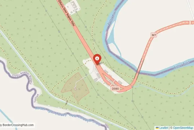
This checkpoint connects the Sədərək District of the Nakhchivan Autonomous Republic with the Iğdır Province of Turkey. It is a major international crossing, open 24/7 to all passenger cars, buses, and commercial freight. The facility is modern and designed to handle a significant volume of traffic. It is the main route for Turkish goods entering Nakhchivan and for people traveling between the two countries. The crossing can be busy, but the procedures are generally efficient, reflecting the friendly relationship between the two states.
A History of an Exclave and an Alliance
The history of this crossing is the history of Nakhchivan’s isolation and the strategic alliance between Turkey and Azerbaijan. The modern exclave was created in the 1920s by the Treaty of Kars, which was signed between Turkey and the Soviet republics of the Caucasus. A key provision of this treaty was the establishment of this small border between Turkey and the Nakhchivan SSR, with Turkey acting as a guarantor of Nakhchivan’s autonomous status. During the Soviet era, the border was closed. After the collapse of the Soviet Union and the Armenian blockade of Nakhchivan, this border became the exclave’s most vital lifeline. The “Bridge of Hope” was opened in 1992, providing a crucial outlet for the besieged territory.
Border Crossing Procedure
The border crossing procedure is a standard two-part process. You will first complete exit formalities at one country’s checkpoint and then proceed across the bridge to the other country’s checkpoint for entry inspection. You will need a valid passport. Visa requirements vary by nationality, but there are often simplified procedures for citizens of the two countries. Vehicle registration and international insurance (Green Card) are also necessary. The process is generally more straightforward and faster than at the Iranian borders of Nakhchivan, reflecting the close political relationship.
The Surrounding Region: Nakhchivan Side
On the Nakhchivan side, the crossing is in the Sədərək District. The exclave of Nakhchivan is a land of stunning, arid landscapes and incredible historical treasures. The capital, Nakhchivan City, is home to the magnificent 12th-century Momine Khatun Mausoleum and the Alinja Fortress, often called the “Machu Picchu of the Caucasus.” The region is also famous for the Ashab-i-Kahf caves, a sacred site mentioned in the Quran. The entire exclave is a unique and fascinating destination for the adventurous traveler.
The Surrounding Region: Turkey Side
On the Turkish side, the crossing is in the Iğdır Province, a plain that lies in the shadow of the magnificent Mount Ararat, the biblical resting place of Noah’s Ark. The city of Iğdır is the main regional center. The crossing is a gateway to the historic city of Kars, with its magnificent medieval Armenian churches and its unique Russian-era Baltic-style architecture. The ruins of the ancient Armenian capital of Ani, a UNESCO World Heritage site, are also near Kars. The Ishak Pasha Palace, a stunning Ottoman-era palace near the town of Doğubayazıt, is another major attraction in the region.
Practical Travel Information
Practical planning for this route is straightforward. The main road is well-maintained. The official currencies are the Azerbaijani Manat (AZN) in Nakhchivan and the Turkish Lira (TRY) in Turkey. Currency exchange facilities are available. Ensure your vehicle’s Green Card insurance explicitly covers both Azerbaijan and Turkey. Services like petrol stations are readily available on the main route. The crossing is an excellent entry or exit point for an overland journey that includes eastern Turkey and the Caucasus.
Final Considerations
The Sədərək–Dilucu border crossing is more than just a checkpoint; it is a geopolitical lifeline and a powerful symbol of a strategic alliance. It is a journey into a unique and isolated land with a deep and rich history. For the adventurous and well-prepared traveler, it offers an unforgettable experience, a passage between two closely linked cultures. It is a border that is defined by its strategic importance, a testament to the enduring power of geography and history in shaping the destiny of nations. It is the “Bridge of Hope” that connects Nakhchivan to the wider world.
See other crossings between Azerbaijan and Turkey (via Nakhchivan exclave)
See other crossings between Azerbaijan and Turkey (via Nakhchivan exclave)
No reviews yet.