Approximate Border Location
Wait Times
20–60 min
Just crossed? Tap to report:
Operating Hours
24 hours
Crossing Types
Pedestrians, vehicles
Border Type
Land crossing via road
Peak Times
7–10 AM, weekends
Daily Crossings
2,500–3,500 daily
Currency Exchange
Exchange nearby; BYN, RUB
Safety Information
Busy periods; generally safe
Languages Spoken
Belarusian/Russian
Accessibility Features
Ramps; elevators
About Krasnaya Gorka & Redki
Monthly Update (April 2026):
Cars move through without building any real line, even at busier moments. Through April 2026, Krasnaya Gorka & Redki Border Crossing is mostly stable and easygoing. Checks are light, though they can slow slightly at times. Regional traffic and time of day shape the pace.
No Cell Service at the Border? No Problem.
Don’t get caught scrambling for paperwork when you lose signal. Download the complete South America Transit Guide directly to your device and access every critical detail, fast-track strategy, and border rule – 100% offline.
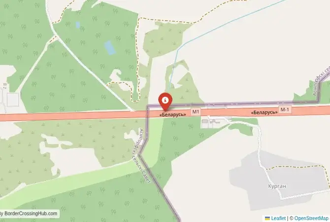
The Main Minsk-Moscow Highway
Important Note for Travelers: While historically there were minimal controls on this border for citizens of the Union State of Russia and Belarus, the situation has become more complex. Controls have been tightened, and this crossing is often NOT designated for third-country nationals. It is absolutely essential to check the current entry requirements before attempting to cross. As of early 2026, this crossing remains open primarily for Union State citizens with enhanced checks; third-country nationals are frequently redirected to other points. The border crossing connecting the area near Redki in Belarus with Krasnaya Gorka in Russia is the most important and iconic checkpoint between the two nations. This is the M1 highway, the primary superhighway that links Minsk with Moscow. It is the absolute main artery, a massive, multi-lane corridor that is the economic and social lifeline between the two capitals. To cross here is to travel on the most strategic road in the Union State, a route that is both a symbol of the close alliance between the two countries and, increasingly, a point of significant control. Its character is defined by its immense scale and the constant, high-volume flow of traffic.
Operational Details
This checkpoint connects the Vitebsk Region (Viciebskaja voblasć) of Belarus with the Smolensk Oblast of Russia. It is a massive, 24/7 facility built to handle a constant stream of traffic. For many years, the checkpoint for private cars was almost non-existent for Union State citizens, who could often drive through without stopping. However, a large, formal checkpoint has always existed for customs control of commercial freight. In recent years, formal passport control points have been re-established for all traffic, though the intensity of the checks can vary.
A History of the Union State Border
The history of this route is the history of the post-Soviet relationship between Belarus and Russia. The M1 highway was a flagship Soviet infrastructure project. After 1991, it became the key symbol of the Union State agreement. The removal of border posts in the 1990s was a powerful statement of integration. For two decades, this was arguably the most open international border in the region. However, starting in 2016, Russia began re-establishing a formal border zone and declared that the land border was not equipped for international travelers (third-country nationals), who were technically required to enter Russia from Belarus via an international airport. This created a highly confusing and controversial situation, with the Krasnaya Gorka checkpoint becoming the focal point of this new, harder border policy.
The Ambiguous Border Procedure
The border crossing procedure here is notoriously ambiguous for non-Union State citizens. For Russians and Belarusians, the process is usually a quick check of internal passports. For third-country nationals, attempting to cross here by car is extremely risky. The crossing is often not officially recognized by Russia as an international checkpoint for people, only for goods. This means that even if you have valid visas for both countries, you can be, and often are, denied entry into Russia and told to re-route via Latvia or an airport. There is no formal immigration stamping facility for foreigners. For freight, the process is a formal customs procedure, and the queues of trucks can be enormous.
The Surrounding Region
The surrounding area is a landscape of rolling hills and forests, the historic “Smolensk Gate.” On the Belarusian side, the highway passes near the historic city of Orsha, a major railway hub. On the Russian side, the road leads directly to the ancient and heroic city of Smolensk, with its formidable Kremlin walls. The entire route is dotted with memorials to the brutal battles of World War II, as this was on the main axis of the German advance on Moscow and the subsequent Soviet counter-offensives. The landscape itself is a testament to this history.
Practical Travel Information
Practical planning for this route is simple for citizens of the Union State but extremely complex for others. International travelers are strongly advised NOT to use this crossing to enter Russia from Belarus by car. The risk of being turned back is very high. You must consult the latest official information from the Russian and your own country’s diplomatic missions. The highway itself is a modern, multi-lane toll road in Belarus. The official currencies are the Belarusian Ruble (BYN) and the Russian Ruble (RUB). Numerous large service stations line the highway on both sides.
Final Considerations
The Redki–Krasnaya Gorka border crossing is the most important symbol of the Belarus-Russia Union State. It is a massive piece of infrastructure that facilitates a huge volume of trade and travel. However, for the international community, it is also a symbol of a legal and administrative gray zone. It is a border that is simultaneously open and closed, a place where the rules are complex and subject to change. It perfectly encapsulates the unique, and often paradoxical, relationship between Minsk and Moscow.
No reviews yet.