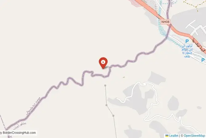
Approximate Border Location
Border Countries
- 🇦🇫Afghanistan
- 🇵🇰Pakistan
Border Cities
- 🇵🇰Peshawar area
- 🇦🇫Torkham
Wait Times
45-120 min, peak delays
Just crossed? Tap to report:
Operating Hours
Open 12:00 AM – 11:59 PM
Crossing Types
Pedestrians, vehicles, commercial
Border Type
Land crossing via road
Peak Times
7:00-10:00 AM, weekends
Daily Crossings
5000-7000 daily
Currency Exchange
Near Torkham; AFN, PKR
Safety Information
Heavy traffic; security checks
Languages Spoken
Dari/Urdu
Accessibility Features
Ramps, elevators
About Peshawar area & Torkham
Monthly Update (March 2026):
As of 03/2026, the Peshawar area & Torkham Border Crossing remains one of the busiest routes between Afghanistan and Pakistan. Trucks and passenger vehicles stack up through security and customs checks. Late afternoon tends to bring longer waits. Trade shipments and regional travel keep the crossing moving.
No Cell Service at the Border? No Problem.
Don’t get caught scrambling for paperwork when you lose signal. Download the complete Asia Transit Guide directly to your device and access every critical detail, fast-track strategy, and border rule – 100% offline.
A Crossing on the Khyber Pass
Important Note for Travelers: This border crossing is located in an extremely volatile and dangerous region. The security situation is unpredictable, with a high risk of terrorism, kidnapping, and military operations. The border can be closed without notice. Travel to this region is extremely dangerous and strongly discouraged. This guide is provided for historical and informational purposes only. The border crossing at Torkham, connecting Afghanistan with the region of Peshawar in Pakistan, is one of the most famous, historic, and chaotic checkpoints in the world. This is not just a border; it is the gateway to the legendary Khyber Pass, the mountain corridor that has been the primary route for armies, traders, and invaders moving between Central Asia and the Indian subcontinent for millennia. To cross here is to travel a path trodden by Alexander the Great, Genghis Khan, and countless others. Today, it is a bustling, often overwhelmed artery for trade and a major crossing point for people, a place defined by its immense historical weight and the complex and often violent realities of the modern Afghan-Pakistani frontier.
Operational Details
This checkpoint connects Afghanistan’s Nangarhar Province with the Khyber District of Pakistan’s Khyber Pakhtunkhwa province. It is the busiest and most important official crossing between the two nations, open 24/7 to pedestrians, passenger vehicles, and commercial freight. The facility has been modernized in recent years, but it is constantly overwhelmed by the sheer volume of traffic. The queues of colorfully decorated trucks, buses, and people can be immense, and the atmosphere is one of organized chaos. It is a critical lifeline for landlocked Afghanistan’s trade with the outside world.
A History of the Durand Line
The history of this crossing is the history of the Durand Line, the border established in 1893 between British India and Afghanistan. This line was drawn through the heart of the Pashtun tribal lands, dividing the Pashtun people between two states. Afghanistan has never officially recognized the Durand Line as a permanent international border, which is a major source of tension with Pakistan to this day. The Khyber Pass itself has been a strategic prize for centuries. During the Soviet-Afghan War, it was a major supply route for the Mujahideen. It has always been a place of conflict and intrigue.
The Border Crossing Procedure
The border crossing procedure is a complex and often very slow process, reflecting the high-security nature of the location. You will need a valid passport and valid visas for both countries, which must be obtained well in advance. The checks by both Afghan and Pakistani authorities are very thorough. The process can be particularly difficult for Afghans, who often face long waits and stringent document checks. The area is a major transit point for refugees and migrants, adding to the complexity. For foreigners, the process is meticulous, and you should be prepared for a long and potentially stressful experience.
The Surrounding Region: Afghanistan Side
On the Afghan side, the crossing is the gateway to the city of Jalalabad, the main urban center of eastern Afghanistan. The road from the border through the Khyber Pass is a spectacular but dangerous journey. The region has been a major stronghold for various militant groups, including the Taliban and ISIS-K. The security situation is extremely volatile.
The Surrounding Region: Pakistan Side
On the Pakistani side, the crossing is in the Khyber District, part of the former Federally Administered Tribal Areas (FATA). The area is known for its rugged mountains and its fiercely independent Pashtun tribes. The nearby city of Peshawar is one of the oldest cities in South Asia, a historic center of trade and culture on the edge of the subcontinent. It has a magnificent old walled city, bustling bazaars, and a rich history, but it has also been the scene of numerous terrorist attacks.
Practical Travel Information
Travel on this route is not possible for independent tourists. The Khyber Pass region is a high-risk security zone, and foreigners are often required to travel with armed guards. The official currencies are the Afghan Afghani (AFN) in Afghanistan and the Pakistani Rupee (PKR) in Pakistan. The climate is one of hot summers and mild winters. Any travel must be undertaken with extreme caution and professional security advice.
Final Considerations
The Torkham border crossing is a journey into the heart of one of the world’s most famous and challenging frontiers. It is a place where ancient history, modern geopolitics, and the daily struggle for survival converge in a chaotic and vibrant spectacle. It is a vital economic artery that operates under the constant shadow of conflict and instability. It is a border that is not for the faint of heart, a true adventure into the legendary and dangerous Khyber Pass.
No reviews yet.