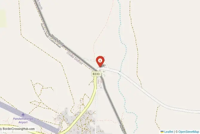
Approximate Border Location
Wait Times
30–60 min usual
Just crossed? Tap to report:
Operating Hours
Open 7:00 AM–5:00 PM
Crossing Types
Pedestrians, vehicles
Border Type
Land crossing via road
Peak Times
7:00–10:00 AM, weekends
Daily Crossings
1,400–1,600 crossings
Currency Exchange
Limited near Pandamatenga (BWP, ZWL)
Safety Information
Generally safe, remote risks
Languages Spoken
Setswana, Shona, English
Accessibility Features
Ramps, assistance
About Pandamatenga & Pandamatenga
Monthly Update (March 2026):
As of 03/2026, the Pandamatenga Border Crossing between Botswana and Zimbabwe sees a modest flow of trucks and passenger vehicles moving through the agricultural corridor. Freight inspections slow the truck lanes a little. Passenger traffic usually clears quicker. Crop transport often drives the busiest periods.
No Cell Service at the Border? No Problem.
Don’t get caught scrambling for paperwork when you lose signal. Download the complete Africa Transit Guide directly to your device and access every critical detail, fast-track strategy, and border rule – 100% offline.
The Pandamatenga Crossing: A Remote Safari Route
The border crossing at Pandamatenga is a remote and minor gateway located in the wild and sparsely populated forest reserves of northern Botswana and western Zimbabwe. This is not a major highway or a commercial corridor. It is a quiet, rural checkpoint on a gravel road, a passage through a vast, unfenced wilderness that is a major wildlife corridor. This border is primarily used by safari operators, 4×4 adventurers, and the local farming communities. The atmosphere is one of a remote bush outpost, a world away from the busy tourist hubs of Kasane and Victoria Falls. For the adventurous traveler with a suitable vehicle, this is an off-the-beaten-path route that connects the less-visited parts of Chobe National Park in Botswana with the vast Hwange National Park in Zimbabwe. It is a border for those who are looking to escape the crowds and experience the true, wild heart of the southern African bush.
A History on a Hunter’s and Explorer’s Trail
The history of this crossing is the history of the old hunter’s road. The route through Pandamatenga was part of the traditional “Old Hunter’s Road” that was used by European explorers, missionaries, and big-game hunters in the 19th century to travel from the south up towards the Zambezi River and the Victoria Falls. It was a rough, wild, and dangerous track through the wilderness. The modern border is a colonial legacy, a line drawn between the British protectorate of Bechuanaland and the colony of Southern Rhodesia. The Pandamatenga crossing was established as a simple checkpoint on this historic trail. For many years, it remained a very minor and difficult post. Its recent upgrading is a result of the growth of safari tourism and the development of the Kavango-Zambezi Transfrontier Conservation Area (KAZA), which aims to link the great national parks of the region. The crossing is a key link in this conservation landscape, allowing for tourist movement between the protected areas.
The Border Crossing Procedure: A Basic and Rustic Affair
This is a very quiet border, and the process is generally very relaxed and personal. The border is open from 08:00 to 17:00, and it is essential to check the current operating times before you travel.Exiting Botswana (Pandamatenga): The Botswanan immigration and customs post is a small, simple facility. You will present your passport and get your exit stamp. The customs process for vehicles is a brief formality. The officials are friendly and the process is very quick. You will also need to go through the mandatory veterinary control.The No-Man’s-Land: After clearing the Botswanan side, you will proceed on a gravel road through the forest reserve to the Zimbabwean side.Entering Zimbabwe (Pandamatenga): The Zimbabwean post is equally small and basic. You will go to the immigration office. You can obtain a Zimbabwean visa on arrival for most nationalities. The KAZA uni-visa is also available here. You will pay the fee in US dollars. After immigration, you will proceed to the customs office. If you are in a vehicle, you will need to pay a carbon tax and purchase temporary third-party insurance for Zimbabwe. The entire process is manual and can be slow, but it is generally friendly and hassle-free.
Route, Onward Travel, and Important Considerations
This crossing is for the self-sufficient traveler with a high-clearance vehicle, preferably a 4×4. The roads on both sides are primarily gravel and can be in poor condition, especially after rains. On the Botswanan side, the road connects to the main paved highway between Nata and Kasane. The area around Pandamatenga is known for its vast commercial farms and excellent birdwatching. On the Zimbabwean side, the road from the border leads directly to the main entrance of the Hwange National Park, Zimbabwe’s largest and most famous wildlife reserve. This makes the crossing a very strategic route for safari enthusiasts. There is no public transport on this route. You must be completely self-sufficient with fuel, food, and water, as services are extremely limited. The main consideration is the road condition. It is essential to get up-to-date information on the state of the gravel roads before you travel.
Final Planning Advice for a Bushveld Backroad
The Pandamatenga crossing is a fantastic option for the adventurous overland traveler with their own vehicle who is looking for a direct route between the great national parks of Botswana and Zimbabwe. The key to using this crossing is to have a suitable vehicle and to be completely prepared for a remote, self-sufficient journey. It is absolutely essential to check the current operating hours of the border before you set out. The reward is a journey through a beautiful and wild part of southern Africa, and a border crossing experience that is relaxed, friendly, and efficient. It is a passage that feels like a true safari adventure, a journey into the deep, untamed heart of the African wilderness.
No reviews yet.