Approximate Border Location
Border Countries
- 🇳🇦Namibia
- 🇿🇦South Africa
Border Cities
- 🇿🇦Onseepkans
- 🇳🇦Velloorsdrif
Wait Times
30–60 min typical
Just crossed? Tap to report:
Operating Hours
Open 7:00 AM–5:00 PM
Crossing Types
Pedestrians, vehicles
Border Type
Land crossing via road
Peak Times
7:00–10:00 AM, weekends
Daily Crossings
900–1,100 crossings
Currency Exchange
Limited exchange (NAD, ZAR)
Safety Information
Safe, remote area
Languages Spoken
English, Afrikaans
Accessibility Features
Ramps, assistance
About Onseepkans & Velloorsdrif
Monthly Update (March 2026):
In 03/2026, the Onseepkans & Velloorsdrif Border Crossing remains fairly quiet with a modest stream of cars and small trucks. Passport checks rarely take long. Traffic tends to pick up slightly around midday. Local farming travel shapes the pace.
No Cell Service at the Border? No Problem.
Don’t get caught scrambling for paperwork when you lose signal. Download the complete Africa Transit Guide directly to your device and access every critical detail, fast-track strategy, and border rule – 100% offline.
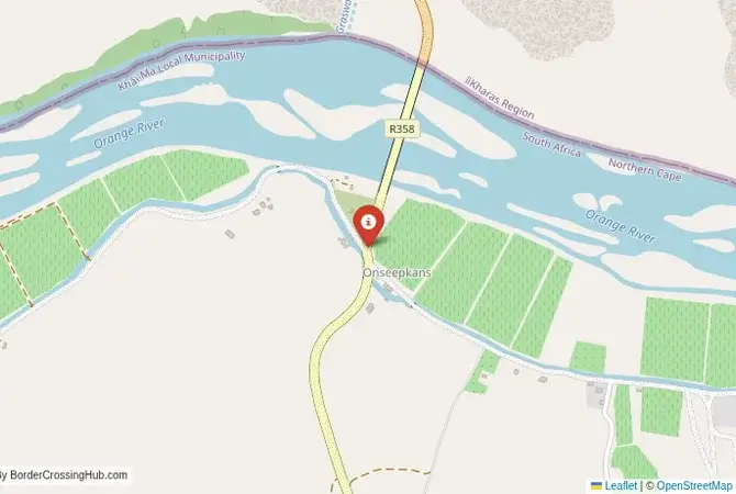
The Velloorsdrif-Onseepkans Crossing: A Remote River Route
The border crossing at Velloorsdrif in Namibia, which connects to the South African post of Onseepkans, is a minor, remote, and beautiful gateway between the two countries. This is not a major highway or a commercial route. It is a quiet, rural checkpoint on a gravel road, a passage through the spectacular and rugged landscape of the lower Orange River valley. The border is the Orange River, and the crossing is a simple, single-lane bridge. This is a border for the adventurous traveler, the 4×4 enthusiast, and those exploring the remote Richtersveld and the Green Kalahari regions. The atmosphere is one of profound peace and quiet, a world away from the endless stream of trucks on the main highways. The facilities are very basic, the traffic is minimal, and the sense of being on a true backroad adventure is immense. It is a border that feels like a secret, a tranquil passage through a stunning desert landscape.
A History of a Forgotten Corner
The history of this crossing is the history of a forgotten corner of the colonial frontier. The region of the lower Orange River is a harsh and sparsely populated desert. The crossing at Onseepkans was established as a minor checkpoint, primarily to serve the few farmers and prospectors in the area. It has never been a major route. For many years, the road on both sides was a rough, unpaved track, and the crossing was a simple pontoon ferry. The construction of the bridge was a more recent development, but the crossing has retained its remote and rustic character. Its significance comes not from trade or politics, but from its location in the heart of a unique and beautiful landscape. It is a gateway to the Ai-Ais/Richtersveld Transfrontier Park, a UNESCO World Heritage site known for its dramatic desert mountain scenery and its unique succulent flora. It is a border that has been shaped more by geology and botany than by history and economics.
The Border Crossing Procedure: A Basic and Rustic Affair
This is a very quiet border, and the process is generally very relaxed and personal. The border is open only during daylight hours, and it is essential to check the current operating times before you travel, as they can be limited. Recent reports confirm consistent operation from approximately 8:00 AM to 5:00 PM, weather and river conditions permitting, with occasional short closures during high river levels.Exiting Namibia (Velloorsdrif): The Namibian immigration and customs post is a very basic facility, likely a small, simple building. You will present your passport and get your exit stamp. The process will be manual, with your details recorded in a ledger. The officials are generally friendly and may be surprised to see a foreign traveler.The Bridge: You will then drive across the narrow bridge over the beautiful Orange River. The view of the green river valley cutting through the stark desert mountains is spectacular.Entering South Africa (Onseepkans): The South African post is equally basic. You will go to the immigration office and present your passport. For most nationalities, South Africa offers visa-free entry. The officer will stamp your passport. The customs check is usually a very informal and brief formality. The entire process on both sides can often be completed in less than 30 minutes.
Route, Onward Travel, and The Green Kalahari
This crossing is for the self-sufficient traveler with a suitable vehicle, preferably a 4×4 or at least a high-clearance vehicle. The roads on both sides are primarily gravel. On the Namibian side, the road connects to the main B1 highway, but it is a long and slow journey on unpaved roads. On the South African side, the road from Onseepkans connects to the town of Pofadder and the main N14 highway. The journey takes you through the beautiful “Green Kalahari” region, a landscape of vineyards and quiver tree forests along the Orange River. This crossing is the perfect gateway for an off-road adventure through the Ai-Ais/Richtersveld Transfrontier Park. It is also a key link for those traveling between the Fish River Canyon in Namibia and the Augrabies Falls National Park in South Africa. There is no public transport on this route. You must be completely self-sufficient with fuel, food, and water, as services are extremely limited.
Final Planning Advice for a Desert Backroad
The Velloorsdrif-Onseepkans crossing is a fantastic option for the adventurous overland traveler looking for a scenic and peaceful alternative to the main highways. The key to using this crossing is to have a suitable vehicle and to be completely prepared for a remote, self-sufficient journey. It is absolutely essential to check the current operating hours of the border before you set out. The reward is a journey through one of the most beautiful and least-visited parts of southern Africa. It is a border that offers a sense of discovery and a deep connection to the wild, rugged landscape. It is a passage for the true explorer, a quiet and beautiful gateway into the heart of the desert.
No reviews yet.