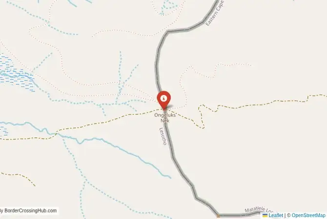
Approximate Border Location
Border Countries
- 🇿🇦South Africa
- 🇱🇸Lesotho
Border Cities
- 🇿🇦Ongeluksnek
- 🇱🇸Ongeluksnek
Wait Times
30–60 min usual
Just crossed? Tap to report:
Operating Hours
Open 8:00 AM–4:00 PM
Crossing Types
Pedestrians, vehicles
Border Type
Land crossing via road
Peak Times
7:00–10:00 AM, weekends
Daily Crossings
550–650 crossings
Currency Exchange
Limited near Sepapu’s (ZAR, LSL)
Safety Information
Generally safe, mountain risks
Languages Spoken
English, Sesotho, Afrikaans
Accessibility Features
Ramps, assistance
About Ongeluksnek & Ongeluksnek
Monthly Update (March 2026):
In recent weeks of 03/2026, the Ongeluksnek Border Crossing sees very light traffic along the mountain route between South Africa and Lesotho. Vehicles arrive sporadically and document checks rarely take long. Weather on the pass can slow things down. Most hours remain calm.
No Cell Service at the Border? No Problem.
Don’t get caught scrambling for paperwork when you lose signal. Download the complete Africa Transit Guide directly to your device and access every critical detail, fast-track strategy, and border rule – 100% offline.
The Ongeluksnek Crossing: A Legendary and Extreme 4×4 Challenge
The border crossing at Ongeluksnek Pass is not a border in any conventional sense. It is one of the most difficult, remote, and legendary 4×4 challenges in all of southern Africa. The “crossing” is a rugged, unmaintained, and often treacherous track that climbs steeply over the Drakensberg mountains, connecting a remote corner of the Eastern Cape province of South Africa with the even more remote highlands of Lesotho’s Quthing District. This is not a route for tourists or for any vehicle other than a heavily modified, low-range 4×4. It is an expedition. The border posts are very basic, and the pass is often closed and impassable. The atmosphere is one of complete and utter wilderness, a place where the challenge of the terrain is the only thing that matters. For the most hardcore of 4×4 adventurers, conquering Ongeluksnek is a major achievement, a journey into one of the most inaccessible and beautiful parts of the Mountain Kingdom.
A History of a “Nek of Misfortune”
The history of this crossing is written in its name. Ongeluksnek is Afrikaans for “Nek of Misfortune” or “Accident Pass.” The name was given after a group of Griqua trekkers suffered a disaster here in the 19th century when their wagons overturned on the steep and treacherous path. The route has always been a marginal and dangerous one, a simple bridle path used by the Basotho people. It has never been a formal trade route or a major point of connection. Its modern fame comes entirely from its reputation in the 4×4 community as one of the toughest and most rewarding passes in the country. The formalization of the border posts is a simple administrative measure; the pass itself remains as wild and untamed as it was a century ago. It is a border that is defined not by politics or economics, but by its formidable and unforgiving geography. It is a place that demands respect and a high level of skill from anyone who attempts to traverse it.
The Border Crossing Procedure: A Rustic Formality
This is a very quiet border, and the process is a simple formality in the midst of a major expedition. The border is open from 08:00 to 16:00, but its operation is entirely dependent on the weather and the condition of the pass. It can be closed for months at a time. It is absolutely essential to check its status in advance.Exiting South Africa: The South African border post is a very basic facility, located at the bottom of the pass. The officials will be surprised to see anyone. You will present your passport and get your exit stamp. They will likely warn you about the condition of the pass.The Ongeluksnek Pass: This is the main challenge. The track is extremely steep, rocky, and often washed out. It requires low-range 4×4 driving and a great deal of skill and nerve. The ascent is a slow, grinding process. The views are spectacular, but your focus will be on the track ahead.Entering Lesotho: The Lesotho post is located at the top of the pass. It is an extremely basic, remote outpost. You will present your passport and get your entry stamp. The officials are accustomed to the few adventurers who make it this far. The entire process is secondary to the challenge of the drive itself.
Route, Onward Travel, and Extreme Self-Sufficiency
This crossing is for expedition-prepared 4×4 vehicles only. On the South African side, the pass is accessed via a long network of gravel roads from the town of Matatiele in the Eastern Cape. The area is part of the Ongeluksnek Nature Reserve. On the Lesotho side, the track from the top of the pass is equally challenging. It connects to the remote town of Mphaki and eventually to the main southern highway (the A4) near Mount Moorosi. The journey is a multi-day affair. There is no public transport. You must be completely self-sufficient with fuel, food, water, communications (satellite phone), and extensive vehicle recovery equipment. Traveling alone is not recommended. This is a journey that should be done in a convoy of at least two vehicles. The main caveat is the extreme and unpredictable nature of the route. The weather can change in an instant, and a mechanical failure here would be a very serious emergency.
Final Planning Advice for an Extreme Adventure
The Ongeluksnek Pass crossing is the pinnacle of 4×4 adventure in southern Africa. It is not a border for tourists but for highly experienced and well-equipped expeditionaries. The logistical challenges are immense. The key to a successful journey is meticulous planning and preparation. You must have a very capable vehicle and extensive off-road experience. You must get reliable, up-to-the-minute information on the status of the pass from local 4×4 clubs or authorities. The reward is the immense satisfaction of conquering one of the region’s toughest challenges and a journey through a landscape of breathtaking and untouched beauty. It is a border that is not a gateway but an obstacle, a formidable and legendary challenge for the true off-road adventurer.
No reviews yet.