Approximate Border Location
Wait Times
Cars 10-50m; peaks 60-180m storms
Just crossed? Tap to report:
Operating Hours
08:00 AM-08:00 PM
Crossing Types
Ped,cars,buses,trucks; full customs
Border Type
Land crossing via road (Bolivia–Chile)
Peak Times
09:00-12:00 PM; summer tours; snow events
Daily Crossings
200-900/day
Currency Exchange
Bs; CLP in Calama/Oruro; little at post
Safety Information
Altitude + weather risk; closures possible
Languages Spoken
Spanish
Accessibility Features
Basic step-free; cold shelters limited
About Ollague & Ollagüe
The Ollague-Ollagüe border crossing runs across the high Andean altiplano at 3,695 meters, serving as a key overland link between Bolivia’s Potosí Department near Uyuni and Chile’s Antofagasta Region near Calama.
Location and Basic Connections
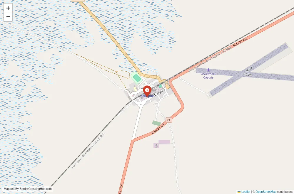
You approach this pass along Ruta Nacional 5 on the Bolivian side from Uyuni or the Salar de Uyuni area, and Chilean Route 21 (CH-21) from Calama or Ollagüe village. The Bolivian immigration and customs post sits near Estación Avaroa or the border zone, while the Chilean complex is at Ollagüe, with the two facilities separated by about 3 to 6 km of gravel road. The route connects the Uyuni Salt Flats region to northern Chilean cities like Calama and Antofagasta. Most foreign travelers use it as the endpoint of multi-day 4×4 tours from Uyuni, though trucks handle freight and some private vehicles cross. Public buses are rare on this stretch; shared taxis or tour vans cover parts from Uyuni.
Alternative Names
This point is known as Paso Ollagüe, Complejo Fronterizo Ollagüe, Paso Salar de Ollagüe, or the Ollague border crossing.
Historical Background
The frontier line here dates to post-War of the Pacific treaties in the late 19th century, when Chile acquired the Atacama region from Bolivia. The pass follows ancient trade routes across the altiplano, later paralleled by the historic Arica-La Paz railway (now mostly freight). Ollagüe village grew around mining and rail activity, with sulfur exports playing a role. The modern crossing developed in the 20th century as road links improved, gaining popularity among tourists in the 2000s with the rise of Uyuni tours extending to Chile.
Geopolitical Significance
This crossing ranks as the third of four main Bolivia-Chile land points from north to south, handling a mix of tourist vehicles, trucks, and local traffic. It supports Bolivia’s access to Chilean ports and Chile’s connections to the altiplano interior. Freight includes minerals and goods, while tourism drives much of the passenger flow. Recent bilateral efforts focus on road upgrades and smoother operations. As of early 2026, the crossing remains open for all vehicle types when weather allows, though it faces periodic closures from snow, wind, or maintenance. Always check Chilean Pasos Fronterizos or Bolivian migration sites for live status, as conditions change quickly in this exposed zone.
Practical Crossing Procedures
You process through separate facilities: exit Bolivia at their post first, drive the short gravel stretch, then enter Chile at Ollagüe. Bolivian side handles passport exit stamps and basic customs. Chilean side requires entry stamps, tourist card issuance for most nationalities, vehicle temporary import permit, insurance verification, and strict agricultural/customs inspection (all food, plants, or animal products must be declared and often discarded). Everyone disembarks for bag scans and questioning. Chile allows all vehicle types here. Bring your passport valid six months, vehicle docs if driving, and be ready to open everything. Most nationalities get 90-day visa-free entry to each country.
Typical Wait Times and Operating Hours
Hours generally run from 08:00 to 20:00 daily on both sides, though Bolivian processing may include a lunch break around midday. Waits stay reasonable at this quieter crossing, often 30 to 90 minutes total, but multiple tour groups arriving together create lines. Truck traffic adds time during business hours. Extreme weather can close the pass suddenly for hours or days.
Transportation Options
Organized 4×4 tours from Uyuni dominate, including the border as part of multi-day itineraries ending in San Pedro de Atacama or Calama. Private high-clearance vehicles work if prepared with paperwork. No regular public buses cross; hitchhiking occurs along the route but remains sparse due to remoteness. Arrange fuel and spares in Uyuni or Calama, as options disappear in between.
Road Conditions and Scenery
The Bolivian approach features gravel and dirt tracks across salt flats, volcanic terrain, and open altiplano, with some rutted or sandy sections (especially during construction or after rain). Chilean Route 21 improves to better graded gravel and partial paving. The pass delivers vast desert views, active volcanoes (including the smoking Ollagüe volcano nearby), lagoons, and stark Andean landscapes. Altitude and wind make driving demanding; chains or caution needed in winter.
Scams and Warnings
This remote crossing sees little in the way of touts, but some budget tours rush procedures or fail to explain Chilean customs rules, leading to confiscated items. Altitude sickness poses a serious risk at nearly 3,700 meters; symptoms like headaches or nausea hit during waits. Carry meds, water, and warm clothes. Road conditions turn treacherous in bad weather; snow or wind closures strand travelers. Monitor forecasts and official updates closely. Carry extra supplies, as facilities are basic and isolated.
Nearby Attractions
On the Bolivian side, the route ties into the Uyuni Salt Flats, colorful lagoons, and Eduardo Avaroa Reserve with geysers and flamingos. In Chile, Ollagüe village offers minimal amenities, but Calama provides urban services, while San Pedro de Atacama (farther south) features the Valley of the Moon, El Tatio geysers, and desert stargazing. The crossing suits those combining salt flat tours with Atacama exploration.
Seasonal Variations and Delays
Summer (December to March) risks rain turning roads muddy and causing closures. Winter (May to November) brings snow, ice, intense cold, and frequent interruptions from blizzards. Clear dry periods offer the most reliable passage. Tour volumes peak in shoulder seasons, adding minor congestion.
Cultural and Economic Role
Limited daily crossings support local trade in minerals and goods, alongside tourism jobs for drivers and guides. The altiplano mixes Aymara and Atacameño influences, visible in roadside life and small communities. It remains a functional frontier focused on freight and adventure travel.
Final Planning Notes
Prepare for high altitude: acclimate, hydrate, and carry emergency supplies. Confirm hours and status via official Chilean or Bolivian border sites. Bring passport copies, small cash (CLP, BOB, USD), warm layers, food, water, and vehicle essentials if driving. This suits prepared overlanders or tour passengers ready for remote, high-elevation challenges.
Navigating This Altiplano Crossing
Ollague-Ollagüe provides a stark, scenic high-desert border route linking Uyuni’s salt flats to Chile’s northern interior. With solid prep, current checks, and weather awareness, you handle this isolated Andean pass without surprises.
No reviews yet.