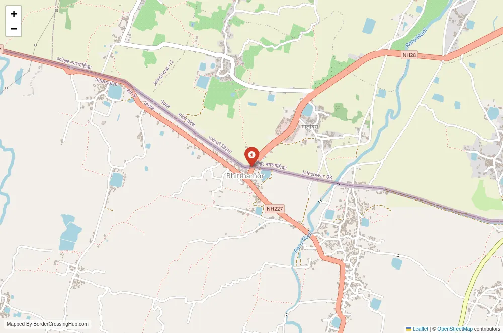
Approximate Border Location
Wait Times
Cars 15-60m; peaks 90-240m
Just crossed? Tap to report:
Operating Hours
06:00 AM-10:00 PM
Crossing Types
Ped,cars,buses; border controls
Border Type
Land crossing via road (NH route)
Peak Times
08:00-10:00 AM; 04:00-08:00 PM
Daily Crossings
3,000-15,000/day
Currency Exchange
INR; NPR in Jaleshwar; ATMs
Safety Information
Crowding at market times; standard caution
Languages Spoken
Hindi, Nepali, English
Accessibility Features
Step-free varies; basic facilities
About Nalitabari & Dalu / Nakugaon
Monthly Update (March 2026):
As of 03/2026, the Nalitabari & Dalu / Nakugaon Border Crossing stays moderately active with trucks and local vehicles passing through the checkpoint. Cargo vehicles often queue briefly on the Bangladesh side during inspection periods. Early mornings usually move faster. Cross-border trade keeps the area busy most days.
No Cell Service at the Border? No Problem.
Don’t get caught scrambling for paperwork when you lose signal. Download the complete Asia Transit Guide directly to your device and access every critical detail, fast-track strategy, and border rule – 100% offline.
The Nalitabari-Dalu / Nakugaon border crossing (also known as Nalitabari on the Bangladeshi side in Sherpur district and Dalu or Nakugaon on the Indian side in Meghalaya’s West Garo Hills district) connects northern Bangladesh to the western part of Meghalaya across a relatively open stretch of the international boundary. You use this point for local and regional overland travel between Bangladesh’s Mymensingh division and India’s Garo Hills, often when moving from Dhaka or Mymensingh toward Tura in Meghalaya or farther into northeast India. The crossing features basic immigration and customs facilities on both sides, with a simple road that crosses the boundary near the villages of Nalitabari and Nakugaon/Dalu, serving as one of the lesser-known land ports along the 4,096-kilometer India-Bangladesh border.
Location and Connections
Nalitabari lies in Sherpur district of Mymensingh division, Bangladesh, about 40 kilometers north of Sherpur town and roughly 200 kilometers north of Dhaka. On the Indian side, Dalu (sometimes referred to as Nakugaon or nearby border hamlets) sits in West Garo Hills, Meghalaya, with onward roads to Tura (around 60 kilometers) and Shillong. The crossing consists of small immigration buildings and customs sheds positioned close together, with a short neutral zone and a paved or semi-paved road linking the two countries. The landscape transitions from Bangladesh’s flat, fertile plains and paddy fields to Meghalaya’s rolling hills, forests, and Garo villages. No major river or bridge dominates; the border here follows surveyed lines through rural terrain. No rail or significant air links serve directly; the route relies on road transport amid agricultural and forested countryside.
Historical and Geopolitical Background
The India-Bangladesh border, one of the world’s longest, was established by the 1947 Radcliffe Line and refined through the 1974 Indira-Mujib agreement and the 2015 land boundary exchange. Nalitabari-Dalu/Nakugaon developed as a minor transit point to regulate local trade and movement in a region where Garo, Bengali, and other communities have long interacted across the line. The open-border policy under the 1950 Treaty of Peace and Friendship allows citizens to cross for short distances, though formal checkpoints enforce customs and security. The crossing supports small-scale trade in agricultural produce, timber, and consumer goods, as well as family visits and labor migration. Meghalaya’s borders saw fencing initiatives in the 2010s to curb smuggling and irregular migration, but this point remains relatively low-key compared to major crossings like Petrapole-Benapole or Akhaura-Agartala. Occasional issues arise from cattle smuggling or seasonal flooding, but the crossing generally stays operational. Fun fact: the Garo Hills on the Indian side preserve matrilineal traditions and living root bridges, contrasting with Bangladesh’s plains agriculture, yet shared markets and festivals continue to link communities across the boundary.
Current Status and Operating Hours
As of early 2026, Nalitabari-Dalu/Nakugaon operates as a functional land customs station for local trade and passenger movement, though traffic volumes remain modest compared to larger crossings. It opens daily during daylight hours (approximately 9:00 a.m. to 5:00 p.m.), with possible extensions for locals or goods trucks. The crossing handles pedestrians, motorcycles, light vehicles, and occasional trucks carrying permitted goods. Monsoon rains (June to September) cause flooding or road damage in the low-lying areas, occasionally disrupting access, while winter brings fog but reliable operations. Security involves India’s Border Security Force (BSF) and Bangladesh’s Border Guard Bangladesh (BGB) conducting routine checks. No major long-term closures reported recently, but verify through local administration, BSF notices, or Bangladesh Land Port Authority, as weather or minor bilateral issues can affect smaller posts.
Crossing Procedures Step by Step
You exit one country then enter the other. From India to Bangladesh: at the Dalu/Nakugaon Indian post, present your passport or voter ID (for Indian citizens) for exit registration or stamp, then clear customs if carrying goods. Walk or drive the short distance to the Nalitabari Bangladesh immigration post for entry stamp (Bangladeshi citizens cross freely; foreigners use visa-on-arrival or pre-arranged visa). The reverse from Bangladesh follows the same sequence: Bangladesh exit stamp followed by Indian entry (customs check for restricted items). Procedures involve manual document verification, occasional bag or vehicle scans, and questions about travel purpose. Wait times typically range from 20 minutes to an hour, longer during market days or truck queues. Foreigners report straightforward processing, though expect additional scrutiny for larger amounts of goods or extended stays.
Visa Requirements for Foreign Visitors
Indian and Bangladeshi citizens cross without visas under bilateral arrangements, using ID cards or voter IDs. Foreigners entering Bangladesh from India can obtain visa-on-arrival at land borders (30 days for $51 USD for most nationalities; payable in cash, USD preferred). Bring passport photos and exact fees. Passports need at least six months validity. India requires no visa for Bangladeshi citizens but may check foreigners for onward permits if traveling to restricted areas in Meghalaya. Rules remain consistent, but confirm via embassies or official portals, as enforcement can vary at smaller crossings.
Transportation Options and Road Details
From Shillong or Tura, shared jeeps or taxis reach Dalu/Nakugaon (5-7 hours from Tura on hilly roads). From Nalitabari, buses or shared taxis head to Sherpur, Mymensingh, or Dhaka. Private cars cross if compliant (insurance, permissions). No direct public buses routinely cross; arrange onward locally after clearance. Roads from Tura remain paved but narrow and winding; Bangladesh side includes highways with occasional rough patches. Monsoon mud or flooding can delay travel. Full Shillong-Dhaka route takes 1-2 days with border time. Daylight travel recommended for safety and visibility.
Scams and Safety Warnings
Minor hassles include overpriced transport near Tura or poor exchange rates (use banks). Touts may offer “fast” services. The area stays generally safe for transit, but petty theft occurs in crowds. Monitor news for local unrest in Meghalaya or Bangladesh. Avoid unofficial paths. Register with embassies if staying longer.
Nearby Attractions and Practical Tips
West Garo Hills offer Nokrek National Park, living root bridges, and Garo cultural sites. Bangladeshi side leads to Sherpur’s rural markets or Mymensingh’s educational institutions. Carry INR/BDT cash, water, snacks, sunscreen, and passport copies. Start early; consider other crossings as backups.
Final Notes for Planning
Borsara provides a quiet, rural crossing between India and Bangladesh’s north, benefiting from open-border ease for citizens and simple procedures for foreigners. Confirm status, prepare visas/fees, and plan for daylight travel. With preparation, it offers reliable passage across this Terai-Himalayan transition. Safe travels.
No reviews yet.