Approximate Border Location
Border Countries
- 🇿🇦South Africa
- 🇸🇿Eswatini
Border Cities
- 🇿🇦Mananga
- 🇸🇿Mananga
Wait Times
15–30 min typical
Just crossed? Tap to report:
Operating Hours
Open 7:00 AM–7:00 PM
Crossing Types
Pedestrians, vehicles
Border Type
Land crossing via road
Peak Times
7:00–10:00 AM, weekends
Daily Crossings
2,900–3,100 crossings
Currency Exchange
Available near Mananga (ZAR, SZL)
Safety Information
Generally safe, traffic moderate
Languages Spoken
English, Zulu, Swazi
Accessibility Features
Ramps, elevators
About Mananga & Mananga
Monthly Update (March 2026):
In recent weeks of 03/2026, the Mananga Border Crossing between South Africa and Eswatini sees a steady mix of cars, minibuses, and small cargo trucks. Passport checks usually move quickly but midday can slow the lanes a little. Local commuting keeps the crossing active.
No Cell Service at the Border? No Problem.
Don’t get caught scrambling for paperwork when you lose signal. Download the complete Africa Transit Guide directly to your device and access every critical detail, fast-track strategy, and border rule – 100% offline.
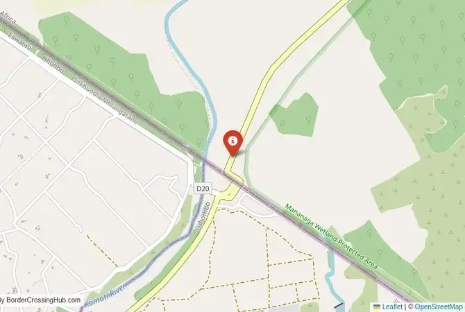
The Mananga Crossing: The Northern Lowveld Gateway
The border crossing at Mananga is a major gateway on the northern frontier between South Africa and the Kingdom of Eswatini. It connects the South African province of Mpumalanga with the Lubombo Region of Eswatini. This is not a mountainous crossing like some of the others; it is located in the hot, flat, and fertile lowveld, a region of vast sugar cane plantations and citrus orchards. This is a busy border, a vital commercial artery for the sugar industry and a key route for tourists traveling between South Africa’s Kruger National Park and the game reserves and cultural attractions of Eswatini. The atmosphere is that of a functional, professional, and busy agricultural and tourist hub. For the traveler, this is a convenient and straightforward crossing, a passage from the wildness of the Kruger region into the heart of Eswatini’s great sugar belt, a journey through a landscape that is both a natural paradise and a major agricultural powerhouse.
A History of Sugar and a New Corridor
The history of this border is the history of the sugar industry. The lowveld region of both Eswatini and the adjacent parts of South Africa has the perfect climate for growing sugar cane. The development of massive, irrigated sugar estates in the 20th century transformed the region’s economy. The Mananga border crossing grew in importance as a key logistical point for this integrated, cross-border industry, facilitating the movement of workers, equipment, and processed sugar. The border is a colonial legacy, a line drawn by the British between their protectorate of Swaziland and the Boer republic of the Transvaal. In the modern era, the crossing has gained new importance as a tourist route. It is located on the most direct path for travelers coming from the southern part of the Kruger National Park and heading to the major game reserves of Eswatini, such as the Hlane Royal National Park. It has become a key link in a popular, multi-country safari circuit.
The Border Crossing Procedure: A Smooth and Orderly Process
The border is open from 07:00 to 18:00, and it is essential to check the current operating times before you travel. The process is known for being very smooth, professional, and efficient. The facilities on both sides are modern and well-organized.Exiting South Africa (Mananga): You will arrive at the modern South African border post. You will go to the immigration hall and get your passport stamped for exit. The customs process for vehicles involves checking your registration papers. The officials are professional and the process is generally quick.The No-Man’s-Land: After clearing the South African side, you will drive a short distance through the sugar cane fields to the Eswatini side.Entering Eswatini (Mananga): You will arrive at the modern Eswatini border post. You will go to the immigration office. For most nationalities, Eswatini offers visa-free entry. The officer will check your passport and provide an entry stamp. After immigration, you will proceed to the customs and road authority offices. If you are in a vehicle, you will need to pay a road tax. You will also need to have third-party insurance for Eswatini, which can be purchased at the border if your existing policy is not valid. The officials are known for being friendly and welcoming, and the process is generally hassle-free.
Route, Onward Travel, and The Sugar Belt
This crossing is on the main R571/MR5 highway. On the South African side, the road connects to the town of Komatipoort and the main N4 highway, which is the southern border of the Kruger National Park. On the Eswatini side, the road from the border is an excellent, paved highway that runs through the heart of the country’s sugar belt. The road leads to the main hub towns of the lowveld, such as Mhlume and Simunye. From here, you can easily access the Hlane Royal National Park, which is famous for its lions and rhinos, and other reserves like the Mkhaya Game Reserve. The road network connects you to the main tourist centers of the Ezulwini Valley and the capital, Mbabane. For those without a car, there are minibus services that run from South African towns like Komatipoort to the border, and from the border into Eswatini. However, this is a route that is most easily explored with your own vehicle.
Final Planning Advice for the Lowveld Route
The Mananga crossing is a modern, efficient, and convenient border. It is the best gateway for travelers coming from the Kruger National Park and heading into the heart of Eswatini. The key to a successful crossing is to check the operating hours in advance, as it is not a 24-hour crossing. Have all your vehicle documents in order if you are driving. The process is straightforward and the officials are friendly. This crossing is a smooth and easy passage into the beautiful lowveld of Eswatini, a journey through a landscape of immense agricultural productivity and rich wildlife. It is a perfect start to an exploration of the unique culture, stunning scenery, and incredible wildlife of Africa’s last mountain kingdom.
No reviews yet.