Monthly Update (September 2026):
Laufenburg & Bad Säckingen remains a practical Rhine crossing, and current traffic is particularly favorable. On September 4, the monitored Laufenburg crossing was showing a zero-minute wait, as were Bad Säckingen and the other tracked crossings in the Aargau–Germany area. There is no significant September traffic disruption to report, making this a useful option when the larger Basel approaches are busy.
About this crossing
Location and Connections
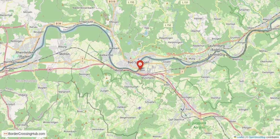
You find this point where Laufenburg (Switzerland, Aargau canton) meets Laufenburg (Germany, Baden-Württemberg state), divided by the Rhine. The main crossing uses the Laufenbrücke (Laufen Bridge), a historic stone arch bridge carrying local road traffic (for cars, bikes, pedestrians) between the two halves. From the Swiss Laufenburg center, the bridge is right in town; from the German side, it's immediate. Swiss Route 3 or local roads lead to the bridge, while German L 151 or similar connect onward. Nearby Bad Säckingen (Germany) lies about 10 to 15 minutes west along the Rhine, with its famous covered wooden bridge to Stein am Rhein (Switzerland). Trains connect Laufenburg (Switzerland) station to nearby Swiss towns, with some services toward Bad Säckingen (Germany). Buses serve cross-border routes. The area ties into High Rhine paths for cycling or walking.
Alternative Names
It appears as the Laufenburg border crossing, Laufenbrücke crossing, Laufenburg (AG)-Laufenburg (Baden) Grenzübergang, or the Rhine bridge at Laufenburg.
Nearby Border Crossings


Historical Background
Laufenburg originated as a single medieval settlement around the 13th century, with the Rhine as a natural trade route for salt, timber, and goods. The border solidified in the 19th century through Swiss-Baden treaties, splitting the town but preserving its shared Alemannic roots. The Laufenbrücke dates to earlier wooden versions, rebuilt in stone over time. Post-WWII, customs operated until Schengen in 2008 eased things for Switzerland. The town retains medieval charm on the Swiss side (castle ruins, old streets), while the German part offers quieter views. The Rhine's role fostered cross-border ties despite the line, with bunkers on the Swiss bank from WWII defense plans.
Geopolitical Context
Schengen since 2008 normally removes routine passport and customs checks for EU/Swiss citizens and visa-exempt travelers. Germany maintains temporary internal border controls due to migration, smuggling, and security. As of February 10, 2026, these extend at least through March 15, 2026, with Bundespolizei random spot inspections at land borders, including Switzerland crossings like Laufenburg. Switzerland occasionally increases checks for security or traffic, but no widespread temporary controls apply here. Spot checks focus on irregular migration or goods; this small bridge crossing sees lighter enforcement than motorways. No permanent booths exist; controls are mobile or rare. The border follows the Rhine's channel, with the bridge midpoint marking the line.
Practical Crossing Procedures
You walk, cycle, or drive across the Laufenbrücke, marked by a white line or signs on the bridge. No booths or systematic queues exist under normal Schengen flow. Temporary German measures may lead to random stops (more likely on roads) for ID checks, travel questions, or vehicle review. EU/Swiss citizens show passport or national ID. Non-EU nationals need valid passports, visas/Schengen entry if required, and proofs like accommodation. Carry vehicle insurance; Swiss vignette needed if continuing on highways (local roads often vignette-free short distances). Pedestrians and cyclists cross freely on the bridge sidewalk.
Typical Wait Times
You cross in seconds to a minute on the bridge. Random checks add variability: most pass quickly, but selected stops or peaks (tourist weekends, events) can cause 10 to 30 minute delays if police are present. Foot crossings often face no waits. The bridge handles light traffic, so backups stay rare.
Operating Hours
The bridge and roads operate 24/7 year-round. Schengen removed fixed hours. Winter weather or rare maintenance might slow access briefly, but the crossing stays open.
Transportation Options and Road Conditions
Drive or cycle across the bridge; regional trains connect Laufenburg (Switzerland) station to nearby towns, with some German extensions. Buses serve cross-border routes. The bridge offers narrow lanes for cars/bikes, with good pavement but urban speed limits. Scenery includes Rhine views, medieval buildings, and town squares. Watch for pedestrians, cyclists, or river traffic.
Scams & Warnings
Scams stay rare in this quiet twin-town area. No common touts or fake services reported. Watch for parking fees or informal changers with poor rates. Carry ID for spot checks. The setting feels safe and welcoming; drive attentively in town traffic.
Nearby Attractions
Swiss Laufenburg features the old town, castle ruins, and Rhine paths. German Laufenburg offers quieter views from the train station. Nearby Bad Säckingen (10-15 minutes west) has the longest covered wooden bridge in Europe (Holzbrücke, 203m) to Stein am Rhein (Switzerland). The High Rhine offers cycling trails, Rhine Falls near Schaffhausen, and lake access toward Lake Constance. The area suits historic walks, river scenery, or border curiosities.
Seasonal Variations and Weather Impacts
Winter brings snow; roads clear quickly but river activities reduce. Summer sees crowds and clear weather. Autumn offers foliage and milder days. Rain can slick the bridge, but closures stay rare.
Travel Tips and Preparation
Carry passport/ID for spot checks. Use cross-border transport apps. Pack layers for river weather. Check police sites for control updates. Enjoy the seamless town feel.
Cultural and Economic Significance
The crossing supports daily life and tourism in the split Laufenburg, linking Swiss and German communities through shared Rhine heritage. Medieval architecture, festivals, and cross-border shopping thrive on open movement.
Before You Cross
Verify spot check status and traffic from official sources near your travel date. With prep for rare stops and relaxed pace, you navigate this historic Rhine bridge crossing and explore the charming twin towns on both sides. Safe travels.
View all border crossings between Switzerland and GermanyPractical information
Fuel
Switzerland: <1 km - Germany: <1 km
Currency
EUR; CHF in both towns; ATMs
Safety information
Urban bridge traffic; occasional checks
Connectivity
Wi-Fi points; 4G
Have you crossed here?
Help other travelers by sharing your experience, wait times, and any updates.