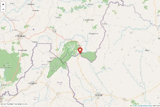
Approximate Border Location
Border Countries
- 🇨🇮Ivory Coast
- 🇬🇳Guinea
Border Cities
- 🇨🇮Gbapleu
- 🇬🇳Doromou
Wait Times
35–100 min
Just crossed? Tap to report:
Operating Hours
6:00 AM–6:00 PM
Crossing Types
Cars, small trucks
Border Type
Land
Peak Times
Trade peaks
Daily Crossings
200–700
Safety Information
Remote, minimal services
Languages Spoken
French,local dialects
Accessibility Features
Minimal
About Gbapleu & Doromou
Monthly Update (May 2026):
In May 2026, the Doromou and Gbapleu Border Crossing is looking mostly stable and relaxed. The Ivory Coast side stays quiet most of the day, though things can slow down when a cluster of motorbikes arrives at the Guinea post. It’s a predictable trip for the most part, unless local events in the nearby villages bring an unexpected surge in foot traffic.
A remote forest crossing you should approach with caution
Deep in the western interior of Ivory Coast and Guinea, the Gbapleu–Doromou border crossing is one of the least developed routes between the two countries. You are dealing with a remote and lightly monitored crossing where infrastructure is minimal and reliable information can be limited. Extra caution is strongly advised, especially regarding safety, transport, and up-to-date entry requirements. This crossing is sometimes referred to as the Gbapleu Border on the Ivorian side and Doromou Crossing on the Guinean side. It sits within a region better known for forests and rural communities than for international travel routes.
A border shaped by geography more than politics
Unlike major crossings that developed around trade corridors, Gbapleu–Doromou exists largely because of proximity between local communities. The border here cuts through forested terrain that historically limited large-scale movement. Colonial boundaries divided ethnic groups across what later became Ivory Coast and Guinea, but this area never grew into a major transit point. As a result, you will find far less traffic and fewer formal systems compared to crossings in the north or along coastal routes. Local trade still occurs, mainly involving agricultural products, but the scale is modest.
What the crossing looks like on the ground
Do not expect structured facilities. On the Gbapleu side, border control may be handled in small administrative buildings or even informal posts depending on the time and staffing. Doromou on the Guinean side is similarly basic. Signage can be limited or absent. You may need to ask locals to locate immigration offices, as they are not always positioned directly along a clearly marked road. The atmosphere is quiet compared to busier borders, but that also means fewer services and less predictability.
Signal can be a coin toss at borders, and the last thing you want is to be stuck at the gate hunting for info. We’ve pulled all our research for this region into one simple eBook that works 100% offline. It keeps everything you need in one spot so you can stay focused on the trip. Grab the guide here.
Border procedures and document checks
You are still required to complete formal exit and entry procedures, even if the setup feels informal. Start by locating Ivorian immigration in Gbapleu to stamp out, then proceed to Doromou for Guinean entry. Visa requirements for Guinea generally apply, and you should arrange your visa in advance. Do not assume that smaller crossings offer visa-on-arrival options. Processing times can vary widely. If officials are present, the process might take 15 to 30 minutes. However, delays can occur if officers are temporarily unavailable or if you arrive outside standard working hours.
Transport and access challenges
Reaching this border is often the most difficult part. Roads leading to Gbapleu are typically unpaved and can be in poor condition, especially during the rainy season. You may encounter mud, ruts, and sections that are difficult to pass without a suitable vehicle. On the Guinean side, routes from Doromou connect to rural roads that are similarly rough. Transport options are limited, usually consisting of shared vehicles that run irregularly or motorcycle taxis. You should not expect frequent or reliable public transport. Planning your route in advance is essential.
Seasonal impact and isolation
Weather plays a major role here. During the rainy season, usually from May to October, roads can become nearly impassable. Travel times increase significantly, and some routes may be temporarily cut off. In the dry season, conditions improve, but dust and heat become factors. Even then, road quality remains inconsistent. Because of the remote setting, delays can have a bigger impact. If something goes wrong, assistance may not be immediately available.
Safety concerns and common issues
This is not a heavily policed crossing, which increases certain risks. While serious incidents are not commonly reported, the lack of oversight means you should stay cautious at all times. Unofficial payments may be requested, and the informal environment can make it harder to distinguish legitimate fees from scams. As always, ask for receipts and remain polite but firm. You should also be aware of petty theft risks, particularly if you are carrying visible valuables. Keep your belongings secure and avoid traveling alone if possible. Due to the isolation, it is advisable to check current security conditions before attempting this route. Situations can change, and official guidance should be your reference.
Nearby areas and what to expect
Gbapleu and Doromou are small, rural communities with limited services. Accommodation options are scarce, and you should not rely on finding suitable lodging at the border itself. Larger towns in western Ivory Coast or southeastern Guinea offer better facilities, but they may still be several hours away depending on road conditions. The surrounding region is characterized by forest landscapes and agricultural land, with a slower pace of life compared to urban centers.
Cultural and economic context
The crossing reflects local connections rather than international travel demand. Communities on both sides share cultural ties, languages, and trade relationships that predate modern borders. You will likely encounter local traders and residents rather than international travelers. This creates a different dynamic, where you stand out more and should be mindful of local customs. Economic activity is limited but important for those living nearby, relying on cross-border exchange of everyday goods.
Practical preparation tips
You should carry all necessary documents in printed form, along with multiple copies. Mobile connectivity may be unreliable, so digital backups are not enough. Bring sufficient cash in local currencies, as there are no banking facilities at the border. Plan your transport in advance, including how you will continue your journey after crossing. Travel during daylight hours only. Attempting this crossing late in the day increases the risk of delays and complications.
Final thoughts
### A crossing for experienced travelers only Gbapleu–Doromou is not suited for casual travel. The lack of infrastructure, combined with transport and safety challenges, means you need careful planning and up-to-date information before attempting it. If you are prepared and understand the conditions, it offers a glimpse into a quieter, less-traveled part of West Africa. Otherwise, you may want to consider more established crossings between Ivory Coast and Guinea.
No reviews yet.