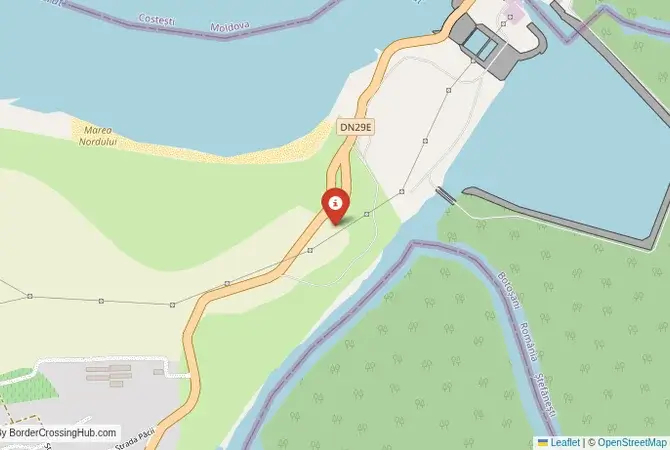
Approximate Border Location
Wait Times
15-55 min pedestrians/vehicles
Just crossed? Tap to report:
Operating Hours
6:00 AM-10:00 PM
Crossing Types
Pedestrians, vehicles
Border Type
Land crossing via dam
Peak Times
7-10 AM
Daily Crossings
2500-3500 travelers/vehicles
Currency Exchange
Near Costești (MDL, RON)
Safety Information
Rural, river risks
Languages Spoken
Romanian/Moldovan
Accessibility Features
Ramps, assistance
About Costești & Stânca, Ștefănești
Monthly Update (April 2026):
Cars gather lightly before the crossing, then pass through in small bursts. During April 2026, Costești & Stânca, Ștefănești Border Crossing is mostly stable and manageable. Inspections can slow things slightly entering Romania. Weekend travel and local movement can nudge waits.
No Cell Service at the Border? No Problem.
Don’t get caught scrambling for paperwork when you lose signal. Download the complete South America Transit Guide directly to your device and access every critical detail, fast-track strategy, and border rule – 100% offline.
A Crossing Over a Soviet-Era Giant
The border crossing between Costești in Moldova and Stânca in Romania is a journey over a monumental piece of Soviet-era engineering: the Costești-Stânca Hydroelectric Power Station. Similar to the Iron Gates dams on the Danube, this crossing carries the road directly over the crest of the massive dam that spans the Prut River. The experience is dominated by the scale of the structure and the vast reservoir it has created, known as the Stânca-Costești Lake. This is a major international checkpoint, but its character is defined by the dual purpose of the structure it sits upon: it is at once a bridge between nations and a powerful tool for energy generation and flood control. It is a fascinating blend of Cold War-era collaboration, impressive engineering, and the natural beauty of the upper Prut valley.
Operational Details
This checkpoint connects Moldova’s Rîșcani District with Romania’s Botoșani County in the northern part of the two countries. It operates 24 hours a day, 7 days a week, and is open to both passenger cars and commercial freight. Its continuous operation and strategic location make it the most important crossing in the northern region, a vital link for commerce and travel between northern Moldova and the northeastern part of Romania. Driving across the dam, with the huge, placid lake on one side and the river valley below on the other, is a unique and memorable experience that sets it apart from any other crossing on this border.
A History of Taming the Prut
The history of this crossing is tied to the large-scale infrastructure projects of the Soviet era. The dam was a joint project between the Soviet Union (of which the Moldavian SSR was a part) and the Socialist Republic of Romania. Construction began in the 1970s and was completed in 1978. Its primary goals were to prevent the catastrophic floods that periodically devastated the Prut valley and to generate hydroelectric power for both sides. The project required the relocation of numerous villages and the flooding of a large area of agricultural land, a common and often painful legacy of such massive undertakings. The dam stands today as a powerful symbol of that era of state-planned, large-scale development and a rare example of a major collaborative project between a Soviet republic and a Warsaw Pact country that often pursued its own independent foreign policy.
Border Crossing Procedure on the Dam
The border crossing procedure takes place on the dam structure itself. As Moldova is a non-EU country, you will undergo full customs and immigration checks upon entering Romania. The process is sequential, with checkpoints at either end of the dam. You will first stop at the Moldovan exit checkpoint at Costești. After being cleared, you will drive across the nearly kilometer-long crest of the dam. The official border line is marked at the midpoint. You will then arrive at the Romanian entry checkpoint at Stânca for a full EU inspection by the Poliția de Frontieră. You will need a valid passport, vehicle registration, and international insurance (Green Card). Due to the strategic nature of the dam, be mindful of any signs restricting photography. The crossing is generally efficient, with separate lanes for cars and trucks. Recent reports indicate minimal wait times for passenger vehicles.
The Surrounding Region
The surrounding region is one of rolling hills and agricultural landscapes. On the Romanian side, the crossing leads into Botoșani County, a region known for being the birthplace of Romania’s national poet, Mihai Eminescu, in the town of Ipotești, and the world-renowned composer, George Enescu, in the village of Liveni. The city of Botoșani has a charming old town center with many historic buildings. The area is also close to the famous painted monasteries of Bucovina, a UNESCO World Heritage site, though reaching them requires a further drive to the southwest. On the Moldovan side, the Stânca-Costești Lake is the largest body of water in Moldova and is an important area for fishing and birdwatching. The nearest major Moldovan city is Bălți, the country’s northern capital. The region is also home to one of Moldova’s most important natural monuments, the “One Hundred Hills” (Suta de Movile), a unique landscape of rolling mounds stretching for several kilometers, whose origin is still debated by geologists.
Practical Travel Information
Practical planning for this route is straightforward. The crossing is part of the main road network connecting the northern regions of both countries. You must have the required vignettes: the Romanian `rovinietă` and the Moldovan road use vignette. Both can be purchased online. The official currencies are the Moldovan Leu (MDL) and the Romanian Leu (RON). You will find necessary services like petrol stations and currency exchange in the larger towns near the border, such as Costești in Moldova and Ștefănești in Romania. The drive across the dam is a unique experience, but it is important to drive cautiously and adhere to the posted speed limits.
Final Considerations
The Costești–Stânca border crossing is much more than a simple point of transit. It is a destination in its own right, a place where impressive engineering, Cold War history, and the natural environment converge. Its 24/7 operation makes it a reliable and practical choice for travel in the northern border region. The experience of driving over the massive dam provides a unique perspective on the scale of human impact on the landscape. It is a functional and memorable passage that connects two nations via a powerful symbol of shared history and resource management, a concrete giant in a green and rolling land, with efficient passages reported in recent times.
No reviews yet.