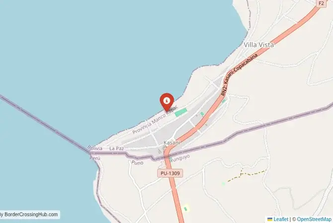
Approximate Border Location
Wait Times
30-90 min for pedestrians/vehicles
Just crossed? Tap to report:
Operating Hours
Open 7:30 AM – 6:00 PM (PE) – 8:30 AM – 7:00 PM (BO)
Crossing Types
Pedestrians, vehicles, ferry
Border Type
Land crossing via road/ferry
Peak Times
Mornings (7-10 AM), weekends
Daily Crossings
~3000 travelers/vehicles
Currency Exchange
Available near Yunguyo (PEN, BOB)
Safety Information
Generally safe, lake hazards
Languages Spoken
Spanish
Accessibility Features
Ramps, assistance
About Copacabana & Yunguyo
Monthly Update (February 2026):
The lakeside setting keeps things relaxed around the Copacabana & Yunguyo Border Crossing, with buses arriving in small waves. Lately, into February 2026, it’s been mostly stable, though vehicle checks heading into Peru can slow the line. Early afternoons move best once tour groups clear. Tourism cycles and weather are the main wild cards.
A Crossing on the Shores of a Sacred Lake
The border crossing connecting the Bolivian town of Copacabana with Yunguyo in Peru is a journey through the heart of the Lake Titicaca region, a landscape of immense natural beauty and profound spiritual significance. This is not a chaotic commercial corridor, but a major international checkpoint that serves almost exclusively tourists and local residents. To cross here is to travel along the shores of the highest navigable lake in the world, a passage from one charming lakeside town to another. It is a crossing defined by the stunning scenery, the deep blue waters of the sacred lake, and the ancient Aymara and Quechua cultures that have thrived here for millennia.
Operational Details
This checkpoint connects the La Paz Department of Bolivia with the Puno Department of Peru. It is a major international crossing, but it operates with limited hours, typically closing in the early evening. It is essential to check the current schedule before travel. The crossing is located a few kilometers outside the two towns, in a quiet, rural setting. The facilities are simple but functional. This is the most popular and direct route for tourists traveling on the classic “gringo trail” between La Paz, Copacabana, Puno, and Cusco.
A History of the Inca Heartland
The history of this region is the history of the great civilizations of the Altiplano. Lake Titicaca was the sacred birthplace of the Inca civilization. The Isla del Sol, just off the coast of Copacabana, is where the first Inca, Manco Cápac, is said to have been created by the sun god, Inti. The entire region is dotted with sacred sites (huacas). The modern border, established in the 19th century, divided the lake and the historic territory of the Aymara and Quechua peoples. The crossing at Copacabana-Yunguyo is a modern gateway that allows travelers to explore this unified cultural and historical landscape.
Border Crossing Procedure
The border crossing procedure is a standard two-part process that is generally more relaxed and straightforward than at the busier Desaguadero crossing. You will first complete exit formalities at one country’s immigration office. You then walk or drive a short distance through a “no man’s land” to the other country’s checkpoint for their entry inspection. You will need a valid passport. Visa requirements vary by nationality, and it is essential to check them in advance. The process is usually quite fast, but queues can form when several international buses arrive at the same time. A yellow fever vaccination certificate is required for entry into Bolivia at this high-altitude crossing.
The Surrounding Region: Bolivia Side
On the Bolivian side, the town of Copacabana is a major tourist destination and a pilgrimage site. It is famous for its magnificent 16th-century basilica, home to the statue of the Virgen de Copacabana, the patron saint of Bolivia. The town has a beautiful setting on the shores of the lake and is the main departure point for boat trips to the sacred Isla del Sol and Isla de la Luna, with their Inca ruins. The hike over the island is a classic backpacker experience. The town has a relaxed, bohemian atmosphere.
The Surrounding Region: Peru Side
On the Peruvian side, the town of Yunguyo is a smaller, quieter market town. It is the gateway to the magnificent Lake Titicaca region of Peru. The nearby city of Puno is the main tourist hub, the departure point for boat trips to the famous floating Uros islands and the traditional islands of Taquile and Amantaní, where visitors can experience the local culture through homestays. The road from the border also leads to the historic city of Cusco, the former capital of the Inca Empire, and the gateway to Machu Picchu.
Practical Travel Information
Practical planning is essential for this route. The most important factor is the limited operating hours of the border. The high altitude (over 3,800 meters) can cause altitude sickness (soroche). It is crucial to acclimatize properly. The official currencies are the Bolivian Boliviano (BOB) in Bolivia and the Peruvian Sol (PEN) in Peru. Currency exchange facilities are widely available. Many international buses ply this route, and they will wait for all passengers to complete the border formalities. This is the most convenient way to cross for most travelers.
Final Considerations
The Copacabana–Yunguyo border crossing is a journey through a landscape of sacred waters and ancient myths. It is a peaceful and stunningly beautiful gateway to some of the most important cultural and natural treasures in South America. The journey through it is a rite of passage for many travelers exploring the Andes. It is a border that is defined by the magnificent lake it serves, a passage that connects two charming towns and two parts of a shared, ancient world. It is a crossing that is as much a part of the adventure as the destinations themselves.
No reviews yet.