Approximate Border Location
Wait Times
Cars 0-10m; peaks 15-40m cyclists
Just crossed? Tap to report:
Operating Hours
Open 24 hrs; weather closures possible
Crossing Types
Cars,bikes,ped; no routine controls
Border Type
Land crossing via mountain road (seasonal)
Peak Times
Sat-Sun 09:00 AM-05:00 PM; Sep-Oct
Daily Crossings
200-1,200/day
Currency Exchange
EUR only; ATMs in Banyuls/Roses area
Safety Information
Steep gravel/road works at times; drive slow
Languages Spoken
French/Spanish
Accessibility Features
Limited; rough surface, no marked bays
About Coll de Banyuls & Rabós
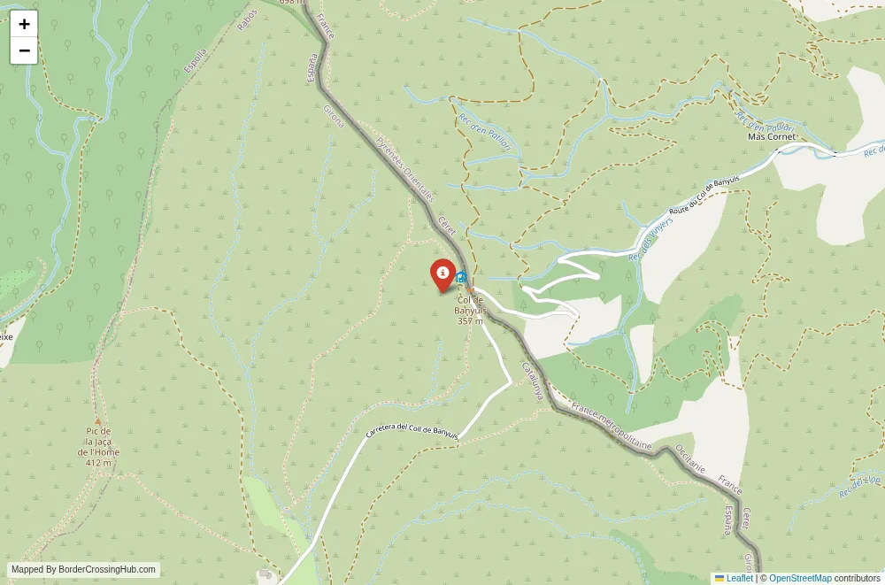
The Coll de Banyuls border crossing winds through the Albera Massif at a modest 357 meters elevation, forming a historic mountain pass that connects the French coastal commune of Banyuls-sur-Mer in the Pyrénées-Orientales department to the Spanish municipality of Rabós in Catalonia’s Alt Empordà comarca.
Location and Basic Connections
You approach this pass along narrow, winding local roads from Banyuls-sur-Mer (France) on the northern side or from Rabós and Espolla (Spain) on the southern side. The route lies in the easternmost Pyrenees, about 8 km inland from Banyuls and roughly 15 km from the main Le Perthus crossing. No major highways serve it directly; access relies on secondary D roads in France and local tracks in Spain. The path suits hikers, cyclists, or drivers seeking quiet Pyrenean scenery rather than high-volume traffic. Local buses from Banyuls or Figueres get you near the base, but the final climb requires private vehicles, taxis, or walking.
Alternative Names
This point is known as Coll de Banyuls, Col de Banyuls, Coll del Portell de Banyuls, or the Banyuls Rabós border pass.
Historical Background
The pass has served as a frontier route since ancient times, gaining deep significance during the 1939 Retirada when tens of thousands of Spanish Republicans fled Franco’s forces into France along this and nearby paths. Monuments and memorials mark these “roads to freedom,” commemorating the exodus and later escapes during the Nazi occupation. The border line follows the 1659 Treaty of the Pyrenees, with the Albera Massif forming a natural divide. For decades it functioned as an informal or lightly controlled crossing until modern restrictions altered its status.
Geopolitical Significance
This secondary pass once facilitated local ties and cross-border movement in the Albera region, but France blocked it with large rocks in January 2021 to curb irregular migration and perceived terrorist threats, part of broader closures of small Pyrenean routes. A grassroots group (Esborrem Fronteres) reopened it in January 2023 using an excavator in protest. France reblocked it shortly after, though reports indicate some reopenings of similar minor crossings in mid-2024 amid local pressure and agreements. As of early 2026, the pass remains closed or heavily restricted for vehicular traffic, with physical barriers in place and no routine reopening confirmed. It is not a Schengen operational crossing like Le Perthus; any use involves unofficial paths or hiking trails. Check official French or Spanish border sources or local news for updates, as political and security factors keep it unpredictable.
Practical Crossing Procedures
When open or passable, you would cross on foot or by vehicle along the narrow asphalt track, with no permanent booths due to its minor status. Formal immigration or customs processing is absent; spot patrols or checks may occur if active. Most nationalities move freely within Schengen (90 days visa-free short stay), but the closure means no standard procedures apply. Pedestrians or hikers sometimes use trails around barriers, but this risks fines or safety issues. Vehicles face physical blocks; no bridge or wide road exists for easy transit. Current restrictions make it unreliable for practical travel.
Typical Wait Times and Operating Hours
No official hours or processing exist due to the closure and lack of infrastructure. Any passage depends on weather, barriers, and patrols; waits are irrelevant when blocked. Informal crossings (if attempted) carry unpredictable risks from authorities or terrain.
Transportation Options
Private vehicles or bicycles reach the base from Banyuls or Rabós, but the summit road remains obstructed. No public transport crosses routinely. Hiking trails allow foot access in some seasons, though barriers deter most. The route suits dedicated adventurers or locals rather than general travelers, who use the nearby Le Perthus or other open crossings.
Road Conditions and Scenery
The narrow, winding road climbs through Mediterranean scrub, vineyards, and cork oak forests typical of the Albera Massif. The French side starts coastal and rises steadily; the Spanish descent leads into rolling Empordà countryside. Scenery includes wild, unspoiled views of the eastern Pyrenees foothills, distant Mediterranean glimpses, and natural quiet. Snow is rare at this low elevation, but rain creates mud or slippery sections.
Scams and Warnings
This closed or restricted pass carries risks from attempting unofficial crossings: fines, encounters with patrols, or terrain hazards like steep drops. Physical barriers (rocks) block vehicles; bypassing them may lead to legal issues. The area has low crime but high sensitivity due to migration and security concerns. Avoid if not prepared for remote conditions; use major crossings like Le Perthus for reliable transit. Recent reports emphasize local frustration over the closure’s economic impact on cross-border ties.
Nearby Attractions
Banyuls-sur-Mer offers beaches, the Maillol Museum (sculptor Aristide Maillol lived nearby), vineyards, and coastal paths. Rabós provides rural Catalan charm with quiet villages and access to the Albera Natural Park for wildlife and hikes. The pass ties into “roads to freedom” memorials commemorating Civil War exiles. The region suits nature seekers, history buffs, or wine enthusiasts exploring the Vermilion Coast and Empordà.
Seasonal Variations and Delays
Mild year-round climate at low altitude means rare closures from weather. Summer draws hikers and cyclists; winter stays open but quieter. The main “delay” stems from the ongoing closure rather than seasons.
Cultural and Economic Role
The pass once sustained local family links, trade in wine and produce, and tourism between Banyuls and Rabós. Its closure has strained cross-border communities, fueling protests and associations demanding reopening. Catalan culture dominates both sides, with shared traditions in food, language, and festivals.
Final Planning Notes
Treat this as a closed or restricted pass in 2026; avoid relying on it for travel. Use open crossings like Le Perthus instead. Carry ID, water, and sun protection if hiking nearby trails. Research current status via local news or authorities for any changes.
Exploring This Blocked Albera Pass
Coll de Banyuls stands as a poignant, low-altitude Pyrenean frontier with deep historical resonance but current physical barriers that limit practical use. It remains a symbol of contested borders in the region, best visited on foot for scenery or memorials rather than transit. For reliable crossing, head to nearby major points and enjoy the surrounding wild landscape from safe access.
No reviews yet.