Approximate Border Location
Wait Times
30–60 min usual
Just crossed? Tap to report:
Operating Hours
Open 7:00 AM–5:00 PM
Crossing Types
Pedestrians, vehicles
Border Type
Land crossing via road
Peak Times
7:00–10:00 AM, weekends
Daily Crossings
1,500–2,500 crossings
Currency Exchange
Limited exchange (LAK, VND)
Safety Information
Safe, mountain risks
Languages Spoken
Lao, Vietnamese, English
Accessibility Features
Ramps, assistance
About Cấu Treo & Nam Phao
Monthly Update (March 2026):
In recent weeks of 03/2026, the Cấu Treo & Nam Phao Border Crossing stays active with freight trucks carrying goods between Laos and Vietnam. Cargo inspections can slow the truck lanes while cars pass through faster. Midday usually brings the longest waits. Trade shipments drive most of the movement.
No Cell Service at the Border? No Problem.
Don’t get caught scrambling for paperwork when you lose signal. Download the complete Asia Transit Guide directly to your device and access every critical detail, fast-track strategy, and border rule – 100% offline.
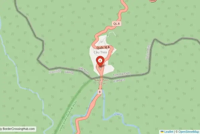
The Nam Phao-Cầu Treo Crossing: A High Mountain Pass
The border crossing at Nam Phao in Bolikhamxai Province, Laos, which connects to the Vietnamese post of Cầu Treo (“Hanging Bridge”) in Ha Tinh Province, is one of the most dramatic and scenic gateways between the two countries. This is a high-altitude crossing, winding its way through the rugged Annamite Mountains that form the spine of Indochina. It is a major trade route, the main link between the Lao capital of Vientiane and the coast of Vietnam, and is constantly busy with a stream of heavy trucks. For the traveler, the journey to and from this border is a spectacular adventure, a ride on a winding road that offers breathtaking views of mist-shrouded peaks and deep, jungle-clad valleys. The atmosphere at the crossing itself is often cool and misty, a true mountain frontier. It is a border where the journey is as memorable as the destination, a passage through the beautiful and imposing highlands of the Annamite Cordillera.
A History on the Ho Chi Minh Trail
The history of this crossing is deeply connected to the Vietnam War. The rugged mountains of the Laos-Vietnam border were the heart of the Ho Chi Minh Trail, the complex network of paths and roads that North Vietnam used to supply its forces in the south. The area around the modern Nam Phao-Cầu Treo crossing was a key part of this network. The route was subjected to intense American bombing. The modern highway that exists today, National Highway 8, was built after the war, with Vietnamese assistance, to formalize this historic connection and to provide landlocked Laos with access to a Vietnamese seaport. The crossing has since become a vital economic artery for both nations. It is a major conduit for Lao exports, such as timber and minerals, and for the import of Vietnamese goods. It is a border that has been transformed from a secret wartime trail into a major, modern commercial highway, a symbol of the “special relationship” between the two socialist states.
The Border Crossing Procedure: A Formal Mountain Gateway
The border is open from 07:00 to 17:00 daily. The facilities on both sides are modern and functional, designed to handle a large volume of commercial traffic. The process for travelers is formal and can sometimes be slow, depending on the truck traffic. You must have a valid visa for the country you are entering, obtained in advance. Visas on arrival are not available at this crossing.Exiting Laos (Nam Phao): The Lao immigration and customs post is located in a large, modern building on the Lao side of the pass. You will present your passport to the immigration officer and get your exit stamp. The customs check is usually a brief formality for tourists. The officials are professional and the process is generally straightforward.The No-Man’s-Land: After clearing the Lao post, you will proceed through a scenic, winding no-man’s-land to the Vietnamese side. The views from this section of the road are particularly spectacular.Entering Vietnam (Cầu Treo): The Vietnamese border post at Cầu Treo is also a large and modern facility. You will enter the immigration hall and present your passport and your pre-arranged Vietnamese visa (or e-visa printout). The officer will process your entry and give you a stamp. After immigration, your luggage will be passed through an X-ray scanner for a customs check. The Vietnamese officials are known for their professional and thorough approach. The entire process is systematic and well-organized.
Route, Onward Travel, and Direct Buses
The most convenient way to navigate this crossing is by taking a direct international bus. There are regular bus services that run from Vientiane in Laos all the way to several cities in Vietnam, including Vinh, and sometimes Hanoi. These buses handle the border crossing as part of their journey, making it a very hassle-free option for travelers. If you are traveling independently, you can take a local bus from Vientiane to the town of Lak Sao in Laos, and then a smaller bus or shared taxi to the border. On the Vietnamese side, from the Cầu Treo border, there are buses and shared taxis to the nearest major city, Vinh, which is on the main Vietnamese coast. From Vinh, you can get trains and buses to Hanoi, Hue, and other destinations in Vietnam. The road on both sides is the paved National Highway 8, but it is a steep and winding mountain road that can be slow, especially when you are behind a long line of trucks.
Final Planning Advice for the Annamite Route
The Nam Phao-Cầu Treo crossing is a spectacular and adventurous way to travel between Laos and Vietnam. The mountain scenery is a major highlight. The key to a smooth journey is to have your Vietnamese visa or e-visa sorted out well in advance. Visas on arrival are not available at this crossing. Taking one of the direct international buses from Vientiane is by far the easiest and most recommended option, as it simplifies all the transport logistics. Be prepared for a long but beautiful journey on a winding mountain road. This crossing is a passage through a region of great historical importance and stunning natural beauty, a perfect route for the traveler who enjoys dramatic landscapes and wants to understand the deep connections that bind these two neighboring nations.
No reviews yet.