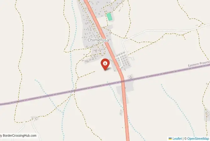
Approximate Border Location
Border Countries
- 🇿🇲Zambia
- 🇲🇿Mozambique
Border Cities
- 🇲🇿Cassacatiza
- 🇿🇲Chanida
Wait Times
30–60 min usual
Just crossed? Tap to report:
Operating Hours
Open 7:00 AM–5:00 PM
Crossing Types
Pedestrians, vehicles
Border Type
Land crossing via road
Peak Times
7:00–10:00 AM, weekends
Daily Crossings
900–1,100 crossings
Currency Exchange
Limited exchange (ZMW, MZN)
Safety Information
Safe, remote area
Languages Spoken
English, Portuguese
Accessibility Features
Ramps, assistance
About Cassacatiza & Chanida
Monthly Update (March 2026):
As of 03/2026, the Cassacatiza & Chanida Border Crossing moves at a moderate pace with trucks carrying goods between Zambia and Mozambique. Freight inspections occasionally stretch the truck line. Passenger vehicles tend to pass quicker. Trade along the corridor drives most of the activity.
No Cell Service at the Border? No Problem.
Don’t get caught scrambling for paperwork when you lose signal. Download the complete Africa Transit Guide directly to your device and access every critical detail, fast-track strategy, and border rule – 100% offline.
The Chanida-Cassacatiza Crossing: A Remote Eastern Route
The border crossing at Chanida in Zambia, which connects to the Mozambican post of Cassacatiza, is a very remote and secondary gateway between the two nations. This is not a major highway or a tourist route. It is a quiet, rural checkpoint on a rough, unpaved road, a passage through the wild and sparsely populated bushveld of eastern Zambia and the Tete province of Mozambique. This crossing is primarily used by local people and a very small amount of commercial traffic. For the traveler, this is a serious off-road adventure, a journey that requires a high-clearance 4×4 vehicle, a high degree of self-sufficiency, and a tolerance for basic infrastructure and unpredictable conditions. The atmosphere is one of profound isolation, a place where you are unlikely to see another foreign traveler. It is a border for the dedicated overland explorer who is looking to traverse the deep, wild heart of southern Africa, far from the main tourist trails.
A History on a Porous Frontier
The history of this border is the history of the Chewa and Nsenga peoples, whose traditional lands straddle the frontier between modern Zambia, Mozambique, and Malawi. The border is a colonial legacy, a line drawn by the British and Portuguese through a single cultural and linguistic region. For many years, the border was a porous and informal frontier. During the Mozambican Civil War, the Tete province was a major conflict zone, and this remote border region was used by refugees fleeing the violence and by various armed groups. In the post-war era, the Chanida-Cassacatiza crossing was formalized as an official, though minor, checkpoint. Its primary purpose is to serve the local communities and to provide a degree of state control over a long and difficult-to-police frontier. It is not a border that has been shaped by major trade routes or grand political events, but by the quiet, enduring realities of life in the African bush.
The Border Crossing Procedure: A Basic and Rustic Affair
This is a very quiet border, and its status as an international crossing for foreigners remains basic but officially recognized. You must verify current conditions before attempting to use it. The border is open from 06:00 to 18:00 daily.Exiting Zambia (Chanida): The Zambian immigration and customs post is a very basic facility, likely a small, simple building. You will present your passport and get your exit stamp. The customs check for vehicles involves checking your temporary import permit. The process will be manual, with your details recorded in a ledger. The officials may be surprised to see a foreign traveler and the process, while friendly, may be slow.The No-Man’s-Land: After clearing the Zambian side, you will proceed on a rough track through the bush to the Mozambican side.Entering Mozambique (Cassacatiza): The Mozambican post will be equally basic. You must have a pre-arranged Mozambican visa. It is highly unlikely that visas on arrival are available at this remote post. You will present your passport and visa to the immigration officer. The customs process for a vehicle will be a manual, bureaucratic affair. You will need to purchase mandatory third-party insurance for Mozambique, which may or may not be available for purchase at this remote post. The entire process requires a high degree of self-reliance and patience.
Route, Onward Travel, and Extreme Challenges
This crossing is for 4×4 vehicles only. The roads on both sides are unpaved, rough, and can be completely impassable during the rainy season (December to April). On the Zambian side, the road connects to the Great East Road, the main highway between Lusaka and the Malawian border. On the Mozambican side, the road from Cassacatiza leads towards the city of Tete. The journey is a long, slow, and arduous one, through a very remote area with no services of any kind. You must be completely self-sufficient with fuel, food, water, and vehicle recovery equipment. There is no public transport on this route. The main caveat for any traveler is the uncertainty. The border’s status, the road conditions, and the availability of services are all highly unpredictable. This is a route that requires extensive and detailed local research before it is attempted. The security situation in the Tete province of Mozambique can also be volatile, and you must check for any current issues before traveling. A bilateral agreement signed in October 2025 aims to establish a One-Stop Border Post here in the future, which may eventually ease procedures.
Final Contextual Note: A Route for Expeditionaries Only
The Chanida-Cassacatiza crossing is a true overland expedition. It is not a border for tourists but for serious, well-equipped adventurers. The logistical challenges and uncertainties are immense. For 99.9% of travelers, the main crossings into Mozambique from Malawi (at Mwanza or Dedza) or from Zimbabwe (at Nyamapanda) are the only sensible and viable options. The Chanida crossing is a fascinating line on a map, a tantalizing shortcut for those with a taste for extreme adventure. However, the reality on the ground is one of extreme difficulty and risk. It is a border that should only be attempted by the most experienced and self-reliant of overlanders, a journey into the deep, wild heart of the continent, a place where the modern world of paved roads and organized tourism has not yet reached.
No reviews yet.