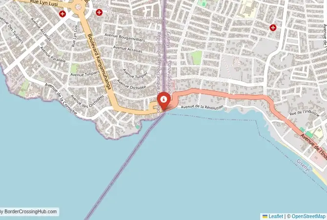
Approximate Border Location
Wait Times
30–60 min typical
Just crossed? Tap to report:
Operating Hours
Open 7:00 AM–5:00 PM
Crossing Types
Pedestrians, vehicles
Border Type
Land crossing via road
Peak Times
7:00–10:00 AM, weekends
Daily Crossings
1,900–2,100 crossings
Currency Exchange
Limited exchange (RWF, CDF)
Safety Information
Restricted, security risks
Languages Spoken
Kinyarwanda, French, Swahili, English
Accessibility Features
Ramps, assistance
About Bugarama & Goma
Monthly Update (March 2026):
In recent weeks of 03/2026, the Bugarama & Goma Border Crossing sees a steady mix of motorcycles, cars, and pedestrians moving between Rwanda and the DR Congo. Document checks usually move along but queues grow during market hours. Cross-border traders drive the daily rhythm.
No Cell Service at the Border? No Problem.
Don’t get caught scrambling for paperwork when you lose signal. Download the complete Africa Transit Guide directly to your device and access every critical detail, fast-track strategy, and border rule – 100% offline.
Important Note: A High-Risk and Restricted Border
The border between southwestern Rwanda and the South Kivu province of the Democratic Republic of the Congo (DRC) is located in an active and extremely dangerous conflict zone. The Bugarama-Kamanyola crossing is a secondary border that is not a designated international gateway for tourists. The entire South Kivu region is the site of intense fighting between the Congolese army and numerous rebel groups and militias. Most foreign governments advise against all travel to this region. This guide is for informational and geopolitical context only. Attempting to travel to this border is extremely dangerous and not possible for tourists.
The Bugarama-Kamanyola Crossing: The Rusizi Plain Route
The border crossing near the Rwandan town of Bugarama, which connects to the Congolese town of Kamanyola, is a secondary gateway located on the fertile Rusizi Plain. This is the flat, low-lying land at the northern end of Lake Tanganyika that forms the border between Rwanda, Burundi, and the DRC. This is not a tourist crossing like the main “Grande Barrière” at Gisenyi-Goma. It is a local and commercial crossing, a dusty and functional outpost that serves the agricultural communities and trade routes of the region. The atmosphere is one of a tense, heavily militarized frontier. The crossing is a chokepoint in a region that has been at the heart of the Congo’s long-running wars. For the traveler, this is a no-go zone, a passage through a landscape that is beautiful but has been profoundly and tragically scarred by decades of unrelenting violence.
A History on a Perpetual Frontline
The history of this border is the history of the Congo Wars. The Rusizi Plain has been a major strategic corridor for countless armed groups. Its location, at the intersection of three countries, has made it a perfect sanctuary, supply route, and battleground. During and after the 1994 Rwandan genocide, the area was a major route for refugees and Hutu militants fleeing into the Congo. This led directly to the First and Second Congo Wars, during which the Rwandan army and its allies used this corridor to pursue their enemies and to exert influence in the eastern Congo. The South Kivu province has been a perpetual battlefield ever since, home to a bewildering array of local and foreign armed groups, all fighting for control of land, resources, and political power. The Bugarama-Kamanyola crossing has been a constant feature in this conflict, a place where armies have crossed, and where civilians have been caught in the crossfire. It is a border that has known very little peace.
Border Procedures: Not Applicable for Tourists
As this is not an official international crossing for foreigners, there are no procedures for tourists. The crossing is not equipped or authorized to process international travelers or issue visas.The Process for Local Traffic: For the local traders and residents who are permitted to cross, the process is dominated by security checks. The area is controlled by the national armies of both countries (the RDF and the FARDC) as well as a heavy UN peacekeeping (MONUSCO) presence. Movement is tightly controlled. All vehicles and individuals are subject to multiple, thorough searches and checks of their identification and permits. The atmosphere is intimidating, and the procedures are unpredictable.For a foreign traveler, there is no legal or practical way to cross here. Any foreigner arriving at this crossing would be immediately detained and subjected to intense questioning by security and intelligence officials from both countries. You would be suspected of being a mercenary, a spy, or a journalist trying to access the conflict zones without authorization. It is an extremely dangerous and ill-advised proposition.
The Regional Context: The South Kivu War Zone
The crossing connects the southwestern corner of Rwanda with the South Kivu province of the DRC. On the Rwandan side, the area is near the beautiful Nyungwe Forest National Park, but the immediate border area is a high-security zone. On the Congolese side, the road from Kamanyola leads to the city of Bukavu, the capital of South Kivu. The entire region is an active conflict zone. The roads are notoriously dangerous and are subject to frequent ambushes and illegal checkpoints by armed groups. The city of Bukavu itself is insecure. The only relatively safe way for a foreigner to visit this part of the DRC is by flying into Bukavu and being under the care of a major international organization like the UN, or to visit the Kahuzi-Biega National Park (for lowland gorilla trekking) as part of a highly organized tour that uses the main Rusizi I crossing, not this one.
Final Contextual Note: A Border to Be Avoided
The Bugarama-Kamanyola crossing is a functional, local border that exists in the middle of a war zone. It is a place that illustrates the grim reality of life in the eastern Congo, a region of stunning natural beauty that has been torn apart by decades of conflict. For the traveler, the message is absolute and unequivocal: this is a no-go zone. It is not a place for adventure but a place of extreme and unpredictable danger. The story of this border is a sobering lesson in the complexities of the Congo’s wars and the devastating impact they have had on the people and the land. Any overland travel between Rwanda and the DRC must be done through the main, official international crossing at Gisenyi-Goma, and even then, only with the utmost caution and professional guidance.
No reviews yet.