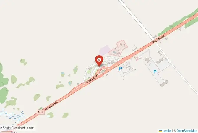
Approximate Border Location
Wait Times
30–180 min peak delays
Just crossed? Tap to report:
Operating Hours
Open 24 hours
Crossing Types
People, cars, freight
Border Type
Land crossing via road
Peak Times
7–10 AM, weekends
Daily Crossings
6,000–9,000 daily
Currency Exchange
Local exchange UAH, RUB
Safety Information
Heightened controls
Languages Spoken
Ukrainian/Russian
Accessibility Features
Ramps, elevators
About Bachivsk & Troyebornoye
Monthly Update (April 2026):
Approach roads sit mostly empty, with no consistent flow of vehicles. Through April 2026, Bachivsk & Troyebornoye Border Crossing is largely inactive or closed to regular traffic. Any movement is limited and irregular. Security conditions and policy decisions shape access.
No Cell Service at the Border? No Problem.
Don’t get caught scrambling for paperwork when you lose signal. Download the complete South America Transit Guide directly to your device and access every critical detail, fast-track strategy, and border rule – 100% offline.
The Main Moscow-Kyiv Highway Crossing
Important Note for Travelers: Due to the ongoing war, this border crossing is closed and the entire region is a high-risk security zone. It is not operational as of early 2026. This guide is provided for historical and informational purposes only. The border crossing connecting Bachivsk in Ukraine with Troyebortnoye in Russia was the most important and busiest checkpoint between the two nations. This is the main M3/E101 highway, the primary superhighway that links the two capital cities, Moscow and Kyiv. It was a massive, 24/7 international facility, the absolute main artery for trade, travel, and transit between the two largest Slavic countries. To cross here was to travel on the most strategic road in Eastern Europe, a route that was both a symbol of the deep, centuries-old ties between the two peoples and, ultimately, a primary axis of the 2022 invasion. Its character was defined by its immense scale and its critical, now severed, role.
Operational Details
This checkpoint connected Ukraine’s Sumy Oblast with Russia’s Bryansk Oblast. It was a full-service international crossing, open to all passenger cars, buses, and commercial freight. The facility was large and modern, designed to handle a constant, heavy flow of traffic. It was the preferred route for the vast majority of travelers and goods moving between the two capitals and their surrounding populous regions. Its closure has had a profound and devastating impact on the trade and personal connections it once served.
A History of a Shared Heartland
The history of this route is the history of Kievan Rus’, the medieval state that is the cradle of both Russian and Ukrainian civilization. The road from Kyiv to Moscow has been a path of princes, armies, traders, and pilgrims for a thousand years. The modern border is a 20th-century creation, a line drawn by Soviet administrators. After the collapse of the Soviet Union, the Bachivsk-Troyebortnoye crossing became the most powerful symbol of the new relationship between an independent Ukraine and Russia. For two decades, it was a bustling, largely friendly frontier, a place where millions of family, cultural, and economic ties were maintained. This began to change after 2014, and the border became progressively harder and more tense.
Former Border Procedure
The border crossing procedure, when it was operational, was a large-scale, two-part process. Travelers would first complete exit formalities at the large Ukrainian checkpoint at Bachivsk. This involved checks by the State Border Guard Service of Ukraine and customs officials. They would then proceed to the even larger Russian entry checkpoint at Troyebortnoye for a full inspection by the Russian Border Guard Service and Federal Customs Service. A valid passport and, if required, a Russian visa were necessary. As the main crossing, it was frequently congested, and queues, especially for trucks and during holiday periods, could last for many hours.
The Surrounding Region
The surrounding area is a landscape of rolling hills, forests, and fields, the historic borderland between Ukraine and Russia. On the Ukrainian side, the crossing is in the Sumy Oblast, an agricultural and industrial region. The nearest major Ukrainian city is Hlukhiv, a former capital of the Cossack Hetmanate. On the Russian side, the crossing leads into the Bryansk Oblast, a region known for its dense forests. The E101 highway is the main route north towards Moscow. The entire region is dotted with villages and towns that share a common cultural and linguistic heritage.
Closure Due to War
The closure of the Bachivsk-Troyebortnoye crossing was an immediate and direct consequence of the full-scale Russian invasion of Ukraine in February 2022. This highway was a primary axis of advance for Russian forces moving from Russia towards Kyiv. The Sumy region saw some of the most intense and heroic resistance in the initial phase of the war. The border was immediately sealed by Ukraine and has become a heavily fortified and active frontline. The modern checkpoint facilities have been damaged or destroyed in the fighting, with no reopening as of early 2026.
Final Considerations
The Bachivsk–Troyebortnoye border crossing was once the most vital artery connecting the hearts of Ukraine and Russia. It was a symbol of a deep, if complex, relationship. Today, it is a symbol of a brutal war and a complete rupture between the two nations. The silent, battle-scarred highway is a powerful testament to the tragedy that has unfolded. The busiest crossing has become one of the quietest, a place where the only movement is that of soldiers, and the only sounds are those of war. It is a stark reminder of how the closest of neighbors can become the most bitter of foes.
No reviews yet.