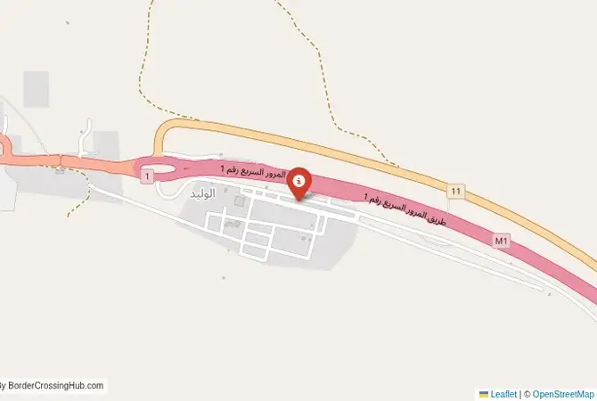
Approximate Border Location
Wait Times
60–180 min
Just crossed? Tap to report:
Operating Hours
Open 12:00 AM–11:59 PM
Crossing Types
Pedestrians, vehicles
Border Type
Land
Peak Times
Weekdays
Daily Crossings
Low volume
Currency Exchange
Local cash; IQD, SYP
Safety Information
High-risk zone
Languages Spoken
Arabic
Accessibility Features
Basic access
About Al-Waleed & al‑Tanf region Border Crossing
Monthly Update (March 2026):
In recent weeks of 03/2026, the Al-Waleed & al-Tanf Border Crossing stays tightly controlled with very limited movement. Traffic is minimal and crossings usually require special permissions. Most of the day remains quiet around the checkpoint. Security conditions in the region continue to shape access.
No Cell Service at the Border? No Problem.
Don’t get caught scrambling for paperwork when you lose signal. Download the complete Asia Transit Guide directly to your device and access every critical detail, fast-track strategy, and border rule – 100% offline.
A Desert Gateway with High Stakes
Caution: The Al-Waleed–Al-Tanf border crossing, also known as Al-Tanf Gate or Waleed Checkpoint, is in a volatile region with security risks, including past insurgent activity and military presence. Avoid unofficial guides and check official sources for safety updates. Connecting Iraq’s Al-Waleed in Anbar Governorate to Syria’s Al-Tanf in Homs, this crossing lies on the M2 Baghdad–Damascus Highway, offering a path to Syria’s historic sites or Iraq’s urban centers.
Historical and Geopolitical Significance
This crossing, near the Iraq-Syria-Jordan tripoint, has been a trade route since the 1980s, when the Baghdad-Trebil highway became Iraq’s lifeline under sanctions. Its strategic location made it a flashpoint during the Syrian Civil War, with Islamic State militants seizing it in May 2015, only to be repelled by U.S.-backed forces in 2016. The U.S. maintains a base at Al-Tanf, training anti-IS rebels, which has drawn Russian and Iranian scrutiny. The nearby Rukban refugee camp adds complexity, with thousands stranded in a deconfliction zone. Tensions persist, as the crossing remains closed to most civilian traffic, impacting regional trade.
Crossing Procedures and Wait Times
The crossing is largely closed to civilians due to security concerns, but limited humanitarian and military traffic occurs. From Iraq to Syria, you’d need a passport valid for six months and special permits, often restricted to aid workers. Syria requires a $100 visa for most nationalities, obtainable in Baghdad, and proof of onward travel. From Syria to Iraq, expect rigorous checks and a $3-5 entry fee. The border operates from 8:00 AM to 4:00 PM, with U.S. and Iraqi forces coordinating inspections. Wait times vary from 1-3 hours for authorized personnel, but closures are frequent due to regional instability. Always confirm access beforehand.
Routes and Road Conditions
From Baghdad, the M2 highway to Al-Waleed (570 km, 8-10 hours by bus, $20) cuts through Anbar’s desert, with checkpoints slowing travel. From Damascus, the M2 to Al-Tanf (450 km, 7 hours, $15) is paved but risky due to conflict zones. The Iraqi side has basic facilities, while Syria’s side is militarized, with U.S. forces at Al-Tanf base. The desert scenery is stark, with occasional Bedouin camps. Driving requires caution due to potential insurgent activity and poor road maintenance near the border.
Practical Tips for Travelers
Scams are less common due to restricted access, but beware of unofficial fixers charging $50 for permits that may be invalid. Use US dollars for fees, as local currencies face poor exchange rates. No ATMs or reliable facilities exist, so bring cash and essentials. Theft risks are low but present in crowded aid convoys. Carry a passport copy and emergency contacts, as cell service is spotty. Avoid travel after dark due to security threats. Drones are prohibited and may be confiscated.
Cultural and Economic Role
Al-Waleed–Al-Tanf supports limited trade, mainly humanitarian aid and military logistics, due to its closure to regular commerce. The nearby Al-Waleed refugee camp houses Palestinians, reflecting the region’s displacement crisis. Iraq’s Sunni tribes and Syria’s Bedouin communities influence the area’s culture, with markets selling basic goods when open. The crossing’s closure limits economic ties, but its strategic role draws U.S., Russian, and Iranian interest, shaping regional power dynamics. When open, it could boost trade along the M2 highway.
Nearby Attractions to Explore
In Iraq, Ramadi (3 hours) offers markets and a glimpse of Anbar’s recovery. In Syria, Palmyra’s ancient ruins (4 hours, if safe) are a UNESCO site, though access is restricted. The Rukban camp, while not a tourist spot, underscores the region’s humanitarian challenges. Due to security risks, side trips are limited, but Jordan’s Azraq (2 hours from the tripoint) offers historical castles. Travel only with security clearance and local guides.
Seasonal and Weather Impacts
The dry season (May to October) brings 40°C heat, making crossings grueling without shade. The wet season (November to April) offers cooler 20°C temperatures but occasional sandstorms disrupt travel. Peak military activity or holidays like Ramadan can delay authorized crossings. Check for closures due to U.S.-Iran tensions or insurgent activity, as the border’s status shifts unpredictably. Early morning travel minimizes exposure to heat and delays.
Planning Your Journey
Travel only with official clearance, arriving by 8:00 AM to avoid delays. Carry US dollars, a valid passport, and permits. Coordinate with aid agencies or embassies, as civilian access is restricted. From Baghdad, book buses early; from Damascus, secure armed escorts if permitted. Check security advisories, as the U.S. base and regional conflicts can close the border. Consider safer routes like Jordan’s crossings unless essential. A night in Ramadi or Azraq offers a safer base for planning.
No reviews yet.