Approximate Border Location
Border Countries
- 🇿🇦South Africa
- 🇱🇸Lesotho
Border Cities
- 🇿🇦Sepapu’s Gate
- 🇱🇸Sepapu’s Gate
Wait Times
30–60 min typical
Just crossed? Tap to report:
Operating Hours
Open 8:00 AM–4:00 PM
Crossing Types
Pedestrians, vehicles
Border Type
Land crossing via road
Peak Times
7:00–10:00 AM, weekends
Daily Crossings
750–850 crossings
Safety Information
Generally safe, mountain risks
Languages Spoken
English, Sesotho, Afrikaans
Accessibility Features
Ramps, assistance
About Sepapu’s Gate & Sepapu’s Gate
Monthly Update (June 2026):
As of 06/2026, Sepapu’s Gate & Sepapu’s Gate Border Crossing ticks along at a steady pace and rarely feels crowded. Local traffic moves through without much buildup, while occasional inspection checks can add a short delay. Conditions can vary a little after bad weather in the surrounding rural areas.
Important Note: A Remote and Highly Restricted Crossing
The border crossing at Sepapu’s Gate is an extremely remote, minor, and often non-operational checkpoint between the Eastern Cape province of South Africa and the Quthing District of Lesotho. It is not a designated international border crossing for foreign tourists. This is a local post, intended to serve the isolated communities living in the high mountains, and it lacks the formal immigration and customs infrastructure required to process international travelers. This guide is for geographical and contextual purposes only. It is not possible for a foreign tourist to legally use this crossing to travel between South Africa and Lesotho. You must use one of the designated international crossings like Tele Bridge or Ramatseliso’s Gate.
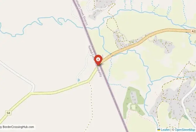
The Sepapu’s Gate Crossing: A Forgotten Mountain Path
The border crossing at Sepapu’s Gate is located deep within the rugged and sparsely populated southern Drakensberg mountains. This is not a road crossing in any conventional sense. It is a high-altitude footpath or a rough 4×4 track, a point on the map that represents a traditional, local connection in a wild and inaccessible landscape. The border here is a colonial-era line drawn through the heart of the Basotho kingdom’s traditional lands. The crossing exists as a pragmatic concession to the reality that local people, living a life of subsistence farming and herding in these isolated valleys, need to move across the frontier to visit family or access pastures. The atmosphere would not be that of a formal border post, but of a simple, perhaps unmanned, gate, a place where the modern state has a very minimal presence. It is a border that is defined by the formidable geography of the mountains and the ancient paths of the people who call them home.
A History of a Local Lifeline
The history of this crossing is one of local, everyday life, far from the grand narratives of politics and war. The route has been used for centuries by the Basotho people. The establishment of a formal “gate” was a way for the two states to provide a legal, if very basic, crossing point for these isolated communities, and to exert a minimal degree of administrative control over a porous frontier. It has never been a route for trade or transit. Its function has always been purely local. During the apartheid era in South Africa, such remote crossings were often used by political activists and refugees seeking sanctuary in Lesotho, which was a key “Frontline State.” In the modern era, it remains a simple, functional link for the local population, a border that has been largely bypassed by the development that has modernized the main highway crossings. Its quietness and simplicity are a direct reflection of its profound isolation.
Signal can be a coin toss at borders, and the last thing you want is to be stuck at the gate hunting for info. We’ve pulled all our research for this region into one simple eBook that works 100% offline. It keeps everything you need in one spot so you can stay focused on the trip. Grab the guide here.
Border Procedures: Not Applicable for Tourists
As this is not an international crossing for foreigners, there are no procedures for tourists. The crossing is not equipped or authorized to handle international passports or visas.The Process for Local Residents: For the local residents who are permitted to cross here, the process would be very simple. They would likely need to show a local identity card or a special border pass to the guards, if any are present. The movement would be restricted to a limited zone on either side of the border.For a foreign traveler, there is no way to get a legal entry or exit stamp at this location. The border post would not have the necessary stamps, systems, or legal authority to process a foreign national. Any foreigner attempting to use this crossing would be in violation of the immigration laws of both countries and would be immediately detained by the police or military for questioning in a remote and sensitive area. It is not a legal or viable route.
The Regional Context: The Southern Drakensberg
The crossing is located in the beautiful and rugged southern Drakensberg mountains. On the South African side, it is in a remote part of the Eastern Cape, a region of high peaks, deep valleys, and scattered rural communities. On the Lesotho side, it is in the Quthing District, one of the most remote and least-developed parts of the kingdom. The infrastructure in this entire region is very basic. The “roads” are unpaved dirt tracks that are often impassable during the rainy season or after snow. Travel is slow, difficult, and requires a 4×4 vehicle. This is a region for serious hiking, pony trekking, and exploring the unique culture of the Basotho people. The main international crossings at Tele Bridge (to the west) and Ramatseliso’s Gate (to the east) are the designated gateways for this region, and even they can be challenging. The Sepapu’s Gate crossing exists in a different world of local, subsistence life.
Final Contextual Note: A Border to Be Aware Of, Not to Use
The Sepapu’s Gate crossing is a fascinating example of a local, informal border that serves the deep-seated needs of a community divided by an international line. It is a testament to the resilience of local life on the frontier. However, for the international overland traveler, it is a non-option. It is a point on the map to be understood, not to be included in an itinerary. The risk of being turned away, or worse, detained, is absolute. Any travel plan between South Africa and southern Lesotho must be routed through one of the major, designated international gateways like Tele Bridge. The quiet reality of Sepapu’s Gate is best left to the local residents it is intended to serve, a reminder that not all lines on the map are meant to be crossed by everyone.
No reviews yet.