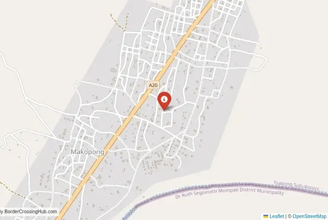
Approximate Border Location
Border Countries
- 🇿🇦South Africa
- 🇧🇼Botswana
Border Cities
- 🇿🇦Makopong
- 🇧🇼Makopong
Wait Times
30–60 min typical
Just crossed? Tap to report:
Operating Hours
Open 7:00 AM–5:00 PM
Crossing Types
Pedestrians, vehicles
Border Type
Land crossing via road
Peak Times
7:00–10:00 AM, weekends
Daily Crossings
1,450–1,550 crossings
Safety Information
Generally safe, remote risks
Languages Spoken
English, Afrikaans, Setswana
Accessibility Features
Ramps, assistance
About Makopong & Makopong
Monthly Update (June 2026):
As of 06/2026, Makopong Border Crossing stays relatively quiet compared with the larger regional gateways. Travelers usually move through without long delays, though processing can slow if several vehicles arrive together. Weather and holiday travel are the most common sources of variation.
The Makopong-Makopong Crossing: A Deep Kalahari Route
The border crossing at the divided village of Makopong is a very remote and minor gateway deep in the heart of the Kalahari Desert. It connects the far southwestern corner of Botswana with the North West province of South Africa. This is not a tourist route or a commercial corridor. It is a quiet, rural checkpoint on a sandy track, a passage through one of the most sparsely populated and arid regions of southern Africa. The border is primarily used by the local communities and the farmers who have vast cattle ranches in this great “thirstland.” The atmosphere is one of profound isolation and silence, a place where the sky is vast and the landscape is an endless expanse of red sand and hardy thorn trees. For the traveler, this is a true off-road adventure, a journey that requires a 4×4 vehicle, complete self-sufficiency, and a desire to experience the Kalahari at its most remote and authentic.
A History of a Forgotten Frontier
The history of this crossing is the history of a forgotten corner of the colonial frontier. The border is a straight line drawn on a map by the British and Germans, cutting through the traditional lands of the San (Bushmen) and Tswana peoples. The crossing at Makopong was established as a simple checkpoint to provide a degree of administrative control over this vast and empty region. It has never been a major route. Its significance is purely local. It allows the farmers and communities on both sides of the border to interact without having to make the immense, multi-day detour to the main crossings at Ramatlabama or on the Trans-Kalahari Highway. It is a border that is defined by the harshness of its environment and the resilience of the people who have made a life in this challenging landscape. It is a place that has been largely untouched by the major historical and economic currents that have shaped the more populous parts of the two countries.
The Border Crossing Procedure: A Basic and Rustic Affair
This is a very quiet border, and the process is generally very relaxed and personal. The border is open from 07:30 to 16:30, and it is essential to check the current operating times before you travel.Exiting South Africa (Makopong): The South African immigration and customs post is a very basic facility, likely a small, simple building. You will present your passport and get your exit stamp. The process will be manual, with your details recorded in a ledger. The officials are generally friendly and may be surprised to see a foreign traveler.The No-Man’s-Land: After clearing the South African side, you will proceed a short distance on a sandy track to the Botswanan side.Entering Botswana (Makopong): The Botswanan post will be equally basic. You will go to the immigration office and present your passport. For most nationalities, Botswana offers visa-free entry. The officer will stamp your passport. The customs check is usually a very informal and brief formality. The entire process on both sides can often be completed in less than 30 minutes. You will also need to go through a veterinary control point to prevent the spread of foot-and-mouth disease, a standard procedure at all Botswana land borders.
Signal can be a coin toss at borders, and the last thing you want is to be stuck at the gate hunting for info. We’ve pulled all our research for this region into one simple eBook that works 100% offline. It keeps everything you need in one spot so you can stay focused on the trip. Grab the guide here.
Route, Onward Travel, and Extreme Challenges
This crossing is for 4×4 vehicles only. The roads on both sides are unpaved, sandy tracks. On the South African side, the road connects to the town of Vryburg, but it is a long and slow journey. On the Botswanan side, the road from Makopong leads north towards the town of Tshabong, the administrative center of the Kgalagadi District. This crossing is the gateway to the Kgalagadi Transfrontier Park from the south, but it is a very challenging route. There is no public transport on this route. You must be completely self-sufficient with fuel, food, water, and vehicle recovery equipment. The main challenge is the road condition and the extreme remoteness. This is a journey into a true wilderness, and you must be prepared for any eventuality. Getting stuck or breaking down here is a very serious situation.
Final Planning Advice for a Deep Desert Route
The Makopong crossing is a true overland expedition. It is not a border for tourists but for serious, well-equipped adventurers. The logistical challenges are immense. The key to using this crossing is to have a very capable 4×4 vehicle and to be completely prepared for a multi-day, self-sufficient desert journey. It is absolutely essential to check the current operating hours of the border before you set out. The reward is a journey through one of the most remote and untouched parts of the Kalahari Desert. It is a border that offers a sense of discovery and a deep connection to the wild, rugged landscape. It is a passage for the true explorer, a quiet and beautiful gateway into the deep heart of the Kalahari, a place where the modern world feels very far away.
No reviews yet.