Approximate Border Location
Border Countries
- 🇳🇦Namibia
- 🇿🇦South Africa
Border Cities
- 🇳🇦Noordoewer
- 🇿🇦Vioolsdrif
Wait Times
15–30 min usual
Just crossed? Tap to report:
Operating Hours
Open 7:00 AM–7:00 PM
Crossing Types
Pedestrians, vehicles
Border Type
Land crossing via road
Peak Times
7:00–10:00 AM, weekends
Daily Crossings
4,800–5,200 crossings
Safety Information
Generally safe, river risks
Languages Spoken
English, Afrikaans
Accessibility Features
Ramps, elevators
About Noordoewer & Vioolsdrif
Monthly Update (June 2026):
In recent weeks of 06/2026, Noordoewer & Vioolsdrif Border Crossing has been ticking along steadily. Commercial vehicles usually account for the longer queues, while private travelers crossing earlier in the day often move through faster. School holidays and seasonal tourism traffic can still add extra waiting time.
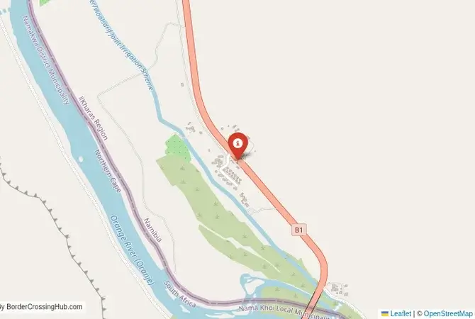
The Noordoewer-Vioolsdrif Crossing: The Orange River Gateway
The border crossing at Noordoewer in Namibia, which connects to the South African post of Vioolsdrif, is the most important and busiest land gateway between the two nations. This is the main border on the N7/B1 highway, the primary road that links the two capitals of Cape Town and Windhoek. This is not a minor outpost; it is a major, 24-hour international crossing, a vital artery for trade and tourism. The border is the mighty Orange River (Gariep River), and the crossing is a modern bridge that spans its wide, green valley. The landscape is a stunning, dramatic contrast: the arid, rocky deserts of the Richtersveld and southern Namibia give way to a vibrant, green ribbon of intensive agriculture along the river banks. The atmosphere is one of a professional, efficient, and constantly busy transport corridor. For the traveler, this is the classic overland route, a smooth and easy passage between the spectacular landscapes of Namibia and the beautiful wine regions and iconic city of Cape Town in South Africa.
A History of a Natural Frontier
The history of this border is the history of the Orange River. The river has been a natural boundary for millennia. In the 19th century, it was formally established as the border between the German colony of South West Africa and the British Cape Colony. The crossing at Vioolsdrif grew as a key checkpoint on the main route north. For much of the 20th century, when Namibia was under South African administration, this was effectively an internal, provincial border. After Namibian independence in 1990, it became a full international frontier. Its importance has grown exponentially with the rise of tourism and the increase in trade between the two friendly nations, who are both members of the Southern African Customs Union (SACU). The border facilities on both sides have been extensively modernized to handle the high volume of traffic, and the bridge has been upgraded. It is a border that has been defined by the enduring presence of the great river and the peaceful, cooperative relationship between the two modern states.
The Border Crossing Procedure: A Smooth and Efficient Process
The border is open 24 hours a day. The process is known for being very smooth, professional, and efficient, especially when compared to other borders in the region. You must have the correct visas if your nationality requires them.Exiting Namibia (Noordoewer): You will arrive at the modern Namibian border post. You will go to the immigration hall and get your passport stamped for exit. The customs process for vehicles involves checking your road tax permit. The process is usually very quick.The Bridge: You will then drive across the bridge over the beautiful Orange River. This is the no-man’s-land.Entering South Africa (Vioolsdrif): You will arrive at the large and modern South African border post. You will go to the immigration hall. For most nationalities, South Africa offers visa-free entry. The officer will check your passport and provide an entry stamp. After immigration, you will proceed to the customs office. The officials will check your vehicle’s documents. They are particularly strict about ensuring that vehicles have the correct registration papers and cross-border authorization. The customs check for luggage is usually a brief formality for tourists. The entire process is well-organized and can often be completed in under an hour during off-peak times.
Signal can be a coin toss at borders, and the last thing you want is to be stuck at the gate hunting for info. We’ve pulled all our research for this region into one simple eBook that works 100% offline. It keeps everything you need in one spot so you can stay focused on the trip. Grab the guide here.
Route, Onward Travel, and The Orange River Valley
This crossing is on the main B1 highway in Namibia, which becomes the N7 in South Africa. The road on both sides is a world-class, paved highway in excellent condition. On the Namibian side, the road leads north through the vast, empty landscapes of southern Namibia, past the Fish River Canyon (the second largest canyon in the world), and on to the capital, Windhoek. On the South African side, the N7 highway leads south through the beautiful Namaqualand region (famous for its spectacular wildflowers in spring) and the Cederberg mountains, and on to the city of Cape Town. For those without a car, there are several direct, high-quality international bus services (like Intercape) that run between Windhoek and Cape Town. This is a very comfortab
No reviews yet.