Approximate Border Location
Border Countries
- 🇲🇿Mozambique
- 🇹🇿Tanzania
Border Cities
- 🇹🇿Mtambaswala (Unity Bridge)
- 🇲🇿Negomano
Wait Times
30–60 min typical
Just crossed? Tap to report:
Operating Hours
Open 7:00 AM–5:00 PM
Crossing Types
Pedestrians, vehicles
Border Type
Land crossing via road
Peak Times
7:00–10:00 AM, weekends
Daily Crossings
1,400–1,600 crossings
Safety Information
Safe, river nearby
Languages Spoken
Portuguese, Swahili, English
Accessibility Features
Ramps, assistance
About Mtambaswala (Unity Bridge) & Negomano
Monthly Update (June 2026):
In 06/2026, Mtambaswala & Negomano Border Crossing is generally calm, with lighter traffic than many larger regional crossings. Most delays come from document checks or occasional surges in commercial vehicles rather than long-standing congestion. Dry-season travel has helped keep movement steady, although weather and road conditions still influence crossing times.
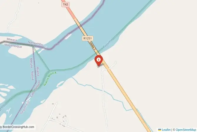
The Negomano-Mtambaswala Crossing: The Unity Bridge
The border crossing at Negomano in Mozambique, which connects to the Tanzanian post of Mtambaswala, is one of the most remote and historically significant gateways between the two nations. The centerpiece of this crossing is the “Unity Bridge” (Ponte da Unidade), a massive, modern bridge that spans the mighty Ruvuma River, which forms the border. This is not a busy border. It is a quiet, isolated outpost, deep in the African bush. The crossing was built with grand ambitions to create a new trade corridor and to physically link two regions that were once united in a common struggle. The landscape is the wild, undeveloped miombo woodland of northern Mozambique and southern Tanzania. The atmosphere is one of profound silence and isolation, a place where a huge piece of modern infrastructure feels almost lost in the vastness of the wilderness. For the adventurous traveler, this is a truly off-the-beaten-path route, a passage across a river that has been a symbol of both division and unity.
A History of a Liberation Frontline
The history of this crossing is the history of the Mozambican War of Independence. The Ruvuma River was the primary frontline between the FRELIMO liberation movement and the Portuguese colonial army. FRELIMO’s main rear bases were located in southern Tanzania, and the river was the main infiltration route for its guerilla fighters. The region was a major conflict zone. After Mozambique gained its independence, the river remained a formidable barrier, with the only way to cross being by a small, unreliable ferry. The idea of building a bridge was a long-held dream of the two countries’ founding fathers, Julius Nyerere of Tanzania and Samora Machel of Mozambique, as a symbol of their shared struggle and post-independence solidarity. The “Unity Bridge” was finally completed in 2010. It was a project of immense symbolic and political importance. However, its economic impact has been limited, as the road networks on both sides, particularly in Mozambique, remain largely undeveloped. It is a border that is rich in history but is still waiting for the economic reality to catch up with the political vision.
The Border Crossing Procedure: A Remote and Basic Affair
This is a very quiet border with very little traffic. The border is open from 07:30 to 16:00 daily. The facilities are modern but very underused. You must have your visas sorted in advance.Exiting Mozambique (Negomano): The Mozambican immigration and customs post is a simple, functional building. You will present your passport and get your exit stamp. The customs check for vehicles involves checking your temporary import permit. The process is generally relaxed and quick due to the low volume of traffic.The Unity Bridge: You will then drive across the impressive, 720-meter-long Unity Bridge. The view of the wide Ruvuma River and the surrounding wilderness is spectacular. You will likely be the only vehicle on the bridge. This is the no-man’s-land.Entering Tanzania (Mtambaswala): The Tanzanian immigration and customs post is a modern but quiet facility. You will present your passport and your pre-arranged Tanzanian visa (or e-visa). Visas on arrival are generally not available at this remote crossing. You will also need your yellow fever vaccination certificate. The officials will stamp you into the country. The customs check is usually a brief formality. The officials may be surprised to see foreign tourists and the process is generally friendly and relaxed.
Signal can be a coin toss at borders, and the last thing you want is to be stuck at the gate hunting for info. We’ve pulled all our research for this region into one simple eBook that works 100% offline. It keeps everything you need in one spot so you can stay focused on the trip. Grab the guide here.
Route, Onward Travel, and Major Challenges
This crossing is for the dedicated overland adventurer with a high-clearance 4×4 vehicle. On the Mozambican side, the road to the Negomano border from the city of Pemba or Lichinga is a very long and extremely challenging journey on rough, unpaved roads that can be impassable in the rainy season. This is the main reason the crossing is so little used. On the Tanzanian side, the road from the Mtambaswala border to the town of Masasi and the main highway is now paved and in good condition. The main challenge is the Mozambican side. The journey takes you through the vast and wild Niassa Reserve in Mozambique, one of Africa’s largest protected areas. It is a journey of incredible beauty and profound isolation. You must be completely self-sufficient with fuel, food, water, and vehicle recovery equipment. There is no public transport on this route. This is a true expedition, not a simple transit.
Final Planning Advice for a Wilderness Route
The Negomano-Unity Bridge crossing is a spectacular and historic journey, but it is one of the most challenging overland routes in southern Africa. The key to a successful crossing is meticulous planning and a very capable vehicle. You must have your visas for both countries in your passport before you arrive. You must have detailed maps and a GPS. And you must be prepared for a multi-day, self-sufficient expedition through a very remote and wild part of the continent. For the very few who are equipped for such a journey, the reward is an unforgettable adventure, a passage through a land of incredible beauty and deep history, and the experience of crossing a magnificent bridge that stands as a lonely monument to the dream of African unity in the middle of the vast wilderness.
No reviews yet.