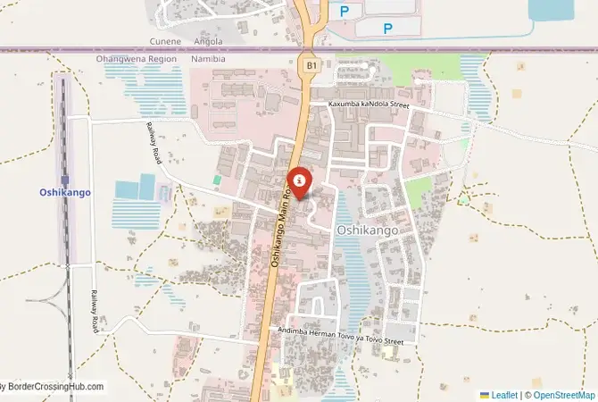
Approximate Border Location
Wait Times
15–30 min usual
Just crossed? Tap to report:
Operating Hours
Open 7:00 AM–7:00 PM
Crossing Types
Pedestrians, vehicles
Border Type
Land crossing via road
Peak Times
7:00–10:00 AM, weekends
Daily Crossings
3,800–4,200 crossings
Safety Information
Safe, traffic moderate
Languages Spoken
Portuguese, Oshiwambo, English
Accessibility Features
Ramps, elevators
About Oshikango & Santa Clara
Monthly Update (June 2026):
In recent weeks of 06/2026, the Oshikango & Santa Clara Border Crossing has been one of the busier crossings in the region and can feel a bit variable through the day. Commercial traffic often moves slower than pedestrians, especially around midday. Trade activity and holiday periods on either side can stretch waits unexpectedly.
The Santa Clara-Oshikango Crossing: The Owamboland Gateway
The border crossing at Santa Clara in Angola’s Cunene Province, which connects to the Namibian town of Oshikango, is the busiest, most important, and most economically significant land gateway between the two nations. This is the main border on the highway that links the Namibian capital of Windhoek with the populous and economically vital regions of southern Angola. This is not a quiet border. It is a massive, sprawling, and chaotic commercial hub, a 24-hour river of trucks, traders, and shoppers. The crossing is located in the heart of Owamboland, the most densely populated region of Namibia, and the atmosphere is one of intense, often informal, cross-border commerce. The contrast between the two sides is stark: Oshikango on the Namibian side is a boomtown of shopping malls and warehouses, while Santa Clara on the Angolan side is a more chaotic market town. For the traveler, this is the primary and most reliable route for entering or exiting northern Namibia, a passage through the engine room of the Angolan-Namibian economic relationship.
A History on a War Frontline
The history of this border is the history of the Angolan Civil War and the Namibian War of Independence. The border is a colonial legacy, a line drawn between Portuguese West Africa (Angola) and German South West Africa (later administered by South Africa). During the second half of the 20th century, this was a major frontline. The SWAPO liberation movement fighting for Namibian independence had its bases in southern Angola, and the South African Defence Force (SADF) launched numerous cross-border raids and invasions from its bases in what was then Owamboland. The border was a heavily militarized and extremely dangerous zone. The end of apartheid in South Africa, the independence of Namibia in 1990, and the end of the Angolan Civil War in 2002 transformed the region. The border at Santa Clara-Oshikango was transformed from a battlefield into a massive marketplace. It became the primary conduit for Namibian and South African goods to flow into the rebuilding markets of southern Angola. It is a border that is a powerful symbol of the region’s dramatic shift from conflict to commerce.
The Border Crossing Procedure: A Busy and Chaotic Process
The border is open 24 hours. The process can be very slow and chaotic due to the immense volume of traffic, particularly the large number of informal traders and pedestrians, with reported wait times of several hours during peak periods. You must have your visas sorted in advance.Exiting Angola (Santa Clara): The Angolan immigration and customs post is a large but often chaotic facility. You will present your passport and get your exit stamp. The customs process for vehicles can be time-consuming. You will likely be surrounded by a crowd of money changers and touts.The No-Man’s-Land: After clearing the Angolan side, you will proceed through a short but very busy no-man’s-land to the Namibian side.Entering Namibia (Oshikango): You will arrive at the large and modern Namibian border post. You will go to the immigration hall. For most nationalities, Namibia offers visa-free entry. The officer will check your passport and provide an entry stamp. After immigration, you will proceed to the customs and road authority offices. If you are in a vehicle, you will need to pay a cross-border charge. You will also need to have third-party insurance for Namibia. The officials are professional, but the facility can be very crowded. The contrast in orderliness between the two sides is often quite noticeable.
Signal can be a coin toss at borders, and the last thing you want is to be stuck at the gate hunting for info. We’ve pulled all our research for this region into one simple eBook that works 100% offline. It keeps everything you need in one spot so you can stay focused on the trip. Grab the guide here.
Route, Onward Travel, and The Owambo Heartland
This crossing is on the main B1 highway, the backbone of Namibia. On the Angolan side, the road connects to major southern cities like Lubango and Ondjiva. On the Namibian side, the B1 highway is a perfectly paved, modern road that runs all the way south to the capital, Windhoek, and on to the border with South Africa. The town of Oshikango is a major transport hub for northern Namibia. From here, you can travel west to the Ruacana Falls and the Kaokoveld, the home of the Himba people, or east to the Caprivi Strip. The crossing is also the gateway to the Etosha National Park, one of Africa’s greatest wildlife destinations, which is a few hours’ drive to the south. For those without a car, there are bus services that run from Namibian cities to the border, and from the border into Angola, but there are no direct, seamless international services. Traveling independently requires changing vehicles at the border.
Final Planning Advice for the Main Gateway
The Santa Clara-Oshikango crossing is the main and most reliable gateway for overland travel between Angola and Namibia. It is a busy, chaotic, but functional border. The key to a successful crossing is to have all your documents in perfect order, especially your Angolan visa, which must be obtained in advance. Be prepared for long queues and a crowded, high-energy environment. This crossing is a journey into the vibrant, commercial heart of the Angolan-Namibian frontier. It is a passage through a land that has been shaped by war but is now defined by trade. It is a powerful and unforgettable introduction to the resilience and entrepreneurial spirit of the people of this fascinating and historically rich region.
No reviews yet.