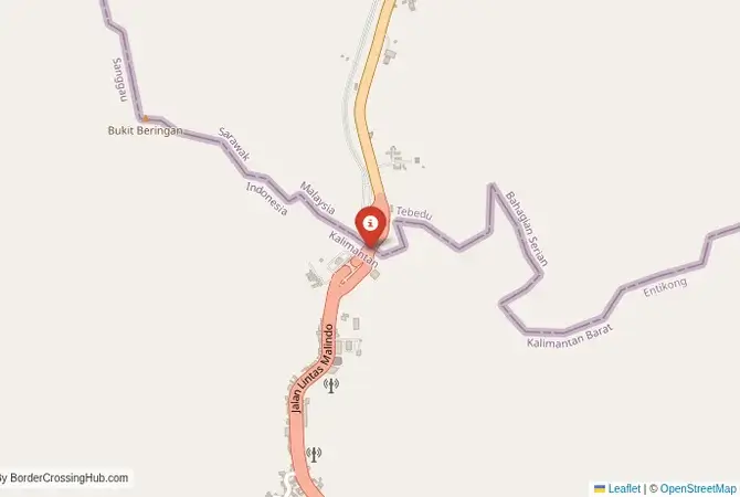
Approximate Border Location
Wait Times
30–60 min usual
Just crossed? Tap to report:
Operating Hours
Open 7:00 AM–7:00 PM
Crossing Types
Pedestrians, vehicles
Border Type
Land crossing via road
Peak Times
7:00–10:00 AM, weekends
Daily Crossings
2,800–3,200 crossings
Safety Information
Safe, traffic moderate
Languages Spoken
Indonesian, Malay, English
Accessibility Features
Ramps, assistance
About Entikong & Tebedu
Monthly Update (June 2026):
As of 06/2026, the Entikong & Tebedu Border Crossing is operating at a mostly steady pace with regular passenger and freight movement. Cargo inspections can occasionally slow the flow on busier days, while individual travelers often clear more quickly. Seasonal weather and increased trade activity can still cause some variation from one day to the next.
The Tebedu-Entikong Crossing: The Borneo Superhighway
The border crossing at Tebedu in the Serian division of Sarawak, Malaysia, which connects to the Indonesian post of Entikong in West Kalimantan, is the main and busiest land gateway on the island of Borneo. This is the primary road link between the Malaysian state of Sarawak and the Indonesian province of West Kalimantan. It is a major international crossing, a vital artery for trade, and the route of the only direct international bus service between the two regions. The crossing is located in a hilly, jungle-clad interior, a landscape of immense natural beauty. The facilities on both sides have been massively upgraded into large, modern Integrated Check Posts, a sign of the growing importance of this cross-border relationship. For the traveler, this is the most straightforward and reliable way to journey overland between the two vast territories of Malaysian and Indonesian Borneo, a passage through the heart of one of the world’s most biodiverse and culturally rich islands.
A History of a Porous Frontier
The history of this border is the history of the division of Borneo between the British and the Dutch colonial powers. The border was demarcated in the late 19th century, cutting through the traditional lands of the Bidayuh and Iban peoples. For decades, it was a remote and porous frontier, a line on a map that had little meaning for the indigenous people who lived in the jungle. The border region became a major conflict zone during the “Konfrontasi,” the armed conflict between Indonesia and Malaysia in the 1960s. After the conflict, relations normalized, but the border remained undeveloped for many years. The recent, massive investment by both the Indonesian and Malaysian governments in upgrading the road and building state-of-the-art border facilities is a very new development. It is part of a broader strategy to boost economic development in the remote border regions and to formalize the huge amount of trade that has always flowed, both legally and illegally, across this frontier. It is a border that is being transformed from a sleepy jungle outpost into a modern superhighway.
The Border Crossing Procedure: A Modern and Organized Process
The border is open during daylight hours. The new facilities on both sides are very large and modern, making the process professional and organized. You must have a valid visa for the country you are entering if your nationality requires one.Exiting Malaysia (Tebedu): You will arrive at the large Malaysian ICQS (Immigration, Customs, Quarantine and Security) complex. You will go to the immigration counter and present your passport to get your exit stamp. The customs check is usually a brief formality for tourists. The process is efficient and well-organized.The No-Man’s-Land: After clearing the Malaysian post, you will proceed a short distance through a well-maintained no-man’s-land to the Indonesian side.Entering Indonesia (Entikong): You will arrive at the equally large and impressive Indonesian “Pos Lintas Batas Negara” (PLBN). This is a brand new facility, built as a showcase of national pride. You will go to the immigration hall. You must check the visa requirements for your nationality. Indonesia offers visa-free entry for many nationalities at this border, but it is essential to confirm this in advance as land border rules can differ slightly from airports. The officer will check your passport and provide an entry stamp. After immigration, your luggage will be passed through an X-ray scanner for a customs check. The officials are professional, and the new, clean facilities make this a surprisingly pleasant experience.
Signal can be a coin toss at borders, and the last thing you want is to be stuck at the gate hunting for info. We’ve pulled all our research for this region into one simple eBook that works 100% offline. It keeps everything you need in one spot so you can stay focused on the trip. Grab the guide here.
Route, Onward Travel, and Direct Buses
The most convenient way to navigate this crossing is by taking the direct international bus service. Several bus companies run comfortable, air-conditioned buses from Kuching, the capital of Sarawak, all the way to Pontianak, the capital of West Kalimantan. The journey is long, typically taking 8-10 hours, but the bus company handles the border formalities, guiding passengers through the process. If you are traveling independently, you can take a local bus from Kuching to the border town of Serian, and then a taxi to the Tebedu border. On the Indonesian side, from Entikong, there are frequent buses and shared taxis for the 3-4 hour journey to Pontianak. The road on both sides is the Pan-Borneo Highway, and it is paved and in good condition with ongoing upgrades under recent infrastructure plans. The journey takes you through a beautiful landscape of rolling hills, pepper plantations, and traditional longhouse communities.
Final Planning Advice for the Borneo Gateway
The Tebedu-Entikong crossing is the main and most recommended gateway for overland travel between Sarawak and West Kalimantan. It is modern, efficient, and well-served by public transport. The key to a smooth journey is to check the current visa regulations for Indonesia for your nationality at this specific land border. The rules for land borders can sometimes differ from airports. Taking the direct international bus from Kuching to Pontianak is by far the easiest and most hassle-free option. This crossing is a journey into the deep interior of Borneo, a passage through a land of incredible biodiversity and rich indigenous culture. It is a border that offers a comfortable and safe way to experience the wild heart of the world’s third-largest island.
No reviews yet.